Report on Langila (Papua New Guinea) — November 1980
Scientific Event Alert Network Bulletin, vol. 5, no. 11 (November 1980)
Managing Editor: David Squires.
Langila (Papua New Guinea) Eruption declines
Please cite this report as:
Global Volcanism Program, 1980. Report on Langila (Papua New Guinea) (Squires, D., ed.). Scientific Event Alert Network Bulletin, 5:11. Smithsonian Institution. https://doi.org/10.5479/si.GVP.SEAN198011-252010
Langila
Papua New Guinea
5.525°S, 148.42°E; summit elev. 1330 m
All times are local (unless otherwise noted)
"Intensified eruptive activity that began in mid-October (05:10) continued until 8 November. Dark emission clouds continued to be released from Crater 2, and emission clouds from Crater 3 were pale grey. Ejections of incandescent lava fragments from both craters were accompanied by rumblings and explosion sounds. The lava flow from Crater 3 was reported to be still active on 11 November.
"A decline in the intensity of the eruption was evident on 8 November, when seismograph attenuation was reduced by 18 decibels. However, glows and ejections of incandescent lava fragments continued from both craters, and grey ash and vapour clouds continued to be emitted."
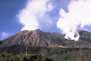
Geological Summary. Langila, one of the most active volcanoes of New Britain, consists of a group of four small overlapping composite basaltic-andesitic cones on the lower E flank of the extinct Talawe volcano in the Cape Gloucester area of NW New Britain. A rectangular, 2.5-km-long crater is breached widely to the SE; Langila was constructed NE of the breached crater of Talawe. An extensive lava field reaches the coast on the N and NE sides of Langila. Frequent mild-to-moderate explosive eruptions, sometimes accompanied by lava flows, have been recorded since the 19th century from three active craters at the summit. The youngest and smallest crater (no. 3 crater) was formed in 1960 and has a diameter of 150 m.
Information Contacts: C. McKee, RVO.

