Report on Bulusan (Philippines) — June 1981
Scientific Event Alert Network Bulletin, vol. 6, no. 6 (June 1981)
Managing Editor: Lindsay McClelland.
Bulusan (Philippines) Earthquake swarm
Please cite this report as:
Global Volcanism Program, 1981. Report on Bulusan (Philippines) (McClelland, L., ed.). Scientific Event Alert Network Bulletin, 6:6. Smithsonian Institution. https://doi.org/10.5479/si.GVP.SEAN198106-273010
Bulusan
Philippines
12.769°N, 124.056°E; summit elev. 1535 m
All times are local (unless otherwise noted)
Seismographs registered a local earthquake swarm 30 June-4 July. Of the 700 recorded events, eleven were felt at intensities I-II on the MRF scale and seven others were accompanied by rumbling. No eruption took place.
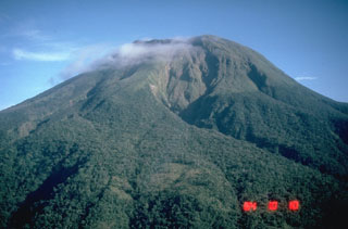
Geological Summary. Luzon's southernmost volcano, Bulusan, was constructed along the rim of the 11-km-diameter dacitic-to-rhyolitic Irosin caldera, which was formed about 36,000 years ago. It lies at the SE end of the Bicol volcanic arc occupying the peninsula of the same name that forms the elongated SE tip of Luzon. A broad, flat moat is located below the topographically prominent SW rim of Irosin caldera; the NE rim is buried by the andesitic complex. Bulusan is flanked by several other large intracaldera lava domes and cones, including the prominent Mount Jormajan lava dome on the SW flank and Sharp Peak to the NE. The summit is unvegetated and contains a 300-m-wide, 50-m-deep crater. Three small craters are located on the SE flank. Many moderate explosive eruptions have been recorded since the mid-19th century.
Information Contacts: O. Peña, COMVOL, Quezon City.

