Report on Telica (Nicaragua) — February 1982
Scientific Event Alert Network Bulletin, vol. 7, no. 2 (February 1982)
Managing Editor: Lindsay McClelland.
Telica (Nicaragua) Largest eruption since 1976; ashfall to coast
Please cite this report as:
Global Volcanism Program, 1982. Report on Telica (Nicaragua) (McClelland, L., ed.). Scientific Event Alert Network Bulletin, 7:2. Smithsonian Institution. https://doi.org/10.5479/si.GVP.SEAN198202-344040
Telica
Nicaragua
12.606°N, 86.84°W; summit elev. 1036 m
All times are local (unless otherwise noted)
The quoted material below is from reports prepared by Dartmouth College geologists.
"On 12 February between 1100 and 1200 Telica had its largest eruption since 1976. It began after 1.5 days of relative seismic quiet and lasted about 45 minutes. Blocks and scoria 2-3 m in diameter were thrown over an area extending 200 m from the crater rim. Minor collapse occurred on the crater rim. Fires were ignited in grass up to 1 km from the crater, especially to the E. At 5-6 km downwind, moist sand-sized ash accumulated to 2-3 cm depth. Ash fell to the SW as far away as Corinto (45 km from Telica), on the Pacific coast."
While flying over the Pacific coast of Nicaragua in a commercial aircraft on 12 February at 1200, William I. Rose, Jr. saw a vertical ash column penetrate the top of the cloud deck (at about 1.8-2.4 km altitude) over the Telica area. After about 50 seconds, the eruption column reached its maximum altitude of 3.7-4.3 km. Rose observed a second, smaller eruption column at 1207 before moving out of view of the area at 1215.
"The eruption followed several months of minor gas and ash ejection and notably heightened levels of seismic activity. Eruptive activity had apparently increased in duration and frequency during the week preceding 12 February." Dull red incandescence had been visible in the deepest portion of the vent for weeks and new bright incandescence was noted on 8 February in a fumarole at a much higher elevation, after a day of eruption. A second eruption from 1545-1610 on 12 February also ejected blocks and scoria but was much smaller.
La Prensa reported that between 12 and 14 February at least 50 people (of the roughly 8,000 living nearby) had been evacuated from the S side of the volcano, and the Red Cross established an aid station. Some farm birds were killed and small cotton fields on the flanks of Telica were coated with ash. Wild birds and animals also fled the area. The Red Cross reported strong activity 14 February and ejection of ash and blocks at 0930 on 15 February.
"On 19 February at 1030 a second large eruption sent ash as far to the WSW as Chinandega (35 km away)." William Rose was again flying along the coast of Nicaragua, about 160 km offshore, and observed 2 distinct explosions, the first starting at about 1030, the second between 1100 and 1115. Tephra clouds rose to more than 3.5 km altitude and black ash blew to the NW. "In the following week, 2-3 small eruptions each day sent ash and gas over the immediate area.
"The day geologists visited the crater, 24 February, there were no large eruptions and there had not been since 20 February. An impressive bomb and block field was laid down on the N side of the crater, extending approximately 300 m to the N. Craters 1-1.5 m across were created by low-angle impact of bombs 50 cm in diameter at the 300-m range. At approximately 100 m from the crater rim, the surface was 100% cratered and at 80 m was 100% covered with debris. Maximum thickness was 50 cm at the crater rim. The deposit was strongly inversely graded. Fresh breadcrusted scoria bombs up to 80 cm in diameter were widely scattered throughout the deposit. The active vent had increased in size by about two times. It was elongated N-S and was approximately 75 x 50 m. No incandescence was visible during the day. Slumping of the wall above the vent may have removed about 10 m from the rim of the crater.
"Gas emission between eruptions on 24 February was very small, as it was on 28 January. The gas was bluish in color and smelled like SO2 and HCl, but not H2S. Samples were taken on both days. Volcanic tremor occurred in irregular pulses only. The volcano has been relatively quiet seismically since the eruption of 12 February. In January and early February, there had been several magnitude 2-3 earthquakes each day."
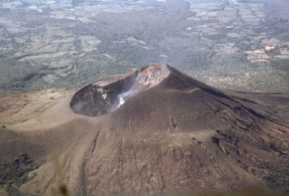
Geological Summary. Telica, one of Nicaragua's most active volcanoes, has erupted frequently since the beginning of the Spanish era. This volcano group consists of several interlocking cones and vents with a general NW alignment. Sixteenth-century eruptions were reported at symmetrical Santa Clara volcano at the SW end of the group. However, its eroded and breached crater has been covered by forests throughout historical time, and these eruptions may have originated from Telica, whose upper slopes in contrast are unvegetated. The steep-sided cone of Telica is truncated by a 700-m-wide double crater; the southern crater, the source of recent eruptions, is 120 m deep. El Liston, immediately E, has several nested craters. The fumaroles and boiling mudpots of Hervideros de San Jacinto, SE of Telica, form a prominent geothermal area frequented by tourists, and geothermal exploration has occurred nearby.
Information Contacts: R. Stoiber, S. Williams, W. Crenshaw, and D. Sussman, Dartmouth College; W. Rose, Jr., Michigan Tech. Univ.; D. Fajardo B., INETER; A. Creusot, Instituto Nicaraguense de Electricidad; La Prensa.

