Report on Manam (Papua New Guinea) — March 1982
Scientific Event Alert Network Bulletin, vol. 7, no. 3 (March 1982)
Managing Editor: Lindsay McClelland.
Manam (Papua New Guinea) Strong explosions; pyroclastic flow; seismicity
Please cite this report as:
Global Volcanism Program, 1982. Report on Manam (Papua New Guinea) (McClelland, L., ed.). Scientific Event Alert Network Bulletin, 7:3. Smithsonian Institution. https://doi.org/10.5479/si.GVP.SEAN198203-251020
Manam
Papua New Guinea
4.08°S, 145.037°E; summit elev. 1807 m
All times are local (unless otherwise noted)
"Strong eruptive activity occurred in 2 intervals in March, the first during several days at the beginning of the month. Spearheaded projections of tephra from Southern crater were observed on 2 and 3 March. Tephra ejections were less intense 4-7 March, but instability of the rapidly accumulated tephra caused avalanches of this material to descend from the summit into the SW valley. Inspections by volcanologists on 10 and 11 March suggested these avalanches were small. No significant changes in tiltmeter readings accompanied this eruptive phase, but seismicity showed a marked intensification on 5 March.
"Much stronger activity occurred near the end of the month. A paroxysmal eruption was observed at 1207 on 27 March. The dark grey-brown Vulcanian eruption cloud ascended to 6-7 km. Lightning flashes were seen in parts of the cloud. Strong Strombolian explosive activity followed the paroxysmal eruption at about 1215. The E side of the island experienced a brief period of darkness and tephra falls were locally severe, but the maximum thickness of the tephra deposit was probably only a few mm. Fragments up to 7 cm in size were collected at one village. Vegetation was strongly affected by the tephra fall and water supplies were polluted, but no structural damage was done to houses. A pyroclastic flow descended the SE valley during the eruption, but stopped about halfway to the coast.
"Seismicity was very strong at the time of the eruption and was still high at month's end. Before and after the eruption discrete B-type earthquakes occurred at the rate of about 1 per minute. For about 15 hours from the commencement of visible activity, discontinuous seismic tremor was recorded. No significant changes were evident in tiltmeter readings."
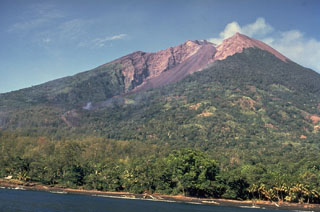
Geological Summary. The 10-km-wide island of Manam, lying 13 km off the northern coast of mainland Papua New Guinea, is one of the country's most active volcanoes. Four large radial valleys extend from the unvegetated summit of the conical basaltic-andesitic stratovolcano to its lower flanks. These valleys channel lava flows and pyroclastic avalanches that have sometimes reached the coast. Five small satellitic centers are located near the island's shoreline on the northern, southern, and western sides. Two summit craters are present; both are active, although most observed eruptions have originated from the southern crater, concentrating eruptive products during much of the past century into the SE valley. Frequent eruptions, typically of mild-to-moderate scale, have been recorded since 1616. Occasional larger eruptions have produced pyroclastic flows and lava flows that reached flat-lying coastal areas and entered the sea, sometimes impacting populated areas.
Information Contacts: C. McKee, RVO.

