Report on Nevado del Ruiz (Colombia) — May 1986
Scientific Event Alert Network Bulletin, vol. 11, no. 5 (May 1986)
Managing Editor: Lindsay McClelland.
Nevado del Ruiz (Colombia) Six weeks of harmonic tremor; increased SO2; light ashfalls
Please cite this report as:
Global Volcanism Program, 1986. Report on Nevado del Ruiz (Colombia) (McClelland, L., ed.). Scientific Event Alert Network Bulletin, 11:5. Smithsonian Institution. https://doi.org/10.5479/si.GVP.SEAN198605-351020
Nevado del Ruiz
Colombia
4.892°N, 75.324°W; summit elev. 5279 m
All times are local (unless otherwise noted)
Activity during 15 April-15 May. A substantial increase in seismic activity began in late April and was continuing in mid-May. Seismic records suggested that a minor ash emission occurred on 4 May, and ashfalls were reported within 3 km of the summit.
Seismicity remained at moderate levels until 20 April, when there was a swarm of 37 high-frequency events, with maximum magnitudes of 2.0. On 24 April a swarm of 24 low-frequency events was apparently accompanied by an increase in the SO2 content of the vapor column that emerges from Arenas Crater. No other eruptive changes were reported.
Harmonic tremor began on 4 May at 1300. A seismic signal with a maximum amplitude of 8 mm started at 1445 and lasted ~4 minutes, apparently marking a brief ash emission that was not directly observed. Periods of tremor of variable duration were recorded on 5, 7, 8, 9, 10, and 11 May, the longest ~26 hours, separated by brief quiet intervals. Tremor frequency remained relatively constant (5-6 Hz) but amplitudes varied significantly, reaching a maximum of 20 mm on 4 May between 2243 and 2300. The beginnings and ends of tremor episodes were often gradual, but on some occasions tremor ceased suddenly. On 7 May between 0000 and 0200, a swarm of high-frequency earthquakes was detected. One event had a magnitude of more than 2.0, the largest registered at Ruiz since December 1985.
dry-tilt data showed inflation of between 2 and 15 µrad on three of the four stations, while the fourth, on the NW flank, indicated 37 µrad of deflation. Electronic tilt measurements and EDM lines showed only minor changes.
COSPEC data yielded rates of SO2 emission that varied between 24 and 5,000 t/d. However, a station that measures wind direction and intensity has failed, and the raw COSPEC data can no longer be corrected for those factors.
Activity during 15 May-15 June. Seismic activity . . . remained dominated by harmonic tremor since 4 May. The tremor had a dominant frequency of 5 Hz, but strong components of frequencies as low as 1 Hz have been recorded at times. During a period of weak tremor on 29 May, there was a several-hour swarm of low-frequency events. About 1 day before this swarm, electronic tiltmeters began to show fluctuations, with daily changes of 1.5 µrad and periods of several hours to a few days. The pattern of all deformation measurements (EDM, dry-tilt, electronic tilt, and levelling) was inflationary as of mid-June, although small and irregular (0.4 µrad/day).
After 6 weeks, harmonic tremor fell to the noise level on 14 June and the number of low-frequency events increased again. Five shallow events, with durations of up to 3 minutes, were counted. Poor visibility prevented correlations with crater activity. Tremor resumed during the evening of 16 June and was continuing the next day.
Ash emissions were evident on many days, sometimes depositing thin layers on fresh snow. When winds forced the column down, a sulfur smell was strong as far as several tens of kilometers from the crater. During most of the few overflights permitted by weather conditions, the crater fumaroles again showed distinct behavior, with one emitting ash, the other only vapor. The most recent COSPEC data, collected at the beginning of June, showed an SO2 emission rate of 3,500-5,200 t/d, in contrast to previous weeks in which values fluctuated between 250 and 1,200 t/d. No significant changes to the summit ice cap were observed.
Because of the significant increase in activity, on 12 June the government released orders for permanent evacuation of a zone within 10 km of Arenas Crater (population ~1,700), and strongly recommended that the area within a radius of 10-20 km also be evacuated (population 8,000-10,000).
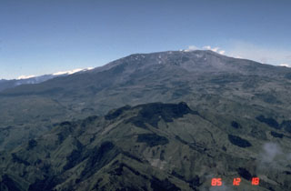
Geological Summary. Nevado del Ruiz is a broad, glacier-covered volcano in central Colombia that covers more than 200 km2. Three major edifices, composed of andesitic and dacitic lavas and andesitic pyroclastics, have been constructed since the beginning of the Pleistocene. The modern cone consists of a broad cluster of lava domes built within the caldera of an older edifice. The 1-km-wide, 240-m-deep Arenas crater occupies the summit. The prominent La Olleta pyroclastic cone located on the SW flank may also have been active in historical time. Steep headwalls of massive landslides cut the flanks. Melting of its summit icecap during historical eruptions, which date back to the 16th century, has resulted in devastating lahars, including one in 1985 that was South America's deadliest eruption.
Information Contacts: H. Meyer (Scientist-in-Charge); E. Parra (Regional Director); A. Núñez, and F. Muñoz, INGEOMINAS, Observatorio Vulcanológico de Colombia, Manizales.

