Report on Pacaya (Guatemala) — January 1987
Scientific Event Alert Network Bulletin, vol. 12, no. 1 (January 1987)
Managing Editor: Lindsay McClelland.
Pacaya (Guatemala) Cloud to 8 km; large tephra damages houses; lava flows
Please cite this report as:
Global Volcanism Program, 1987. Report on Pacaya (Guatemala) (McClelland, L., ed.). Scientific Event Alert Network Bulletin, 12:1. Smithsonian Institution. https://doi.org/10.5479/si.GVP.SEAN198701-342110
Pacaya
Guatemala
14.382°N, 90.601°W; summit elev. 2569 m
All times are local (unless otherwise noted)
The explosion that ejected lapilli and blocks onto the N flank on 21 January was preceded by about 24 hours of low-level tremor, which strengthened about 15 minutes before the explosion. Tephra fell to the NE, with the 5 mm isopach about 15 km from the vent. Ash reached Chiquimula, 180 km to the ENE. Geologists visited the volcano and found a new crater about 160 m in diameter within MacKenney Cone. The small spatter cones that had been growing there in October and November had been destroyed.
A second explosion on 25 January was also preceded by about a day of tremor, initially banded, then increasingly vigorous for about 12 hours. During the 2.5 hours before the explosion, peak-to-peak amplitude reached 8 mm. The explosion, at about 1730, ejected a column that rose to 8 km altitude and was blown south by 70 km/hour winds. Many houses in El Caracol (3 km SW of the vent), El Patrocinio (3.5 km W), and Los Pocitos (6 km SSE) were hit by 25-cm blocks. The 5-cm isopach was about 4 km S of the crater. Tephra volume was probably less than 5 x 10⁶ m3. Lava flowed S but remained far from villages. The press reported at least 15 injuries (but only one that required hospitalization) and as many as 3,000 evacuees. The next day the head of the National Emergency Committee said that 600 people remained evacuated, 63 homes were damaged, and many cattle and pigs had been killed. As of mid-February, typical Strombolian activity had resumed, and no additional strong explosions had been reported.
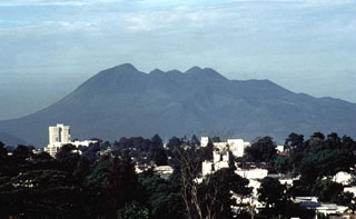
Geological Summary. Eruptions from Pacaya are frequently visible from Guatemala City, the nation's capital. This complex basaltic volcano was constructed just outside the southern topographic rim of the 14 x 16 km Pleistocene Amatitlán caldera. A cluster of dacitic lava domes occupies the southern caldera floor. The post-caldera Pacaya massif includes the older Pacaya Viejo and Cerro Grande stratovolcanoes and the currently active Mackenney stratovolcano. Collapse of Pacaya Viejo between 600 and 1,500 years ago produced a debris-avalanche deposit that extends 25 km onto the Pacific coastal plain and left an arcuate scarp inside which the modern Pacaya volcano (Mackenney cone) grew. The NW-flank Cerro Chino crater was last active in the 19th century. During the past several decades, activity has consisted of frequent Strombolian eruptions with intermittent lava flow extrusion that has partially filled in the caldera moat and covered the flanks of Mackenney cone, punctuated by occasional larger explosive eruptions that partially destroy the summit.
Information Contacts: E. Sánchez, INSIVUMEH; Norman Banks and Michael Doukas, USGS; Prensa Libre, Guatemala City; Agence France-Presse; UPI.

