Report on Pacaya (Guatemala) — July 1987
Scientific Event Alert Network Bulletin, vol. 12, no. 7 (July 1987)
Managing Editor: Lindsay McClelland.
Pacaya (Guatemala) Strombolian activity, seismicity precede June explosion
Please cite this report as:
Global Volcanism Program, 1987. Report on Pacaya (Guatemala) (McClelland, L., ed.). Scientific Event Alert Network Bulletin, 12:7. Smithsonian Institution. https://doi.org/10.5479/si.GVP.SEAN198707-342110
Pacaya
Guatemala
14.382°N, 90.601°W; summit elev. 2569 m
All times are local (unless otherwise noted)
A strong 14 June explosive eruption was preceded by continuing Strombolian activity. During May, weak to moderate explosions from MacKenney Crater ejected pyroclastic material and gas in a dark column that sometimes rose 40-50 m and was carried S by the wind. Most of the pyroclastics fell within the crater. At the end of May, 80-100 explosions were occurring/hour, interspersed with some periods of quiet. Explosions continued at that rate through early June, decreasing to 40-60/hour after 4 June. Some periods of increased activity were recorded until 13 June, when a clear increase was observed.
During May, a lava flow emerged from the N flank of the cone, 80 m below the active crater. It moved down one or two narrow, well-defined channels to the saddle between MacKenney Cone and an older cone just to the N (Cerro Chino), where it spread, then continued SW over older flows to 1,800 m altitude. In some places, flow thickness reached 10 m. On steep slopes, the lava advanced at 3 m/minute. Hours before the 14 June eruption, an observer reported that an explosion occurred from the lava flow vent.
The eruption began at about 2000. A column of ash, cinders, lapilli, and small scoria fragments rose to 3,000 m above sea level (500 m above the summit) and was carried SW by the wind. An elliptical area of 4.4 km2 was covered by 6-10 cm of sand-sized tephra and lapilli. Cinder falls were reported 100 km S of Pacaya. The amount of material ejected was less than in the 21 January explosion and may have been similar to the volume of 25 January tephra.
Seismic activity associated with the eruption was recorded by several stations of the National Seismic Network. Stations PGC (1 km N of the crater) and TER (6 km SSW) registered an increase 15 hours before the eruption, and the increase was evident 5 hours before the eruption at REC station (6 km NE). At GCG (24 km N), the maximum seismic amplitude lasted 45 minutes, longer than for the 21 and 25 January explosions.
An alarm was given to the Comité Nacional de Emergencia (CONE) 2 hours before the eruption. The town of El Caracol (3 km SW) was evacuated by CONE. There were no casualties. After the 14 June eruption, activity declined rapidly. Lava emission stopped and the number of explosions registered on station PGC dropped to 20-30/day, continuing at that rate through the end of June.
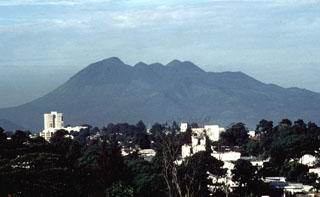
Geological Summary. Eruptions from Pacaya are frequently visible from Guatemala City, the nation's capital. This complex basaltic volcano was constructed just outside the southern topographic rim of the 14 x 16 km Pleistocene Amatitlán caldera. A cluster of dacitic lava domes occupies the southern caldera floor. The post-caldera Pacaya massif includes the older Pacaya Viejo and Cerro Grande stratovolcanoes and the currently active Mackenney stratovolcano. Collapse of Pacaya Viejo between 600 and 1,500 years ago produced a debris-avalanche deposit that extends 25 km onto the Pacific coastal plain and left an arcuate scarp inside which the modern Pacaya volcano (Mackenney cone) grew. The NW-flank Cerro Chino crater was last active in the 19th century. During the past several decades, activity has consisted of frequent Strombolian eruptions with intermittent lava flow extrusion that has partially filled in the caldera moat and covered the flanks of Mackenney cone, punctuated by occasional larger explosive eruptions that partially destroy the summit.
Information Contacts: E. Sánchez, INSIVUMEH.

