Report on Ol Doinyo Lengai (Tanzania) — July 1988
Scientific Event Alert Network Bulletin, vol. 13, no. 7 (July 1988)
Managing Editor: Lindsay McClelland.
Ol Doinyo Lengai (Tanzania) Crater morphology and vent dynamics
Please cite this report as:
Global Volcanism Program, 1988. Report on Ol Doinyo Lengai (Tanzania) (McClelland, L., ed.). Scientific Event Alert Network Bulletin, 13:7. Smithsonian Institution. https://doi.org/10.5479/si.GVP.SEAN198807-222120
Ol Doinyo Lengai
Tanzania
2.764°S, 35.914°E; summit elev. 2962 m
All times are local (unless otherwise noted)
The following includes additional information supplied by C. Nyamweru concerning the 24 June-1 July visit.
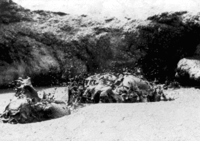
The active crater floor measured 222 x 244 m across and its walls were 30-50 m high. A saddle divided the S side of the active crater from a smaller inactive crater (see figures 4, 6, and 7). During the observation period, activity was concentrated in the T4/T7 lava lake (figures 8 and 9). This pair of vents had partially coalesced from two small separate features since visits in December 1987 and May 1988. In late June, the T4/T7 complex was part of an 80-m-long continuous E-W ridge with a series of gray lava pinnacles. The larger vent, T7, was 8-10 m in diameter and was 20 m W of T4. At the beginning of the June visit, the vents were connected by a bridge of cooled lava which supported a lava pinnacle over 3 m high. When the lava-level was low (late 30 June), it was possible to look through and under the arch from one lake to another. The pinnacle collapsed on 27 June. Lava was also seen and heard moving deep below T5 and there was evidence of recent small flows from T5's N slope. The rapid color change of the lava upon cooling made it difficult to recognize a new flow unless observed within 1 or 2 days of formation. Steam and sulfurous fumes were emitted from numerous vents along the crater wall and floor. The crater floor near T5 and T4/T7 was markedly higher than at the S end. A line of weakness across the crater trending N42°E was marked high on the NE wall by a small gray vent, and on the crater floor by black-stained fumaroles W of T1. On the S crater wall at the saddle, the zone was marked by a crack that emitted sulfurous fumes. The new cone T8 that formed on the night of 30 June was slightly NW of this line. (also see table 1)
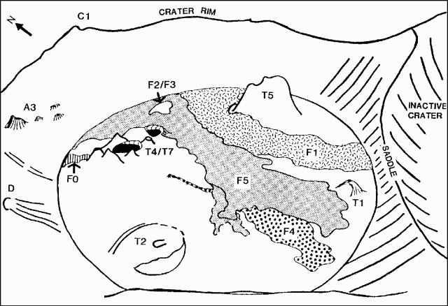 |
Figure 6. Sketch of Ol Doinyo Lengai's crater from the SW rim on 29 June 1988 showing relative positions of vents and new flows. Courtesy of C. Nyamweru. |
Table 1. Flow and vent dimensions at Ol Doinyo Lengai, 24 June-1 July 1988. Data courtesy of C. Nyamweru.
| Feature | Length/Height | Origin/Remarks |
| F0 | 35 m | T4/T7. 3-14 m wide. 30-50 cm thick. |
| F1 | 180 m | E of T4/T7. 50-70 m wide. To S wall |
| F2 | not measured | -- |
| F3 | not measured | SE of T4/T7 |
| F4 | 120 m | Crack on SW of T4/T7. 1-40 m wide. <50 cm thick. |
| F5 | 150 m (?) | Overflow from E of T4/T7 |
| F6 | -- | T8, new vent near T5. 20-50 cm thick. |
| T1 | -- | Inactive, unchanged. 10 m diameter. |
| T2 | -- | Inactive, collapsed. 33 m diameter. |
| T4/T7 | 40 m max. | Active vent. 9 m diameter (T7). |
| T5 | not measured | Steam, heat, lava at depth |
| T8 | 2-3 m | New cone on 30 June. 10 m diameter. |
| C1 | 10 m | Inactive vents. 8 m diameter. |
| D | not measured | Inactive vents. |
| A3 | 6 m max. | Five small vents. |
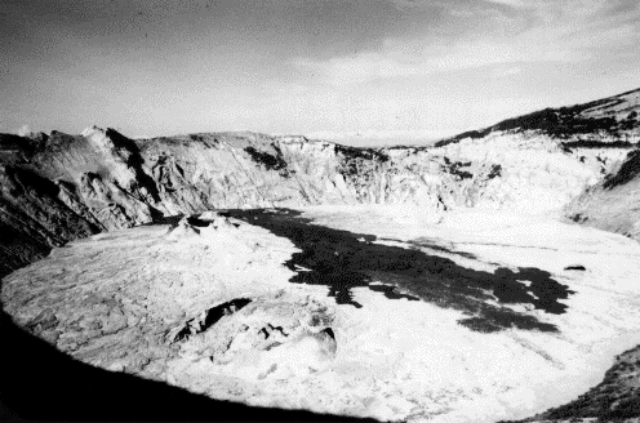 |
Figure 7. Ol Doinyo Lengai's active summit crater, looking NE in June 1988. New flows appear dark against the gray crater floor which is 200-240 m across. Photograph by M. Krafft. |
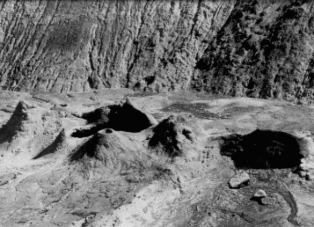 |
Figure 8. Black lava lakes T4 (left) and T7 at Ol Doinyo Lengai, seen from the SE on 29 June 1988. T7 is 8-10 m in diameter. Photograph by M. Krafft. |
Further References. Keller, J., and Krafft, M., 1990, Effusive natrocarbonatite activity of Oldoinyo Lengai, June 1988: BV, v. 52, p. 629-645.
Nyamweru, C., 1989, Report on activity on the northern crater of Ol Doinyo Lengai, 24th June to 1st July 1988: Journal of the East African Natural History Society and National Museum, v. 79, no. 186, 15 p. (available from the editor, National Museum, P.O. Box 40658, Nairobi, Kenya).
Geological Summary. The symmetrical Ol Doinyo Lengai is the only volcano known to have erupted carbonatite tephras and lavas in historical time. The prominent stratovolcano, known to the Maasai as "The Mountain of God," rises abruptly above the broad plain south of Lake Natron in the Gregory Rift Valley. The cone-building stage ended about 15,000 years ago and was followed by periodic ejection of natrocarbonatitic and nephelinite tephra during the Holocene. Historical eruptions have consisted of smaller tephra ejections and emission of numerous natrocarbonatitic lava flows on the floor of the summit crater and occasionally down the upper flanks. The depth and morphology of the northern crater have changed dramatically during the course of historical eruptions, ranging from steep crater walls about 200 m deep in the mid-20th century to shallow platforms mostly filling the crater. Long-term lava effusion in the summit crater beginning in 1983 had by the turn of the century mostly filled the northern crater; by late 1998 lava had begun overflowing the crater rim.
Information Contacts: C. Nyamweru, Kenyatta Univ; M. Krafft, Cernay, France.

