Report on Karkar (Papua New Guinea) — July 1989
Scientific Event Alert Network Bulletin, vol. 14, no. 7 (July 1989)
Managing Editor: Lindsay McClelland.
Karkar (Papua New Guinea) Vegetation returns after 1979 eruption
Please cite this report as:
Global Volcanism Program, 1989. Report on Karkar (Papua New Guinea) (McClelland, L., ed.). Scientific Event Alert Network Bulletin, 14:7. Smithsonian Institution. https://doi.org/10.5479/si.GVP.SEAN198907-251030
Karkar
Papua New Guinea
4.647°S, 145.976°E; summit elev. 1839 m
All times are local (unless otherwise noted)
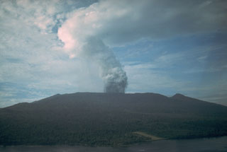
"Aerial and ground inspections and ground deformation measurements were conducted on 24 and 25 July. Aerial inspection involved photography of the summit calderas while the ground inspection covered the 1979 crater and temperature measurements of fumaroles on Bagiai Cone.
"The 1979 crater presently contains a small, shallow, muddy pool and the base of the crater wall is obscured by talus from rockslides. Erosion of the talus has formed a series of channels radial to the centre of the crater. Although no landing was made on the crater floor, observation from the crater rim, and the presence of rapidly advancing vegetation on most parts of the crater wall and on the crater floor, indicated that there were no active fumaroles in the 1979 crater. Temperatures of 74-85°C were measured at the summit of Bagiai, now almost completely revegetated following denudation during the 1974 and 1979 eruptions. The part of the inner caldera wall that was deforested during the 1979 eruption is now completely covered by regrowth, with some trees as much as 6 m tall. Vegetation is also being re-established on the caldera floor.
"The ground deformation measurements involved reoccupation of four dry tilt stations at the summit and three stations near the coast, relevelling on a 1.3-km line on the inner caldera floor, and measurements on the inner caldera EDM network. In general, the tilt and levelling results indicated deflation of the summit area."
Geological Summary. Karkar is a 19 x 25 km forest-covered island that is truncated by two nested summit calderas. The 5.5 km outer caldera was formed during one or more eruptions, the last of which occurred 9,000 years ago. The steep-walled 300-m-deep, 3.2 km diameter, inner caldera was formed sometime between 1,500 and 800 years ago. Cones are present on the N and S flanks of this basaltic-to-andesitic volcano; a linear array of small cones extends from the northern rim of the outer caldera nearly to the coast. Recorded eruptions date back to 1643 from Bagiai, a pyroclastic cone constructed within the inner caldera, the floor of which is covered by young, mostly unvegetated andesitic lava flows.
Information Contacts: B. Talai and C. McKee, RVO.

