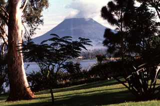
Report on Nyiragongo (DR Congo) — 15 October-21 October 2008
Smithsonian Institution / US Geological Survey
Weekly Volcanic Activity Report, 15 October-21 October 2008
Managing Editor: Sally Sennert.
Please cite this report as:
Global Volcanism Program, 2008. Report on Nyiragongo (DR Congo) (Sennert, S, ed.). Weekly Volcanic Activity Report, 15 October-21 October 2008. Smithsonian Institution and US Geological Survey.
Nyiragongo
DR Congo
1.52°S, 29.25°E; summit elev. 3470 m
All times are local (unless otherwise noted)
Based on analysis of satellite imagery, the Toulouse VAAC reported a diffuse sulfur plume from Nyiragongo on 17 October. The plume may have contained some ash.
Geological Summary. The Nyiragongo stratovolcano contained a lava lake in its deep summit crater that was active for half a century before draining catastrophically through its outer flanks in 1977. The steep slopes contrast to the low profile of its neighboring shield volcano, Nyamuragira. Benches in the steep-walled, 1.2-km-wide summit crater mark levels of former lava lakes, which have been observed since the late-19th century. Two older stratovolcanoes, Baruta and Shaheru, are partially overlapped by Nyiragongo on the north and south. About 100 cones are located primarily along radial fissures south of Shaheru, east of the summit, and along a NE-SW zone extending as far as Lake Kivu. Many cones are buried by voluminous lava flows that extend long distances down the flanks, which is characterized by the eruption of foiditic rocks. The extremely fluid 1977 lava flows caused many fatalities, as did lava flows that inundated portions of the major city of Goma in January 2002.

