Report on Arenal (Costa Rica) — 17 June-23 June 2009
Smithsonian Institution / US Geological Survey
Weekly Volcanic Activity Report, 17 June-23 June 2009
Managing Editor: Sally Sennert.
Please cite this report as:
Global Volcanism Program, 2009. Report on Arenal (Costa Rica) (Sennert, S, ed.). Weekly Volcanic Activity Report, 17 June-23 June 2009. Smithsonian Institution and US Geological Survey.
Arenal
Costa Rica
10.463°N, 84.703°W; summit elev. 1670 m
All times are local (unless otherwise noted)
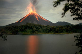
Three strong eruptions on 16 June resulted in pyroclastic flows. The National Park was evacuated as a precaution, but reopened the next day. Increased degassing the previous week had prompted an elevation of the hazard status to Level 3 (on a scale of 1-4).
Geological Summary. Conical Volcán Arenal is the youngest stratovolcano in Costa Rica and one of its most active. The 1670-m-high andesitic volcano towers above the eastern shores of Lake Arenal, which has been enlarged by a hydroelectric project. Arenal lies along a volcanic chain that has migrated to the NW from the late-Pleistocene Los Perdidos lava domes through the Pleistocene-to-Holocene Chato volcano, which contains a 500-m-wide, lake-filled summit crater. The earliest known eruptions of Arenal took place about 7000 years ago, and it was active concurrently with Cerro Chato until the activity of Chato ended about 3500 years ago. Growth of Arenal has been characterized by periodic major explosive eruptions at several-hundred-year intervals and periods of lava effusion that armor the cone. An eruptive period that began with a major explosive eruption in 1968 ended in December 2010; continuous explosive activity accompanied by slow lava effusion and the occasional emission of pyroclastic flows characterized the eruption from vents at the summit and on the upper western flank.
Sources: Inside Costa Rica, Tico Times

