Report on Galeras (Colombia) — 4 January-10 January 2012
Smithsonian Institution / US Geological Survey
Weekly Volcanic Activity Report, 4 January-10 January 2012
Managing Editor: Sally Sennert.
Please cite this report as:
Global Volcanism Program, 2012. Report on Galeras (Colombia) (Sennert, S, ed.). Weekly Volcanic Activity Report, 4 January-10 January 2012. Smithsonian Institution and US Geological Survey.
Galeras
Colombia
1.22°N, 77.37°W; summit elev. 4276 m
All times are local (unless otherwise noted)
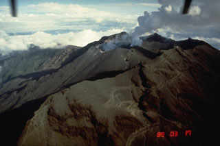
INGEOMINAS reported that low-level activity continued at Galeras during 4-10 January, with steam rising from the main crater and two craters to the N and SW (Paisita and Chavas, respectively). The Alert Level remained at III (Yellow; "changes in the behavior of volcanic activity").
Geological Summary. Galeras, a stratovolcano with a large breached caldera located immediately west of the city of Pasto, is one of Colombia's most frequently active volcanoes. The dominantly andesitic complex has been active for more than 1 million years, and two major caldera collapse eruptions took place during the late Pleistocene. Long-term extensive hydrothermal alteration has contributed to large-scale edifice collapse on at least three occasions, producing debris avalanches that swept to the west and left a large open caldera inside which the modern cone has been constructed. Major explosive eruptions since the mid-Holocene have produced widespread tephra deposits and pyroclastic flows that swept all but the southern flanks. A central cone slightly lower than the caldera rim has been the site of numerous small-to-moderate eruptions since the time of the Spanish conquistadors.

