Report on Ambang (Indonesia) — 6 August-12 August 2014
Smithsonian Institution / US Geological Survey
Weekly Volcanic Activity Report, 6 August-12 August 2014
Managing Editor: Sally Sennert.
Please cite this report as:
Global Volcanism Program, 2014. Report on Ambang (Indonesia) (Sennert, S, ed.). Weekly Volcanic Activity Report, 6 August-12 August 2014. Smithsonian Institution and US Geological Survey.
Ambang
Indonesia
0.75°N, 124.42°E; summit elev. 1795 m
All times are local (unless otherwise noted)
PVMBG noted that due to decreased volcanic seismicity and activity the Alert Level for Ambang was lowered to 1 (on a scale of 1-4) on 8 August. Residents and visitors were advised to not approach the crater.
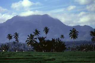
Geological Summary. The compound Ambang volcano is the westernmost of the active volcanoes on the northern arm of Sulawesi. The stratovolcano rises 750 m above lake Danau. Several craters up to 400 m in diameter and five solfatara fields are located at the summit.
Source: Pusat Vulkanologi dan Mitigasi Bencana Geologi (PVMBG, also known as CVGHM)

