Report on Ambae (Vanuatu) — 7 February-13 February 2018
Smithsonian Institution / US Geological Survey
Weekly Volcanic Activity Report, 7 February-13 February 2018
Managing Editor: Sally Sennert.
Please cite this report as:
Global Volcanism Program, 2018. Report on Ambae (Vanuatu) (Sennert, S, ed.). Weekly Volcanic Activity Report, 7 February-13 February 2018. Smithsonian Institution and US Geological Survey.
Ambae
Vanuatu
15.389°S, 167.835°E; summit elev. 1496 m
All times are local (unless otherwise noted)
Based on satellite, pilot, and webcam observations, the Wellington VAAC reported that during 8-9 February ash plumes from Aoba rose to altitudes of 2.7-3 km (9,000-10,000 ft) a.s.l. and drifted N and E.
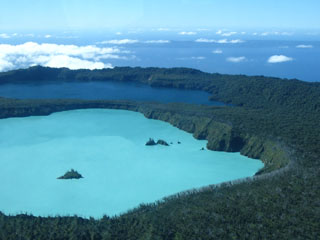
Geological Summary. The island of Ambae, also known as Aoba, is a massive 2,500 km3 basaltic shield that is the most voluminous volcano of the New Hebrides archipelago. A pronounced NE-SW-trending rift zone with numerous scoria cones gives the 16 x 38 km island an elongated form. A broad pyroclastic cone containing three crater lakes (Manaro Ngoru, Voui, and Manaro Lakua) is located at the summit within the youngest of at least two nested calderas, the largest of which is 6 km in diameter. That large central edifice is also called Manaro Voui or Lombenben volcano. Post-caldera explosive eruptions formed the summit craters about 360 years ago. A tuff cone was constructed within Lake Voui (or Vui) about 60 years later. The latest known flank eruption, about 300 years ago, destroyed the population of the Nduindui area near the western coast.

