Report on Nishinoshima (Japan) — 12 February-18 February 2020
Smithsonian Institution / US Geological Survey
Weekly Volcanic Activity Report, 12 February-18 February 2020
Managing Editor: Sally Sennert.
Please cite this report as:
Global Volcanism Program, 2020. Report on Nishinoshima (Japan) (Sennert, S, ed.). Weekly Volcanic Activity Report, 12 February-18 February 2020. Smithsonian Institution and US Geological Survey.
Nishinoshima
Japan
27.247°N, 140.874°E; summit elev. 100 m
All times are local (unless otherwise noted)
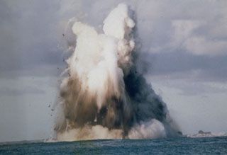
Based on satellite images and a pilot observation, the Tokyo VAAC reported that on 15 February an ash plume from Nishinoshima rose to 3 km (10,000 ft) a.s.l. and drifted E.
Geological Summary. The small island of Nishinoshima was enlarged when several new islands coalesced during an eruption in 1973-74. Multiple eruptions that began in 2013 completely covered the previous exposed surface and continued to enlarge the island. The island is the summit of a massive submarine volcano that has prominent peaks to the S, W, and NE. The summit of the southern cone rises to within 214 m of the ocean surface 9 km SSE.

