Report on Dukono (Indonesia) — 26 May-1 June 2021
Smithsonian Institution / US Geological Survey
Weekly Volcanic Activity Report, 26 May-1 June 2021
Managing Editor: Sally Sennert.
Please cite this report as:
Global Volcanism Program, 2021. Report on Dukono (Indonesia) (Sennert, S, ed.). Weekly Volcanic Activity Report, 26 May-1 June 2021. Smithsonian Institution and US Geological Survey.
Dukono
Indonesia
1.6992°N, 127.8783°E; summit elev. 1273 m
All times are local (unless otherwise noted)
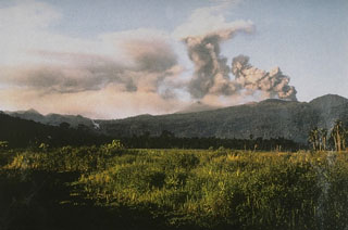
Based on satellite and wind model data, the Darwin VAAC reported that during 25-27 and 29 May ash plumes from Dukono rose to 2.1 km (7,000 ft) a.s.l. and drifted N, NE, and E. The Alert Level remained at 2 (on a scale of 1-4), and the public was warned to remain outside of the 2-km exclusion zone.
Geological Summary. Reports from this remote volcano in northernmost Halmahera are rare, but Dukono has been one of Indonesia's most active volcanoes. More-or-less continuous explosive eruptions, sometimes accompanied by lava flows, have occurred since 1933. During a major eruption in 1550 CE, a lava flow filled in the strait between Halmahera and the N-flank Gunung Mamuya cone. This complex volcano presents a broad, low profile with multiple summit peaks and overlapping craters. Malupang Wariang, 1 km SW of the summit crater complex, contains a 700 x 570 m crater that has also been active during historical time.
Sources: Darwin Volcanic Ash Advisory Centre (VAAC), Pusat Vulkanologi dan Mitigasi Bencana Geologi (PVMBG, also known as CVGHM)

