Report on Manam (Papua New Guinea) — 2 March-8 March 2022
Smithsonian Institution / US Geological Survey
Weekly Volcanic Activity Report, 2 March-8 March 2022
Managing Editor: Sally Sennert.
Please cite this report as:
Global Volcanism Program, 2022. Report on Manam (Papua New Guinea) (Sennert, S, ed.). Weekly Volcanic Activity Report, 2 March-8 March 2022. Smithsonian Institution and US Geological Survey.
Manam
Papua New Guinea
4.08°S, 145.037°E; summit elev. 1807 m
All times are local (unless otherwise noted)
RVO reported that a small pyroclastic flow descending Manam’s flank was visually observed and recorded in webcam images at 0911 on 8 March. Minor ash emissions drifting NW were occasionally visible throughout the day. RSAM values sharply increased at 1900 coincident with escalating activity. An intense Strombolian phase at Southern Crater was observed during 1910-2030, characterized by loud roaring and rumbling heard on the mainland (22 km SW), bright summit incandescence, and ash emissions. The Alert Level was raised to Stage 3. The Darwin VAAC estimated that by 1950 the ash plume had risen as high as 15.2 km (50,000 ft) a.s.l. and drifted W. The plume had detached from the summit by 2050 and dissipated by 0050 on 9 March. Following the more intense eruptive phase, activity at Southern Crater was quiet and only white vapor emissions were visible. Observatory staff conducted a field visit the next day and noted no reports of roof collapses nor casualties in areas to the NW; vegetation including food crops were covered with ash.
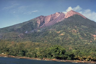
Geological Summary. The 10-km-wide island of Manam, lying 13 km off the northern coast of mainland Papua New Guinea, is one of the country's most active volcanoes. Four large radial valleys extend from the unvegetated summit of the conical basaltic-andesitic stratovolcano to its lower flanks. These valleys channel lava flows and pyroclastic avalanches that have sometimes reached the coast. Five small satellitic centers are located near the island's shoreline on the northern, southern, and western sides. Two summit craters are present; both are active, although most observed eruptions have originated from the southern crater, concentrating eruptive products during much of the past century into the SE valley. Frequent eruptions, typically of mild-to-moderate scale, have been recorded since 1616. Occasional larger eruptions have produced pyroclastic flows and lava flows that reached flat-lying coastal areas and entered the sea, sometimes impacting populated areas.
Source: Rabaul Volcano Observatory (RVO)

