Report on Ruapehu (New Zealand) — 26 April-2 May 2023
Smithsonian Institution / US Geological Survey
Weekly Volcanic Activity Report, 26 April-2 May 2023
Managing Editor: Sally Sennert.
Please cite this report as:
Global Volcanism Program, 2023. Report on Ruapehu (New Zealand) (Sennert, S, ed.). Weekly Volcanic Activity Report, 26 April-2 May 2023. Smithsonian Institution and US Geological Survey.
Ruapehu
New Zealand
39.28°S, 175.57°E; summit elev. 2797 m
All times are local (unless otherwise noted)
On 3 May GeoNet reported that temperatures in Ruapehu’s cater lake had declined from 32 to 21 degrees Celsius since January, and other monitoring parameters indicated that volcanic unrest remained low. Weak volcanic tremor persisted and very few earthquakes were located beneath the volcano. Gas emissions were at low-to-moderate levels during the previous three months, and only minor changes to the lake water chemistry were identified over the past several months and most recently on 6 April. The Volcanic Alert Level remained at 1 (on a scale from 0-5) and the Aviation Color Code remained at Green (the lowest level on a four-color scale).
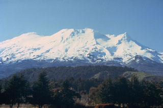
Geological Summary. Ruapehu, one of New Zealand's most active volcanoes, is a complex stratovolcano constructed during at least four cone-building episodes dating back to about 200,000 years ago. The dominantly andesitic 110 km3 volcanic massif is elongated in a NNE-SSW direction and surrounded by another 100 km3 ring plain of volcaniclastic debris, including the NW-flank Murimoto debris-avalanche deposit. A series of subplinian eruptions took place between about 22,600 and 10,000 years ago, but pyroclastic flows have been infrequent. The broad summait area and flank contain at least six vents active during the Holocene. Frequent mild-to-moderate explosive eruptions have been recorded from the Te Wai a-Moe (Crater Lake) vent, and tephra characteristics suggest that the crater lake may have formed as recently as 3,000 years ago. Lahars resulting from phreatic eruptions at the summit crater lake are a hazard to a ski area on the upper flanks and lower river valleys.
Source: GeoNet

