Report on Katla (Iceland) — 24 July-30 July 2024
Smithsonian Institution / US Geological Survey
Weekly Volcanic Activity Report, 24 July-30 July 2024
Managing Editor: Sally Sennert.
Please cite this report as:
Global Volcanism Program, 2024. Report on Katla (Iceland) (Sennert, S, ed.). Weekly Volcanic Activity Report, 24 July-30 July 2024. Smithsonian Institution and US Geological Survey.
Katla
Iceland
63.633°N, 19.083°W; summit elev. 1490 m
All times are local (unless otherwise noted)
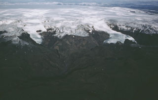
Iceland Met Office (IMO) reported that electrical conductivity levels in the Skálmur River, which drains from the Sandfellsjökull glacier on the E part of the Mýrdalsjökull ice cap that covers Katla, began to increase late on 26 July. Increased seismicity within the Katla caldera began to be detected around 0600 on 27 July. Unrest significantly increased at around 1100 and a jökulhlaup (a glacier-outburst flood) began in the river at around 1320. Reports indicated increased sulfur odors originating from Mýrdalsjökull, specifically in Hólaskjól. As a precaution, and to account for the possibility of volcanic unrest, at 1554 IMO raised the Aviation Color Code to Yellow, the second lowest level on a four-color scale. The flood water flowed over a 1-km-long section of Highway 1 (also known as the Ring Road), damaging the road in several places, and washing away part of the road located next to the Skálmur River bridge. According to a news article local authorities closed the road between Víkur and Kirkjubæjarklausturs and evacuated Sólheimajökull, an area near the glacier, and a service area the end of the Sólheimajökull road. The peak flow rate may have been as high as 1,000 cubic meters per second, making the jökulhlaup significantly larger than previous events in 2011 and 1950. Electrical conductivity levels indicated that the flooding had significantly decreased later that night, though the report noted that it may be days before the rivers return to seasonally normal levels. At 1031 on 29 July IMO lowered the Aviation Color Code to Green, noting that activity at Mýrdalsjökull had returned to normal levels, and water levels and electrical conductivity in the Skálmur River had decreased.
Geological Summary. Katla volcano, located near the southern end of Iceland's eastern volcanic zone, is hidden beneath the Myrdalsjökull icecap. The subglacial basaltic-to-rhyolitic volcano is one of Iceland's most active and is a frequent producer of damaging jökulhlaups, or glacier-outburst floods. A large 10 x 14 km subglacial caldera with a long axis in a NW-SE direction is up to 750 m deep. Its high point reaches 1380 m, and three major outlet glaciers have breached its rim. Although most recorded eruptions have taken place from fissures inside the caldera, the Eldgjá fissure system, which extends about 60 km to the NE from the current ice margin towards Grímsvötn volcano, has been the source of major Holocene eruptions. An eruption from the Eldgjá fissure system about 934 CE produced a voluminous lava flow of about 18 km3, one of the world's largest known Holocene lava flows. Katla has been the source of frequent subglacial basaltic explosive eruptions that have been among the largest tephra-producers in Iceland during historical time and has also produced numerous dacitic explosive eruptions during the Holocene.
Sources: Icelandic Meteorological Office (IMO), Icelandic National Broadcasting Service (RUV), Icelandic National Broadcasting Service (RUV)

