Report on Iwatesan (Japan) — 2 October-8 October 2024
Smithsonian Institution / US Geological Survey
Weekly Volcanic Activity Report, 2 October-8 October 2024
Managing Editor: Sally Sennert.
Please cite this report as:
Global Volcanism Program, 2024. Report on Iwatesan (Japan) (Sennert, S, ed.). Weekly Volcanic Activity Report, 2 October-8 October 2024. Smithsonian Institution and US Geological Survey.
Iwatesan
Japan
39.853°N, 141.001°E; summit elev. 2038 m
All times are local (unless otherwise noted)
Japan Meteorological Agency (JMA) reported increased unrest at Iwatesan. Data from instrumentation detecting deformation indicated inflation centered in deeper parts of the volcano beginning in February. The frequency of volcanic earthquakes had been somewhat high since April 2020, although the number of small volcanic earthquakes located near Kurokurayama began increasing in May and further increased in late July. Results in INSAR imagery collected on 26 September revealed very shallow inflation near Ojigokudani (erosional caldera to the W). At 1500 on 2 October the Alert level was raised to 2 (the second lowest level on a 1-5 scale) prompting access restrictions around the crater; the public was warned that an eruption could affect an area within a 2 km radius of the crater.
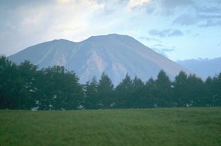
Geological Summary. Viewed from the east, Iwatesan volcano has a symmetrical profile that invites comparison with Fuji, but on the west an older cone is visible containing an oval-shaped, 1.8 x 3 km caldera. After the growth of Nishi-Iwate volcano beginning about 700,000 years ago, activity migrated eastward to form Higashi-Iwate volcano. Iwate has collapsed seven times during the past 230,000 years, most recently between 739 and 1615 CE. The dominantly basaltic summit cone of Higashi-Iwate volcano, Yakushidake, is truncated by a 500-m-wide crater. It rises well above and buries the eastern rim of the caldera, which is breached by a narrow gorge on the NW. A central cone containing a 500-m-wide crater partially filled by a lake is located in the center of the oval-shaped caldera. A young lava flow from Yakushidake descended into the caldera, and a fresh-looking lava flow from the 1732 eruption traveled down the NE flank.

