Report on Copahue (Chile-Argentina) — 23 October-29 October 2024
Smithsonian Institution / US Geological Survey
Weekly Volcanic Activity Report, 23 October-29 October 2024
Managing Editor: Sally Sennert.
Please cite this report as:
Global Volcanism Program, 2024. Report on Copahue (Chile-Argentina) (Sennert, S, ed.). Weekly Volcanic Activity Report, 23 October-29 October 2024. Smithsonian Institution and US Geological Survey.
Copahue
Chile-Argentina
37.856°S, 71.183°W; summit elev. 2953 m
All times are local (unless otherwise noted)
The Servicio Nacional de Geología y Minería (SERNAGEOMIN) reported that during 15-24 October surficial activity at Copahue increased based on analysis by Observatorio Volcánico de los Andes del Sur (OVDAS). Tremor signals slightly intensified on 15 October. Sulfur dioxide emissions increased on 15 October and averaged 2,900-3,000 tons per day (t/d) during 17-19 October, higher than the average of 2,400 t/d more typically observed. Sulfur dioxide emissions were detected with both satellite images and Differential Optical Absorption Spectroscopy (DOAS) instruments. Beginning on 16 October episodic intensifications of a thermal anomaly in El Agrio Crater were identified in satellite data with the most intense anomaly recorded on 19 October. Gas-and-steam emissions rose no higher than 300 m above the crater rim and contained ash starting on 17 October; the ash content was denser on 19 October. Gas-and-ash plumes on 19 October deposited ash in an area extending 2.9 km SE of the vent. By 24 October activity had decreased; sulfur dioxide emissions, a thermal anomaly, and ash emissions were no longer being detected. SERNAGEOMIN noted that an increase may occur again and raised the Alert Level to Yellow (the second lowest level on a four-color scale). SENAPRED declared a Yellow Alert (the middle level on a three-color scale) for residents of the Alto Biobío municipality and access to an area within 500 m of El Agrio Crater was restricted to the public.
The Servicio Geológico Minero Argentino (SEGEMAR) maintained an Alert Level of Green (the lowest level on a four-color scale) for Argentina, based on Argentine Volcano Monitoring Observatory (OAVV) analysis. SEGEMAR noted that the crater lake had dried up during the previous few weeks due to seasonal changes in rainfall. Weekly averages of sulfur dioxide emissions were less than 2,000 t/d with a peak of 6,270 t/d on 16 October based on TROPOMI satellite data. Gas-and-steam plumes were visible during 20-24 October when weather conditions allowed for visual observations. Tremor levels decreased after 19 October; an increase recorded on 24 October may have been due to weather. SEGEMAR noted that a possible phreatic eruption could impact an area within 1 km of the crater.
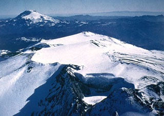
Geological Summary. Volcán Copahue is an elongated composite cone constructed along the Chile-Argentina border within the 6.5 x 8.5 km wide Trapa-Trapa caldera that formed between 0.6 and 0.4 million years ago near the NW margin of the 20 x 15 km Pliocene Caviahue (Del Agrio) caldera. The eastern summit crater, part of a 2-km-long, ENE-WSW line of nine craters, contains a briny, acidic 300-m-wide crater lake (also referred to as El Agrio or Del Agrio) and displays intense fumarolic activity. Acidic hot springs occur below the eastern outlet of the crater lake, contributing to the acidity of the Río Agrio, and another geothermal zone is located within Caviahue caldera about 7 km NE of the summit. Infrequent mild-to-moderate explosive eruptions have been recorded since the 18th century. Twentieth-century eruptions from the crater lake have ejected pyroclastic rocks and chilled liquid sulfur fragments.
Sources: Servicio Nacional de Geología y Minería (SERNAGEOMIN), Servicio Geológico Minero Argentino (SEGEMAR), Sistema y Servicio Nacional de Prevención y Repuesta Ante Desastres (SENAPRED)

