
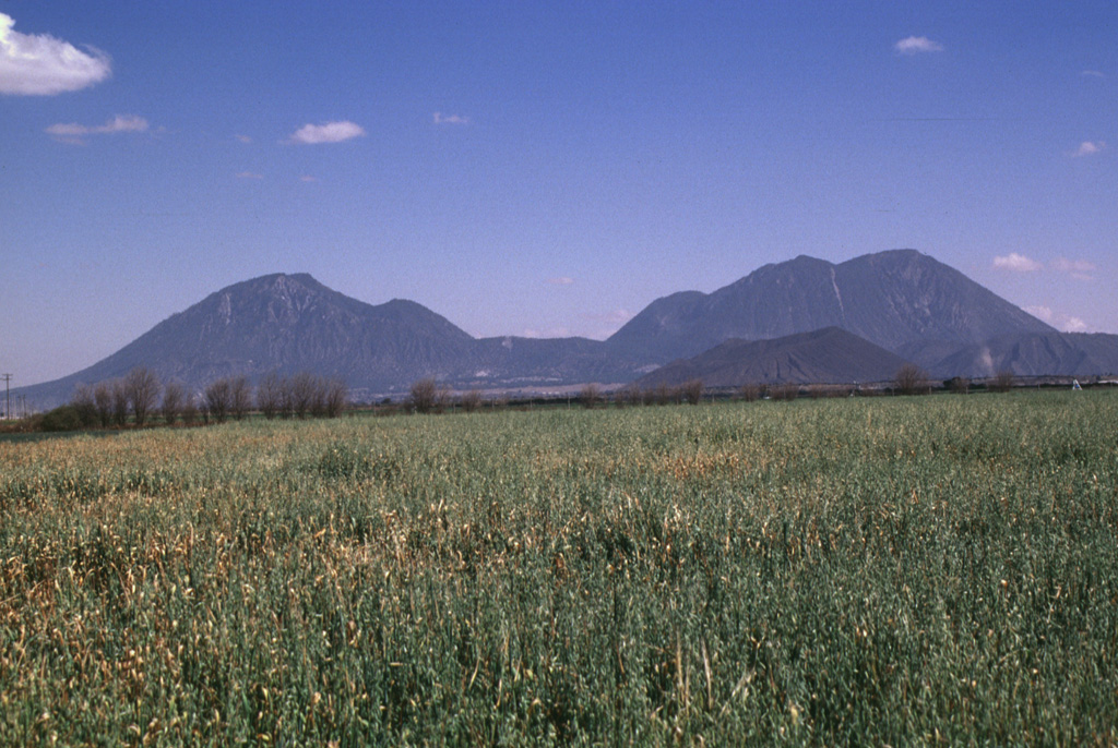
The Global Volcanism Program has no activity reports available for Serdán-Oriental.
The Global Volcanism Program has no Weekly Reports available for Serdán-Oriental.
The Global Volcanism Program has no Bulletin Reports available for Serdán-Oriental.
This compilation of synonyms and subsidiary features may not be comprehensive. Features are organized into four major categories: Cones, Craters, Domes, and Thermal Features. Synonyms of features appear indented below the primary name. In some cases additional feature type, elevation, or location details are provided.
Cones |
||||
| Feature Name | Feature Type | Elevation | Latitude | Longitude |
| Ahuatepec, Cerro | Cone | 2820 m | 19° 3' 0" N | 97° 25' 0" W |
| Alchichica | Tuff ring | 2500 m | 19° 25' 0" N | 97° 24' 0" W |
|
Brujo, Cerro el
Malpais, Cerro |
Shield volcano | 2900 m | 19° 8' 0" N | 97° 35' 0" W |
|
Tepexitl, Cerro
Jalapasquillo |
Tuff ring | 2600 m | 19° 13' 30" N | 97° 25' 30" W |
| Xalapasco, Cerro | Tuff cone | 2500 m | 19° 23' 27" N | 97° 29' 53" W |
Craters |
||||
| Feature Name | Feature Type | Elevation | Latitude | Longitude |
| Aljojuca | Maar | 2520 m | 19° 5' 30" N | 97° 32' 0" W |
|
Atexcac, Laguna
San Luis Atexcac |
Maar | 2600 m | 19° 20' 0" N | 97° 27' 0" W |
| Ocotenco | Maar | 2660 m | 19° 5' 0" N | 97° 28' 0" W |
| Preciosa, La | Maar | 2380 m | 19° 22' 0" N | 97° 23' 0" W |
| Quechulac | Maar | 2360 m | 19° 22' 30" N | 97° 21' 0" W |
| Tecuitlapa | Maar | 2460 m | 19° 7' 30" N | 97° 32' 30" W |
|
Xalapasquillo
Jalapasquillo |
Maar | 2380 m | 19° 13' 0" N | 97° 33' 0" W |
Domes |
||||
| Feature Name | Feature Type | Elevation | Latitude | Longitude |
| Derrumbadas, Las | Dome | 3485 m | 19° 16' 0" N | 97° 27' 0" W |
| Pinto, Cerro | Dome | 3100 m | 19° 22' 0" N | 97° 30' 0" W |
| Pizarro, Cerro | Dome | 3100 m | 19° 30' 30" N | 97° 26' 0" W |
|
|
||||||||||||||||||||||||||||
The Global Volcanism Program is not aware of any Holocene eruptions from Serdán-Oriental. If this volcano has had large eruptions (VEI >= 4) prior to 12,000 years ago, information might be found on the Serdán-Oriental page in the LaMEVE (Large Magnitude Explosive Volcanic Eruptions) database, a part of the Volcano Global Risk Identification and Analysis Project (VOGRIPA).
There is no Deformation History data available for Serdán-Oriental.
There is no Emissions History data available for Serdán-Oriental.
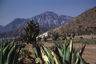 The NW-most dome of the two Las Derrumbadas lava domes, seen here from the NE along the highway to Perote, has undergone extensive hydrothermal alteration. Fumaroles on the domes remain active. The eroded hillside near the center is the outer flank of the San Luis Atexcac tuff ring, which contains a crater lake.
 The most prominent features of the Serdán-Oriental volcanic field are the two Las Derrumbadas lava domes. The NW (left) and SE (right) domes are of similar height and lithology and rise about 1 km above their bases. The Serdán-Oriental is a broad closed basin at the eastern end of the Mexican altiplano containing lava domes, tuff rings, lava flows, and scoria cones of late-Pleistocene to Holocene age. Several of the tuff rings, such as Laguna Atexcac and Laguna Alchichica, contain crater lakes.
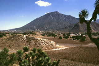 The NW-most of the two Las Derrumbadas lava domes is surrounded by hummocky debris avalanche deposits such as those in the foreground, that were produced by repeated collapse of the domes. The hummocks contain mixtures of rock types, including pyroclastic surge deposits, Cretaceous limestones, lacustrine sediments, and banded obsidians. These are thought to have originated from a former tuff ring that surrounded the lava domes.
 Cerro Pinto on the NE horizon is a lava dome that formed within a tuff cone. Cerro Pinto is one of several large lava domes within the enclosed Serdán-Oriental basin. The hills in the foreground are hummocks of a debris avalanche deposit produced by collapse of Las Derrumbadas lava domes.
 The Cerro Pinto lava dome is seen here from the rim of Laguna San Luis Atexcac maar, just south of Highway 140. The dome grew within a cone with a crater about 2 km wide. The crater overlaps with that of the Cerro Xalapasco cone to the north.
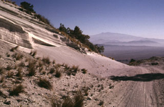 A roadcut through the eastern rim of the Cerro Xalapasco tuff cone exposes pyroclastic-surge deposits. The road provides access to a quarry where perlite (hydrated obsidian) is mined. Cofre de Perote volcano rises on the distant horizon across the Serdán-Oriental basin.
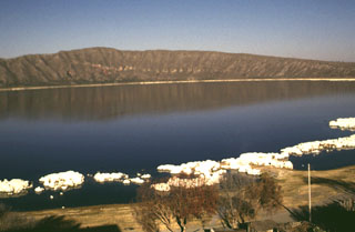 The Laguna Alchichicha maar is filled by the largest lake in the Serdán-Oriental basin. The rim of the basaltic to basaltic-andesitic maar varies in height and is highest on the western side. The western crater wall exposes a scoria cone that was partially destroyed by the maar-forming eruption. White tufa deposits line the shore of the lake.
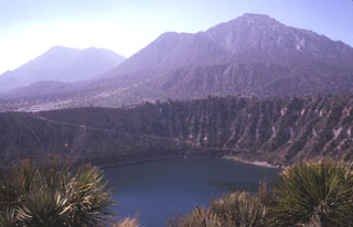 The Las Derrumbadas lava domes rise above the rim of the San Luis Atexcac maar. The two rhyolite lava domes rise about 1 km above their bases. The NW dome (right) consists of a microcrystalline rhyolite that has been extensively altered by fumarolic activity. The SE dome (left) is of similar lithology. The carapace of both domes has been removed by a series of slope failures. The San Luis Atexcac maar in the foreground erupted through Cretaceous limestones and Tertiary monzonites and hornfels.
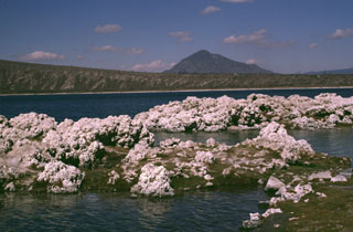 The Laguna Alchichicha maar is the largest of the Serdán-Oriental volcanic field, located just off Highway 140 between Puebla and Jalapa. The low rim of the maar increases in height to the west. The pyroclastic surge deposits contain juvenile fragments of scoriaceous basaltic or basaltic-andesite material. Tufa deposits such as those in the foreground are located along the shore of the lake. Cerro Pizarro in the distance is the northernmost lava dome of the Serdán-Oriental field.
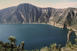 The Atexcac maar is one of several lake-filled maars of the Serdán-Oriental volcanic field. The walls expose pyroclastic surge beds produced during formation of the maar. Cretaceous limestone beds and remnants of a basaltic scoria cone partially destroyed during formation of the maar are also exposed in the western crater walls. Abundant juvenile obsidian clasts are found in the surge deposits.
 The SE-most of the two Las Derrumbadas lava domes is seen here from the SE. The extensively altered dome is surrounded by debris avalanche deposits. The more recent avalanche deposits consist almost entirely of microcrystalline rhyolite from the core of the dome. They left horseshoe-shaped collapse scarps such as the one visible to the upper right. These scarps reveal areas of intense alteration to kaolinite produced by prolonged fumarolic activity.
 The Cerro Pinto rhyolite lava dome (right) rises 700 m above the Serdán-Oriental basin floor in this view looking ENE. The flat ridge to its left is the rim of the 2-km-wide Cerro Xalapasco, which contains multiple craters.
 The summit of the Cerro Pinto lava dome on the western side of the Serdán-Oriental basin provides an overview of the crater floor of Cerro Xalapasco tuff cone in the foreground. Pyroclastic surge deposits associated with Cerro Xalapasco were emplaced in a relatively dry eruptive environment. The peak to the far right is Cerro Pizarro, a lava dome at the northern end of the Serdán-Oriental. The flat ridge stretching across the horizon to the north is Los Humeros caldera.
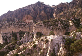 The pyroclastic surge deposits in the foreground are exposed in front of Cerro Pinto lava dome. The dome has a glassy and pumiceous outer layer partly overlain by pyroclastic surge deposits and blocks of local bedrock.
 Glacial erosion has modified the summit of Cofre de Perote volcano. Summit lava flows show glacial striations, and a glacial tarn (left) is SW of the summit. Cofre de Perote overlooks the intermontaine Serdán-Oriental basin, which contains lava domes, tuff rings, lava flows, and scoria cones. The two Las Derrumbadas lava domes are in the distance and Cerro Pinto dome to their right are about 40 km SW.
 The fresh-looking lava flows at the top of the image were erupted from Los Humeros caldera (just out of view to the north). The basaltic and andesitic lava flows extend up to about 15 km from the caldera rim. The flows have not been dated precisely, but are younger than 20,000 years and could in part be of Holocene age. The Tepeyahualco (left) and Limón (right) lava flows bracket circular 3100-m-high Cerro Pizarro lava dome (right center), the northernmost feature of the Serdán-Oriental volcanic field.
 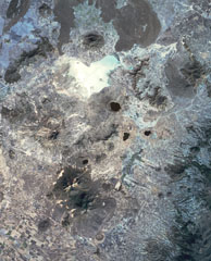 This view of the Serdán-Oriental basin covers about 38 km in a N-S (vertical) direction. The circular peak at the upper center, partially surrounded by young lava flows from Los Humeros caldera, is Cerro Pizarro lava dome. The lake-filled maar to the SSE across the light-colored dry lake basin is Alchichica maar. The erosionally ribbed flanks of Cerro Xalapaxco tuff cone and Cerro Pinto lava dome lie to the SW, and the large forested peaks at the bottom are the the twin Las Derrumbadas lava domes.
Maps are not currently available due to technical issues.
The following 4 samples associated with this volcano can be found in the Smithsonian's NMNH Department of Mineral Sciences collections, and may be availble for research (contact the Rock and Ore Collections Manager). Catalog number links will open a window with more information.
| Catalog Number | Sample Description | Lava Source | Collection Date |
|---|---|---|---|
| NMNH 117450-19 | Obsidian | Derrumbadas, Las | -- |
| NMNH 117450-21 | Obsidian | Derrumbadas, Las | -- |
| NMNH 117551-106 | Obsidian | Derrumbadas, Las | -- |
| NMNH 117551-107 | Obsidian | Derrumbadas, Las | -- |
| Copernicus Browser | The Copernicus Browser replaced the Sentinel Hub Playground browser in 2023, to provide access to Earth observation archives from the Copernicus Data Space Ecosystem, the main distribution platform for data from the EU Copernicus missions. |
| MIROVA | Middle InfraRed Observation of Volcanic Activity (MIROVA) is a near real time volcanic hot-spot detection system based on the analysis of MODIS (Moderate Resolution Imaging Spectroradiometer) data. In particular, MIROVA uses the Middle InfraRed Radiation (MIR), measured over target volcanoes, in order to detect, locate and measure the heat radiation sourced from volcanic activity. |
| MODVOLC Thermal Alerts | Using infrared satellite Moderate Resolution Imaging Spectroradiometer (MODIS) data, scientists at the Hawai'i Institute of Geophysics and Planetology, University of Hawai'i, developed an automated system called MODVOLC to map thermal hot-spots in near real time. For each MODIS image, the algorithm automatically scans each 1 km pixel within it to check for high-temperature hot-spots. When one is found the date, time, location, and intensity are recorded. MODIS looks at every square km of the Earth every 48 hours, once during the day and once during the night, and the presence of two MODIS sensors in space allows at least four hot-spot observations every two days. Each day updated global maps are compiled to display the locations of all hot spots detected in the previous 24 hours. There is a drop-down list with volcano names which allow users to 'zoom-in' and examine the distribution of hot-spots at a variety of spatial scales. |
|
WOVOdat
Single Volcano View Temporal Evolution of Unrest Side by Side Volcanoes |
WOVOdat is a database of volcanic unrest; instrumentally and visually recorded changes in seismicity, ground deformation, gas emission, and other parameters from their normal baselines. It is sponsored by the World Organization of Volcano Observatories (WOVO) and presently hosted at the Earth Observatory of Singapore.
GVMID Data on Volcano Monitoring Infrastructure The Global Volcano Monitoring Infrastructure Database GVMID, is aimed at documenting and improving capabilities of volcano monitoring from the ground and space. GVMID should provide a snapshot and baseline view of the techniques and instrumentation that are in place at various volcanoes, which can be use by volcano observatories as reference to setup new monitoring system or improving networks at a specific volcano. These data will allow identification of what monitoring gaps exist, which can be then targeted by remote sensing infrastructure and future instrument deployments. |
| Volcanic Hazard Maps | The IAVCEI Commission on Volcanic Hazards and Risk has a Volcanic Hazard Maps database designed to serve as a resource for hazard mappers (or other interested parties) to explore how common issues in hazard map development have been addressed at different volcanoes, in different countries, for different hazards, and for different intended audiences. In addition to the comprehensive, searchable Volcanic Hazard Maps Database, this website contains information about diversity of volcanic hazard maps, illustrated using examples from the database. This site is for educational purposes related to volcanic hazard maps. Hazard maps found on this website should not be used for emergency purposes. For the most recent, official hazard map for a particular volcano, please seek out the proper institutional authorities on the matter. |
| IRIS seismic stations/networks | Incorporated Research Institutions for Seismology (IRIS) Data Services map showing the location of seismic stations from all available networks (permanent or temporary) within a radius of 0.18° (about 20 km at mid-latitudes) from the given location of Serdán-Oriental. Users can customize a variety of filters and options in the left panel. Note that if there are no stations are known the map will default to show the entire world with a "No data matched request" error notice. |
| UNAVCO GPS/GNSS stations | Geodetic Data Services map from UNAVCO showing the location of GPS/GNSS stations from all available networks (permanent or temporary) within a radius of 20 km from the given location of Serdán-Oriental. Users can customize the data search based on station or network names, location, and time window. Requires Adobe Flash Player. |
| DECADE Data | The DECADE portal, still in the developmental stage, serves as an example of the proposed interoperability between The Smithsonian Institution's Global Volcanism Program, the Mapping Gas Emissions (MaGa) Database, and the EarthChem Geochemical Portal. The Deep Earth Carbon Degassing (DECADE) initiative seeks to use new and established technologies to determine accurate global fluxes of volcanic CO2 to the atmosphere, but installing CO2 monitoring networks on 20 of the world's 150 most actively degassing volcanoes. The group uses related laboratory-based studies (direct gas sampling and analysis, melt inclusions) to provide new data for direct degassing of deep earth carbon to the atmosphere. |
| Large Eruptions of Serdán-Oriental | Information about large Quaternary eruptions (VEI >= 4) is cataloged in the Large Magnitude Explosive Volcanic Eruptions (LaMEVE) database of the Volcano Global Risk Identification and Analysis Project (VOGRIPA). |
| EarthChem | EarthChem develops and maintains databases, software, and services that support the preservation, discovery, access and analysis of geochemical data, and facilitate their integration with the broad array of other available earth science parameters. EarthChem is operated by a joint team of disciplinary scientists, data scientists, data managers and information technology developers who are part of the NSF-funded data facility Integrated Earth Data Applications (IEDA). IEDA is a collaborative effort of EarthChem and the Marine Geoscience Data System (MGDS). |