Burma (Myanmar) Volcanoes
Burma (Myanmar) has 1 Holocene volcanoes. Note that as a scientific organization we provide these listings for informational purposes only, with no international legal or policy implications. Volcanoes will be included on this list if they are within the boundaries of a country, on a shared boundary or area, in a remote territory, or within a maritime Exclusive Economic Zone. Bolded volcanoes have erupted within the past 20 years. Suggestions and data updates are always welcome ().
| Volcano Name | Last Eruption | Volcanic Province | Primary Landform |
|---|---|---|---|
| Popa | 6050 BCE | Southeast Asia Volcanic Province | Composite |
Chronological listing of known Holocene eruptions (confirmed or uncertain) from volcanoes in Burma (Myanmar). Bolded eruptions indicate continuing activity.
Burma (Myanmar) has 5 Pleistocene volcanoes. Note that as a scientific organization we provide these listings for informational purposes only, with no international legal or policy implications. Volcanoes will be included on this list if they are within the boundaries of a country, on a shared boundary or area, in a remote territory, or within a maritime Exclusive Economic Zone. Suggestions and data updates are always welcome ().
| Volcano Name | Volcanic Province | Primary Volcano Type |
|---|---|---|
| Lower Chindwin | Southeast Asia Volcanic Province | Cluster |
| Medaw Island | Southeast Asia Volcanic Province | Cluster |
| Namyong | Southeast Asia Volcanic Province | Cluster |
| Singu Plateau | Southeast Asia Volcanic Province | Cluster |
| Thaton | Southeast Asia Volcanic Province | Cluster |
There are 2 photos available for volcanoes in Burma (Myanmar).
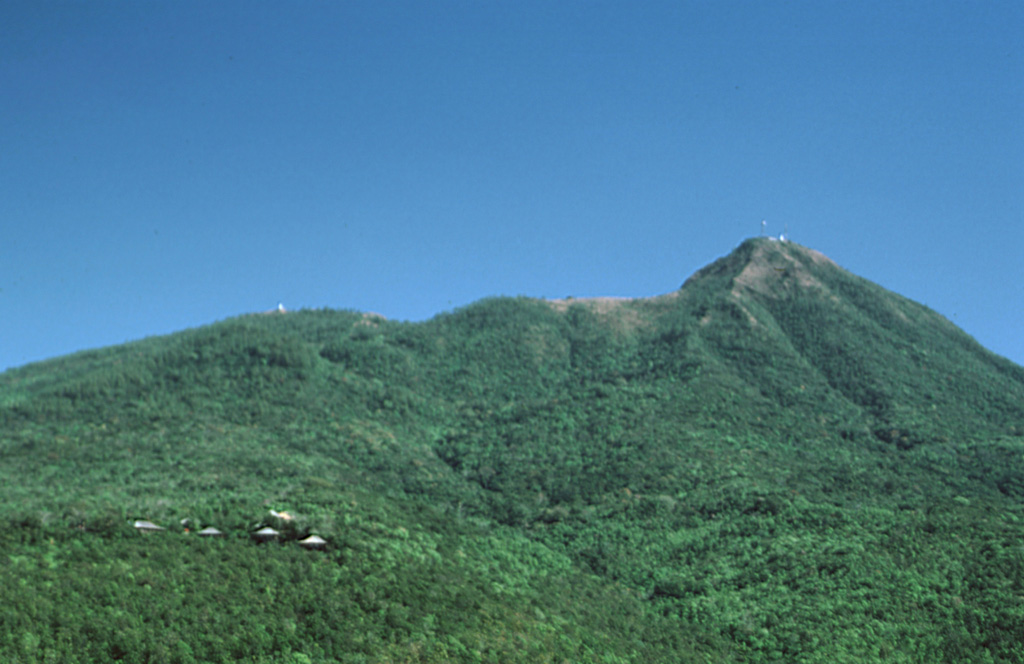
 Mount Popa in central Myanmar is seen here from the town of Popa on the W flank. The summit of the volcano forms the back headwall of a large horseshoe-shaped collapse scar produced by collapse of the edifice. This 1.6-km-wide, 850-m-deep crater opens to the NW, in the direction of the ridge on the left horizon. The 3 km3 debris avalanche deposit to the N covers an area of 27 km2.
Photo by Sorena Sorensen, 2000 (Smithsonian Institution).
 The Singu Plateau is largely comprised of lava flows, with the flow fronts along the river visible in this November 2019 Planet Labs satellite image monthly mosaic (N is at the top; this image is approximately 20 km across). The field has been offset by the Sagaing fault visible down the center of the image, and the river has been diverted around the flow front.
Satellite image courtesy of Planet Labs Inc., 2019 (https://www.planet.com/).
This is a compilation of Burma (Myanmar) volcano information sources, such as official monitoring or other government agencies.
| Volcanic Ash Advisory Center | |
|---|---|
| Darwin Volcanic Ash Advisory Centre (VAAC) | |
| - Darwin VAAC Archive | |

