Germany Volcanoes
Germany has 1 Holocene volcanoes. Note that as a scientific organization we provide these listings for informational purposes only, with no international legal or policy implications. Volcanoes will be included on this list if they are within the boundaries of a country, on a shared boundary or area, in a remote territory, or within a maritime Exclusive Economic Zone. Bolded volcanoes have erupted within the past 20 years. Suggestions and data updates are always welcome ().
| Volcano Name | Last Eruption | Volcanic Province | Primary Landform |
|---|---|---|---|
| West Eifel Volcanic Field | 8300 BCE | Central European Province | Cluster |
Chronological listing of known Holocene eruptions (confirmed or uncertain) from volcanoes in Germany. Bolded eruptions indicate continuing activity.
| Volcano Name | Start Date | Stop Date | Certainty | VEI | Evidence |
|---|---|---|---|---|---|
| West Eifel Volcanic Field | 8300 BCE ± 300 years | Unknown | Confirmed | Isotopic: 14C (uncalibrated) | |
| West Eifel Volcanic Field | 8740 BCE ± 150 years | Unknown | Confirmed | Isotopic: 14C (calibrated) |
Germany has 2 Pleistocene volcanoes. Note that as a scientific organization we provide these listings for informational purposes only, with no international legal or policy implications. Volcanoes will be included on this list if they are within the boundaries of a country, on a shared boundary or area, in a remote territory, or within a maritime Exclusive Economic Zone. Suggestions and data updates are always welcome ().
| Volcano Name | Volcanic Province | Primary Volcano Type |
|---|---|---|
| East Eifel Volcanic Field | Central European Province | Cluster |
| Rodderberg | Central European Province | Minor |
There are 4 photos available for volcanoes in Germany.
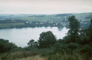
 The Mehrener maar is one of about 80 maars of the West Eifel Volcanic Field. The village of Mehrener is located on the shore of a lake partially filling the crater, whose rim lies behind the village. Maars, scoria cones, and small stratovolcanoes cover an area of 600 km2, W of the Rhine River. Most of the volcanic features formed during eruptions between about 730,000 and 10,000 years ago.
Photo by Richard Waitt, 1990 (U.S. Geological Survey).
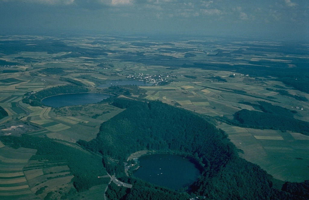
 An aerial view from the NW provides an overview of three lake-filled maars, the Gemunden maar in the foreground, and the Weinfeld and Schalkenmehren maars at the left center. Explosive eruptions through nonvolcanic bedrock during the late Pleistocene formed craters with low rims of volcanic ejecta. The West Eifel volcanic field of western Germany contains about 240 scoria cones and maars.
Copyrighted photo by Katia and Maurice Krafft.
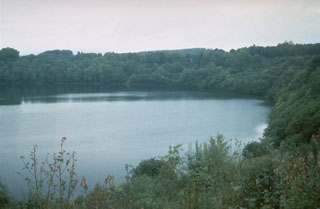
 The lake-filled Weinfelder maar is one of about 80 maars of the West Eifel Volcanic Field in Germany, west of the Rhine River. The roughly 500-m-wide crater was formed during the late Pleistocene by explosions through non-volcanic bedrock. About 230 eruptions during the past 730,000 years formed a 600 km2 area that includes maars, scoria cones, and small stratovolcanoes.
Photo by Richard Waitt, 1990 (U.S. Geological Survey).
 The Schalkenmehren maar is one of about 240 volcanic vents forming the West Eifel volcanic field in western Germany. The crater, now partially occupied by a lake, farmland, and the town of Schalkenhren, was formed by explosive eruptions through nonvolcanic bedrock that created a low, 1-km-wide crater rim of volcanic ejecta.
Copyrighted photo by Katia and Maurice Krafft.
This is a compilation of Germany volcano information sources, such as official monitoring or other government agencies.
| Volcanic Ash Advisory Center | |
|---|---|
| Toulouse Volcanic Ash Advisory Center (VAAC) Notices and Archive | |


