Syria Volcanoes
Syria has 1 Holocene volcanoes. Note that as a scientific organization we provide these listings for informational purposes only, with no international legal or policy implications. Volcanoes will be included on this list if they are within the boundaries of a country, on a shared boundary or area, in a remote territory, or within a maritime Exclusive Economic Zone. Bolded volcanoes have erupted within the past 20 years. Suggestions and data updates are always welcome ().
| Volcano Name | Last Eruption | Volcanic Province | Primary Landform |
|---|---|---|---|
| Harrat Ash Shaam | 2670 BCE | Northern Arabia Volcanic Province | Cluster |
Chronological listing of known Holocene eruptions (confirmed or uncertain) from volcanoes in Syria. Bolded eruptions indicate continuing activity.
| Volcano Name | Start Date | Stop Date | Certainty | VEI | Evidence |
|---|---|---|---|---|---|
| Harrat Ash Shaam | 2670 BCE ± 200 years | Unknown | Confirmed | Isotopic: 14C (calibrated) |
Syria has 4 Pleistocene volcanoes. Note that as a scientific organization we provide these listings for informational purposes only, with no international legal or policy implications. Volcanoes will be included on this list if they are within the boundaries of a country, on a shared boundary or area, in a remote territory, or within a maritime Exclusive Economic Zone. Suggestions and data updates are always welcome ().
| Volcano Name | Volcanic Province | Primary Volcano Type |
|---|---|---|
| Feidat el-Mieza | Northern Arabia Volcanic Province | Minor |
| Himmat el-Jazira | Northern Arabia Volcanic Province | Cluster |
| Kaukab | Northern Arabia Volcanic Province | Cluster |
| Tigris Lava Flows | Northern Arabia Volcanic Province | Cluster |
There are 4 photos available for volcanoes in Syria.
 The Golan Heights basaltic volcanic field lies NE of Lake Tiberius (Sea of Galilee) in the Anti-Lebanon Mountains of SW Syria near the borders with Lebanon and Israel. Lake Tiberius, whose surface lies below sea level, is at the upper left in this NASA Space Shuttle image (N is to the upper right). The volcanic field contains 56 scoria cones of Pliocene-to-Holocene age and includes the prehistoric cone of Majdel Shams in the Golan Heights.
NASA Space Shuttle image STS060-97-24, 1994 (http://eol.jsc.nasa.gov/).
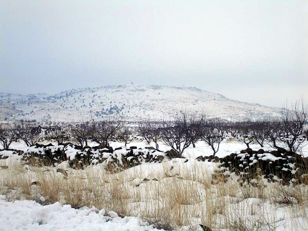
 Snow-capped Tell Qeni is the highest point of the Jabal ad Druze volcanic field, the southernmost in Syria. It lies in the Haurun-Druze Plateau in SW Syria near the border with Jordan. The field consists of a group of 118 basaltic volcanoes active from the lower-Pleistocene to the Holocene.
Anonymous photo by Wikipedia user KFZI310, 2006.
 The 100,000 km2 Harrat Ash Shaam volcanic field extends from the NW corner to the SE corner of this February 2021 Planet Labs satellite image monthly mosaic (N is at the top; this image is approximately 480 km across). The Harrat contains several volcanic fields including Al Harrah, Jabal ad Druze, Es Safa, Golan Heights, and the Kra Lava Field.
Satellite image courtesy of Planet Labs Inc., 2021 (https://www.planet.com/).
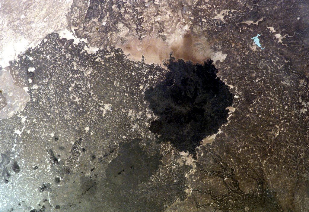
 The dark-colored lava flows in this NASA International Space Station image (N to the left) lie at the south end of the Es Safa volcanic field. This basaltic field (also referred to as As Safa), lies SE of the capital city of Damascas (Dimashq) and contains at least 38 scoria cones. This volcanic field lies within the northern part of the massive alkaline Harrat Ash Shaam volcanic field that extends from southern Syria to Saudi Arabia.
NASA International Space Station image ISS007-E-8414, 2003 (http://eol.jsc.nasa.gov/).
This is a compilation of Syria volcano information sources, such as official monitoring or other government agencies.
| Volcanic Ash Advisory Center | |
|---|---|
| Toulouse Volcanic Ash Advisory Center (VAAC) Notices and Archive | |


