Report on Colo (Indonesia) — August 1987
Scientific Event Alert Network Bulletin, vol. 12, no. 8 (August 1987)
Managing Editor: Lindsay McClelland.
Colo (Indonesia) Plume seen on satellite imagery
Please cite this report as:
Global Volcanism Program, 1987. Report on Colo (Indonesia) (McClelland, L., ed.). Scientific Event Alert Network Bulletin, 12:8. Smithsonian Institution. https://doi.org/10.5479/si.GVP.SEAN198708-266010
Colo
Indonesia
0.162°S, 121.601°E; summit elev. 404 m
All times are local (unless otherwise noted)
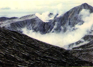
Imagery from the NOAA 10 polar orbiting weather satellite showed a plume that extended S then W ~200 km from Una Una on 14 July at 0708. VSI could not confirm that an eruption had occurred.
Geological Summary. Colo volcano forms the isolated small island of Una Una in the middle of the Gulf of Tomini in northern Sulawesi. The broad, low volcano contains a 2-km-wide caldera with a small central cone. Three eruptions have been recorded since the late 1800's, but two of those caused widespread damage over the island. The last eruption, in 1983, produced pyroclastic flows that swept over most of the island shortly after all residents had been evacuated.
Information Contacts: W. Gould, NOAA/NESDIS; VSI.

