
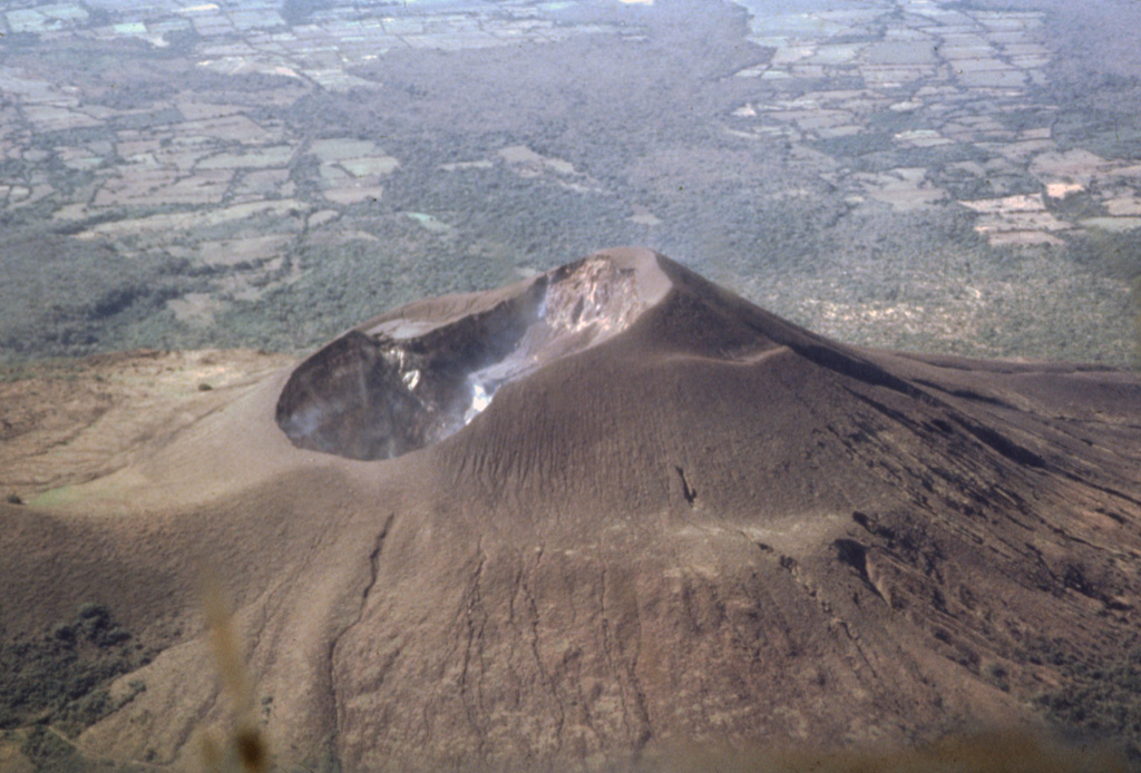
Based on webcam images, the Washington VAAC reported that on 29 March ash emissions at Telica rose as high as 1.5 km (5,000 ft) a.s.l. and drifted W.
Source: Washington Volcanic Ash Advisory Center (VAAC)
Weak explosions and minor ash plumes continue into late March 2022
Weak gas-and-ash explosions have been recorded from the summit crater complex of steep-sided Telica, in NW Nicaragua, since the early 20th century (BGVN 42:01). Its current eruption began in April 2021 and has recently consisted of weak ash explosions and ash plumes, activity which continued from August 2021 into late March 2022. Information primarily comes from monthly and special bulletins posted by the Instituto Nicaragüense de Estudios Territoriales (INETER), Washington Volcanic Ash Advisory Center (VAAC), and satellite images.
Sentinel-2 satellite images during this period showed frequent gas-and-ash emissions from the active eastern crater, intermittent ash plumes, and occasional thermal signals (figure 60). Ash plumes were last seen on satellite images on 27 March, and last reported by INETER on 29 March 2022.
INETER did not report any explosive activity during August 2021. According to INETER, at 0525 on 1 September an explosion generated an ash plume that rose 250 m above the crater rim and drifted N and NW. Emissions periodically continued later that day, without explosions, and caused minor ashfall in areas to the NW, W, and SW, including in the communities of Aguas Frías, San Pedro Nuevo, and Las Marías (7 km NNW). On 4 September, a diffuse ash plume rose to an altitude of 1.2 km (~160 m above the crater rim) and drifted less than 10 km WSW, based on satellite images and model data.
An ash plume was reported by the Washington VAAC on 4 October to 1.2 km altitude that drifted W and SW. During a field excursion on 12 October, several ejected bombs were observed in the crater ranging in diameter from 0.5-30 cm, accompanied by dark gray ash deposits. In the W part of the crater, a particularly large bomb that measured 1.5 x 0.5 m was ejected 65 m from the crater rim. According to INETER, at 1650 on 28 October a minor explosion generated an ash plume that rose 150 m above the crater rim and deposited ash on the NW flank. The event was followed by a short series of weak, low-energy explosions that generated ash plumes that rose 300 m high and drifted N and NE. Minor ashfall was reported in Aguas Frías.
Based on satellite and webcam images, the Washington VAAC reported that during 21-24 and 27-28 February, multiple brown ash emissions rose to an altitude of 1.5 km (~460 m above the crater rim) and drifted as far as 55 km W, WSW, and SW (figure 61). Intermittent ash plumes were also reported on 1, 24, and 29 March that rose to 1.2, 1.5, and 1.5 km altitude, respectively, and drifted SW and W.
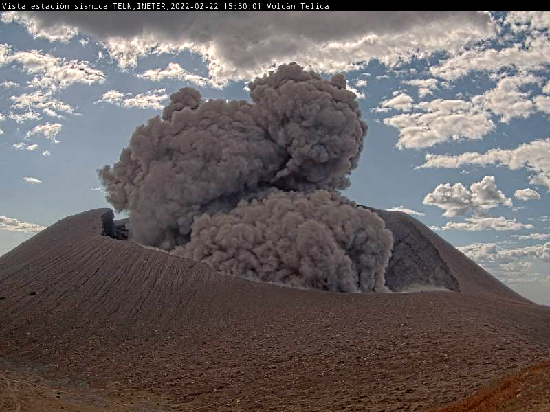 |
Figure 61. Webcam image (color corrected) of an ash explosion at Telica on 22 February 2022 at 1530, taken from seismic station TELN on the E flank. Courtesy of INETER. |
Sulfur dioxide measurements. Sulfur dioxide measurements using the mobile-DOAS technique at Los Mendoza, a fixed station about 7 km W of the volcano, found higher concentrations during July 2021 of 30 tons/day (t/d), an increase from April-June (13-18 t/d). Emissions increased further in August (36 t/d), November (41 t/d), and December (43 t/d), which INETER correlated with greater intermittent eruptive activity.
Other sulfur dioxide measurements using the mobile-DOAS technique and up to 19 transepts around the volcano found much greater average concentrations than the Los Mendoza site. The average concentration in November 2021 (544 t/d) was much greater than previous months: 286 t/d in August, 163 t/d in September, 161 t/d in October. Values dropped again in 2022 to 369 t/d in February and 118 t/d in March. In contrast, the temperatures at the crater decreased August-November, compared to January-April 2021 (figure 62).
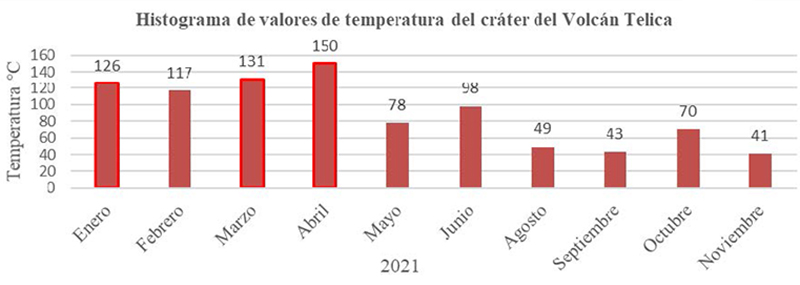 |
Figure 62. Histogram of temperatures taken in the crater of Telica during January-November 2021. Courtesy of INETER (Boletín mensual Sismos y Volcanes de Nicaragua, Noviembre, 2021). |
Information Contacts: Instituto Nicaragüense de Estudios Territoriales (INETER), Apartado Postal 2110, Managua, Nicaragua (URL: http://www.ineter.gob.ni/); Washington Volcanic Ash Advisory Center (VAAC), Satellite Analysis Branch (SAB), NOAA/NESDIS OSPO, NOAA Science Center Room 401, 5200 Auth Rd, Camp Springs, MD 20746, USA (URL: www.ospo.noaa.gov/Products/atmosphere/vaac); Sentinel Hub Playground (URL: https://www.sentinel-hub.com/explore/sentinel-playground).
2022: February
| March
2021: May
| June
| September
| November
2020: July
| October
| November
| December
2018: June
| August
2017: September
2016: February
| March
| April
| May
2015: May
| June
| September
| November
2012: September
2011: May
2007: January
| February
Based on webcam images, the Washington VAAC reported that on 29 March ash emissions at Telica rose as high as 1.5 km (5,000 ft) a.s.l. and drifted W.
Source: Washington Volcanic Ash Advisory Center (VAAC)
Based on webcam images, the Washington VAAC reported that on 25 March ash emissions at Telica rose as high as 1.5 km (5,000 ft) a.s.l. and drifted SW.
Source: Washington Volcanic Ash Advisory Center (VAAC)
Based on satellite and webcam images, the Washington VAAC reported that during 21-24 and 27-28 February multiple ash emissions at Telica rose as high as 1.5 km (5,000 ft) a.s.l. and drifted as far as 55 km W, WSW, and SW.
Source: Washington Volcanic Ash Advisory Center (VAAC)
INETER reported that at 1650 on 28 October a small explosion from Telica produced an ash plume that rose 150 m above the crater rim and deposited ash on the NW flank. The event was followed by a small series of low-energy explosions that generated ash plumes that rose 300 m high and drifted N and NE. Minor ashfall was reported in Aguas Frías.
Source: Instituto Nicaragüense de Estudios Territoriales (INETER)
INETER reported that on 4 September a diffuse ash plume from Telica rose 1.2 km (4,000 ft) a.s.l. and drifted less than 10 km WSW, based on satellite images and model data.
Source: Instituto Nicaragüense de Estudios Territoriales (INETER)
INETER reported that at 0525 on 1 September an explosion at Telica produced an ash plume that rose 250 m above the crater rim and drifted N and NW. Emissions periodically continued later that day, without explosions, and caused minor ashfall in areas to the NW, W, and SW including in the communities of Aguas Frías, San Pedro Nuevo, and Las Marías (7 km NNW).
Source: Instituto Nicaragüense de Estudios Territoriales (INETER)
INETER reported that at 0500 on 29 June ash-and-gas emissions from Telica rose 200 m above the crater rim and drifted SW. The Washington VAAC noted that ash was emitted during 2-3 July. A few discrete emissions and ash near the crater were visible in webcam images on 2 July, and possible diffuse ash just W of the crater was seen in satellite images. Plumes likely rose to 1.2-1.5 km (4,000-5,000 ft) a.s.l. Another steam-and-ash plume drifted SW and then turned N. On 3 July possible ash plumes rose to 1.5 km (5,000 ft) a.s.l. and drifted WSW.
Source: Instituto Nicaragüense de Estudios Territoriales (INETER)
INETER reported that a series of 16 small explosions at Telica began at 0508 on 22 May, and produced ash-and-gas emissions that rose 250 m above the crater. Tephra from the plumes fell back down into the crater.
Source: Instituto Nicaragüense de Estudios Territoriales (INETER)
INETER reported that there were two small ash-and-gas explosions at Telica recorded during 8-9 December, making a total of 1,315 small explosions recorded since the latest activity began 30 November. Gas-and-ash plumes rose as high as 200 m above the crater rim.
Source: Instituto Nicaragüense de Estudios Territoriales (INETER)
INETER reported that there were 598 “low energy” ash-and-gas explosions at Telica recorded during 1-3 December, making a total of 775 recorded since the activity began on 30 November. Gas-and-ash plumes rose 50-400 m above the crater rim and mainly drifted SW. Ashfall was reported in areas downwind including in Zarandaj (7 km WSW), Cristo Rey (6 km W), Las Colinas (7 km WSW), Garrobo Empinado (8 km SW), El Panal (9 km SSW), Canta Rana, Ceibo Chachagua (10 km SW), Las Mercedes, Punta Arena (11 km SW), La Virgen, and Filiberto Morales (15 km WSW).
Source: Instituto Nicaragüense de Estudios Territoriales (INETER)
INETER reported that ash-and-gas plumes rose from Telica on 30 November and drifted NE. Social media posts noted that around 50 ash-and-gas plumes rose 100-400 m above the crater rim during 30 November-1 December. Ash fell in Los Cocos (9 km SSW), El Panal (9 km SSW), Verónica Lacayo (10 km SW), Nuevo Belén, and pictures showed vegetation and buildings coated in ash.
Sources: Instituto Nicaragüense de Estudios Territoriales (INETER); GeoTerra6; Radio 580 Nicaragua
INETER reported that a series of three explosions at Telica began at 1910 on 29 October and ended at 2137. The events ejected rock fragments onto the flanks and produced gas-and-ash plumes that rose as high as 1 km above the crater rim and drifted W. Ashfall was reported in areas downwind including the communities of El Bosque, Jacinto Baca (15 km WSW), Filiberto Morales (15 km WSW), Carlos Huete, Linda Vista, Divino Niño (31 km W). Three explosions produced gas-and-ash plumes that rose 250-600 m above the rim during 30-31 October. A minor amount of ash fell on the flanks.
Source: Instituto Nicaragüense de Estudios Territoriales (INETER)
INETER reported that during 6-7 October there were five explosions recorded at Telica. The largest occurred at 0742 on 7 October; it produced an ash plume that rose 600 m and drifted SW and caused ashfall around the crater.
Source: Instituto Nicaragüense de Estudios Territoriales (INETER)
SINAPRED reported that 7-10 gas-and-ash explosions at Telica on 29 July generated plumes that rose 30-60 m above the crater rim and drifted N.
Sources: Sistema Nacional para la Prevención, Mitigación y Atención de Desastres (SINAPRED); El 19 Digital
SINAPRED stated that at 1659 on 20 July small explosions at Telica produced a gas-and-ash plume that rose 200 m above the crater rim as reported by INETER. RSAM values increased from 57 to 153 units at the time of the explosions, and remained elevated at 144 units afterwards. SINAPRED recommended that the public stay at least 1.5 km away from the crater.
Source: Sistema Nacional para la Prevención, Mitigación y Atención de Desastres (SINAPRED)
SINAPRED reported that on 15 August an explosion at Telica generated an ash plume that rose 200 m above the crater rim.
Source: Sistema Nacional para la Prevención, Mitigación y Atención de Desastres (SINAPRED)
INETER and SINAPRED reported that an eruption at Telica began at 0708 on 21 June. Explosions produced an ash plume that rose 500 m above the crater and drifted E, S, and SW, and ejected tephra that was deposited within a 1-km-radius of the volcano. Ashfall was reported in areas including La Joya, Las Marías (7 km NNW), Pozo Viejo (10 km NNW), Ojo de Agua, San Lucas (11 km NNW), Las Higueras, Las Grietas (12 km NNW), and Posoltega (16 km WSW).
Sources: Instituto Nicaragüense de Estudios Territoriales (INETER); Sistema Nacional para la Prevención, Mitigación y Atención de Desastres (SINAPRED)
INETER reported that a small gas explosion was heard by local residents on 10 September. INETER warned the public to stay at least 2 km away from the crater.
Source: Instituto Nicaragüense de Estudios Territoriales (INETER)
Based on information from INETER, SINAPRED reported that 30 explosion at Telica occurred during 7-8 May, producing gas-and-ash plumes that rose 600 m and drifted S and SW. The explosions originated from a new vent in the N part of the crater; lava emissions were also observed. INETER reported high micro-seismicity and low outgassing during 11-16 May. Incandescence from vents on the crater floor was visible during 11-12 May; sounds from jetting gasses were noted on 11 May. RSAM values were 180-190 units during 11-12 May, dropping to 80 units during 12-14 May.
Sources: Instituto Nicaragüense de Estudios Territoriales (INETER); Sistema Nacional para la Prevención, Mitigación y Atención de Desastres (SINAPRED)
INETER reported that during 6-11 April micro-seismicity at Telica remained high and lava in a vent on the crater floor was observed. Gas emissions were at low to moderate levels and RSAM values were low.
Source: Instituto Nicaragüense de Estudios Territoriales (INETER)
On 30 March INETER reported that micro-seismicity at Telica remained high and was characterized by small, high-energy earthquakes. Incandescence emanated from the crater floor. On 4 April SINAPRED noted that seismicity continued at a high level and warned the public to stay away from the crater.
Sources: Instituto Nicaragüense de Estudios Territoriales (INETER); Sistema Nacional para la Prevención, Mitigación y Atención de Desastres (SINAPRED)
In a 28 March report, SINAPRED noted that incandescence from Telica’s crater continued to be observed, and reminded people to stay away from the crater.
Source: Sistema Nacional para la Prevención, Mitigación y Atención de Desastres (SINAPRED)
INETER reported high micro-seismicity at Telica during 20 February-1 March. Incandescence from the vent on the crater floor increased; lava in the vent was first observed on 25 February and persisted through 1 March. Five gas-and-ash explosions were recorded during 29 February-1 March, generating plumes that rose 300 above the crater and drifted W and SW. The strongest event started at 0819 and produced gas-and-ash emissions for 14 minutes.
Source: Instituto Nicaragüense de Estudios Territoriales (INETER)
INETER reported that high micro-seismicity at Telica was associated with gas explosions during 16-17 February. On 18 February SINAPRED stated that a small amount of lava was visible in a vent.
Sources: Instituto Nicaragüense de Estudios Territoriales (INETER); Sistema Nacional para la Prevención, Mitigación y Atención de Desastres (SINAPRED)
Based on satellite data, the Washington VAAC reported that on 13 February a gas plume possibly containing ash rose from Telica to an altitude of 1.8 (6,000 ft) a.s.l. and drifted WSW. On 16 February INETER reported that high micro-seismicity was associated with gas explosions.
Sources: Instituto Nicaragüense de Estudios Territoriales (INETER); Washington Volcanic Ash Advisory Center (VAAC)
INETER reported that four 5-minute-long explosions at Telica were detected at 0602, 0818, 0934, and 1124 on 25 November, and generated ash-and-ash emissions. On 26 November multiple gas-and-ash explosions were detected; the strongest explosion occurred at 0941 and produced an ash plume that rose more than 800 m above the crater. During 26-27 November a total of 29 explosions were detected, with 16 of those producing ash plumes.
Source: Instituto Nicaragüense de Estudios Territoriales (INETER)
Based on wind and satellite data, pilot observations, and webcam images, the Washington VAAC reported that on 22 November an ash plume from Telica rose to an altitude of 2.4 km (8,000 ft) a.s.l. and drifted almost 100 km W. According to news articles, (at least) two explosions, at 0847 and 0848, generated ash plumes that rose 2 km and ejected tephra at least 900 m away. An unstated number of people living within a 900-m-radius evacuated, and residents in Agua Fría (also 900 m away) noted it was the first time variously-sized lapilli and blocks had reached their community. Ash fell in at least 70 communities in the municipalities of Quezalguaque (13 km SW), Posoltega (16 km WSW), Chichigalpa (20 km WSW), and Chinandega (30 km W).
Sources: Washington Volcanic Ash Advisory Center (VAAC); La Prensa (Nicaragua); La Jornada
INETER reported that a 30-minute period of moderate-intensity explosions at Telica began at 0800 on 23 September. Abundant gas-and-ash emissions initially rose 400 m above the crater and drifted WNW, but then decreased to 50 m. Ashfall was reported in the community of Guanacastal. Explosions occurred at 1645 and 1648. Scientists conducting fieldwork observed deposits on the crater floor from an inner-wall landslide that had occurred on 17 July, and new fumaroles on the crater floor. Five explosions were detected on 24 September. Based on wind and satellite data, the Washington VAAC reported that on 26 September ash plumes rose as high as 3.6 km (12,000 ft) a.s.l. and drifted W and N. During 28-29 September INETER noted that voluminous gas plumes rose from two vents on the crater floor.
Sources: Instituto Nicaragüense de Estudios Territoriales (INETER); Washington Volcanic Ash Advisory Center (VAAC)
On 6 June INETER reported that during the previous day six small gas explosions occurred at Telica, for a total of 806 explosions since an unspecified time of increased activity. A report on 8 June stated that no seismic events had been detected during the previous 72 hours.
Source: Instituto Nicaragüense de Estudios Territoriales (INETER)
Based on webcam views and satellite images, the Washington VAAC reported that on 26 May an ash plume from Telica drifted W at an altitude of 4.3 km (14,000 ft) a.s.l. Later that day a gas-and-ash plume rose to an altitude below 3 km (10,000 ft) a.s.l. and drifted 75 km W. INETER reported continuing small gas explosions during 28 May-1 June; a total of 798 explosions since an unspecified time of increased activity. Ashfall was reported in Posoltega (16 km SW), Corinto (40 km WSW), Chinandega (30 km W), Chichigalpa (20 km WSW), and El Realejo (35 km WSW).
Sources: Washington Volcanic Ash Advisory Center (VAAC); Instituto Nicaragüense de Estudios Territoriales (INETER)
On 8 May INETER reported that activity at Telica had been increasing. Earthquakes SE of the volcano and seven small-intensity explosions had been detected during an unspecified period, although a M 2.4 earthquake had occurred at 1102 on 7 May. During 11-12 May there were 18 explosions, for a total of 64 since the increased activity began. An explosion at 0950 on 12 May was accompanied by small quantities of ash emissions. At 1223 an explosion generated a gas-and-ash plume and ejected hot rocks (pre-existing material) 400 m high and to the W. Minor ashfall was reported in El Realejo, Corinth, Posoltega, and Chichigalpa. Seismicity was at normal levels. By 1200 on 18 May a total of 421 small explosions had been detected (164 in the previous 24 hours); gas emissions were low. During 18-20 May reports noted that 31 small gas explosions had been detected; ash had not been detected since 17 May and activity was decreasing. During 21-22 May 16 small gas explosions occurred, for a total of 540 explosions. Gas explosions continued during 22-24 May. A few of the explosions ejected hot rock fragments and generated ash plumes. Ashfall was reported in Posoltega, Guanacastal, Quezalguaque, Chinandega, El Viejo, Chichigalpa, and El Realejo.
Source: Instituto Nicaragüense de Estudios Territoriales (INETER)
Based on satellite images, the Washington VAAC reported that on 11 May multiple emissions of gas and ash from Telica rose to an altitude below 1.8 km (6,000 ft) a.s.l. and drifted W. The emissions dissipated within six hours.
Source: Washington Volcanic Ash Advisory Center (VAAC)
During 10-11 September INETER reported "jet" sounds from Telica, two incandescent fumaroles, and gas-and-steam plumes rising 100-200 m above the crater. On 11 September two small explosions occurred in the crater. During 12-14 and 17 September gas plumes rose 30-150 m and incandescence from the crater was observed. Gas measurements on 14 and 17 September showed normal levels of sulfur dioxide emissions.
Source: Instituto Nicaragüense de Estudios Territoriales (INETER)
INETER reported that during April seismicity at Telica increased, with earthquake magnitudes ranging up to 3.3 and some explosions detected. On 14 May at approximately 2310 a series of explosions were detected by the seismic network and were accompanied by ash and gas emissions. Tephra fall was reported in La Quemada, 4 km N. During the previous few days residents in nearby communities observed reddish colored gas plumes, and those living on the flanks felt earthquakes. On 16 May the seismic network registered three explosions that were accompanied by gas-and-tephra emissions. One plume rose 1.2 km above the crater. Nearby communities to the SE, including Cristo Rey, Las Colinas, and La Quemada, were affected by the emissions.
During 17-18 May another series of small explosions was detected. A gas-and-ash plume rose 600 m above the crater. On 18 May an explosion that lasted 6 minutes produced an ash plume that rose 2.6 km above the crater. Fifteen explosions during 18-19 May were accompanied by gas-and-ash plumes that rose 500-800 m high. Women and children living on the flanks were evacuated. Explosions continued to be detected during 19-20 May with gas-and-ash plumes again rising 500-800 m above the crater. Residents on the N flank in the community of El Ñajo reported that new fumaroles had opened, prompting authorizes to plan for monitoring all wells within a 5-km-radius of Telica. During 20-21 May activity decreased. An observer reported four strong explosions and gas-and-tephra plumes that rose 500-700 m high.
Source: Instituto Nicaragüense de Estudios Territoriales (INETER)
Based on reports from INETER, the Washington VAAC stated that emissions of gas-and-ash from Telica were detected on 15 May, and ash fell in areas 4 km N. Seismicity was elevated for a period of time.
Source: Washington Volcanic Ash Advisory Center (VAAC)
The Washington VAAC reported that continuous emissions of ash from Telica were visible on a web-camera on 15 February. A resultant plume rose to an altitude of 1.5 km (5,000 ft) a.s.l. Based on satellite imagery, the plume drifted SW and a hotspot was present at the summit.
Source: Washington Volcanic Ash Advisory Center (VAAC)
On 9 January, INETER reported that a gas-and-ash plume from an eruption of Telica reached an altitude of 1.5 km (4,900 ft) a.s.l., drifted W, and then reached a greater altitude. The eruption was accompanied by increased seismic activity. The Washington VAAC reported that a possible ash plume was visible on satellite imagery and on a web camera, drifting SW.
Sources: Washington Volcanic Ash Advisory Center (VAAC); Instituto Nicaragüense de Estudios Territoriales (INETER)
Reports are organized chronologically and indexed below by Month/Year (Publication Volume:Number), and include a one-line summary. Click on the index link or scroll down to read the reports.
Possible rumbling and steam emission
Card 0215-0216 (04 November 1968) Possible rumbling and steam emission
The following was received from Richard Dillard via radio on 4 November 1968. "The last couple of nights the farm people claim that [Telica] is beginning to rumble a little bit. The only thing that is coming out of it is a little smoke and steam, no ash or anything."
Information Contacts: Richard Dillard, León.
Intermittent light ashfall since 11 February
Card 0409 (17 February 1969) Intermittent light ashfall since 11 February
Telica . . . has exhibited limited and intermittent activity since 11 February, primarily comprising light ashfall in the area immediately adjacent to the volcano.
Information Contacts: American Embassy, Managua.
Ashfall noticed in León on 4 March
Card 0459 (10 March 1969) Ashfall noticed in León on 4 March
On 10 February the Telica volcano started its activity with emission of white clouds from the NE side of the crater. On 14 February the clouds . . . were darker and heavier in appearance. On the following days, the activity increased in frequency of emissions, so it did in quantity and altitude reached by the clouds formed by the erupted material. On 19 February Telica decreased in activity, diminishing to such a point that on 27 or 28 February it stopped completely during the day. On 4 March, for the first time, falling ash was perceptible in the city of León.
Information Contacts: Gladys León Quant, National University of Nicaragua.
Ash and lapilli eruption on 14 May
Card 0560 (27 May 1969) Ash and lapilli eruption on 14 May
Activity . . . started 14 May in the morning, erupting fine ash and lapilli. [On 15 May there was] a very strong eruption in the morning. [On 17 May there was] decreasing activity. Many tremors during the activity.
Information Contacts: Jose Viramonte, Servicio Geologico National, Managua.
Large dark eruption column on 19 August
Card 0732 (25 August 1969) Large dark eruption column on 19 August
The following is to report that Telica has not been completely inactive. From time to time it has been throwing out volcanic material but in small quantities and mainly in the early hours of the day. Nevertheless, these last days, it has increased in its activities and today (19 August), at 0900 it had quite a large red-dark brown column of "smoke" that is perhaps four times larger than any previous day's. The clouds of volcanic material seem to be coming out from the northern side of the mouth. It maintained its activity at the same level all day long. Still in activity at 0900 [on 20 August]. It has notoriously diminished. It seems to be one third of what it was yesterday.
Information Contacts: Gladys León Quant, National University of Nicaragua.
Sporadic eruptive emissions strengthen during 18-22 August
Card 1000 (28 August 1970) Sporadic eruptive emissions strengthen during 18-22 August
"Telica began a new eruption on 18 August with sporadic eruptive emissions that were not very large and did not seem more special than usual. On [19 August] the activity was very clear. Columns of ash were emitted from time to time and had a dark, almost black color when coming out of the crater, but took on a brown color a little farther from the volcano. It was clearly observed that the heavier particles erupted fell down quite close to the volcano and the ash particles remained suspended in the atmosphere being dragged by the air towards the Pacific coast. On this day, the frequency of the eruptions were more of less two every five minutes. On 20 August the volcano was more active. The columns were larger, darker, and more frequently erupted. On [21 and 22 August] the activity increased. The emission is constant and from time to time becomes stronger."
Information Contacts: Jose Viramonte, Servicio Geologico National, Managua; Gladys León Quant, National University of Nicaragua.
Largest ashfall in recent years
Card 1002 (04 September 1970) Small eruption cloud on 17 August
The following was received from the American Embassy, Managua. "Telica erupted at 0430 on 17 August and continued in activity until 25 August, around 2100. Explosion was slight but of sufficient magnitude to be called eruption. No blocks, bombs, or lapilli were ejected. There was no lava flow. Eruption cloud rose to [450 m]. Eruption cycle was every ten minutes. Emission consisted of sand particles of basaltic minute spheres. Local farmers heard rumblings in early morning hours but generally eruption has been quiet. No seismic activity reported. Effects of ash minimal because ash fall was fine and apparently chemically non-toxic. Daily rains washed ash from foliage. Although no adverse effects of ash reported, Viramonte has sent samples to Dartmouth College for confirmation non-toxic character. Geological Service as a body has been interested in investigation. Ash was blown in northwestern direction toward Corinto. Volcano has now returned to normal fumarolic activity."
Card 1005 (08 September 1970) Large ash clouds during 17-25 August
"One of the largest ash eruptions of Telica in recent years took place from 17 to 25 August. Large ash clouds reaching approximately [450 m] high were erupted at intervals (5 to 10 minutes) by the central crater. The direction of the ash clouds was NW, and reached the cities of Chichigalpa, Posoltega, and Corinto, affecting the cotton plantations of the region. Petrographical and chemical analyses were made and the following results were obtained. Petrographical descriptions: Olivinic Basaltic ash with plagioclase (Ab30 An70), 35%; pyroxene (augite), 20%; olivine, 5%; magnetite and ilmenite, 10%; basaltic glass (Nd:1.56), 30%. Granulometric studies: 100 mesh, 8%; 150 mesh, 12%; 200 mesh, 18%; 2, 55.10%; Al2O3, 17.20%; Fe2O3, 2.40%; FeO, 6.54%; MnO, 0.20%; MgO, 3.5%; CaO, 7.42%; Na2O, 2.62%; K2O, 1.50%; TiO2, 0.75%; P2O5, 0.10%; H2O+, 0.25%; H2O-, 1.55%; Total, 99.13%.
Information Contacts:
Card 1002 (04 September 1970) Pablo Martinez Navas, Gen. Geological Service, Managua; Jose Viramonte, Servicio Geologico National, Managua; American Embassy, Managua.
Card 1005 (08 September 1970) Jose Viramonte, Servicio Geologico National, Managua.
Active lava lake seen in the summit crater on 1 December
Card 1335 (22 December 1971) Active lava lake seen in the summit crater on 1 December
"An active lava lake was observed deep within Telica's summit crater on 1 December 1971 by Dartmouth College geologists. Similar observations from the rim one year ago showed no lava lake. The volcano has had numerous small ash eruptions in 1971; none of these affected more than the immediate area of the cone."
Information Contacts: R. Stoiber and Paul Taylor, Dartmouth College.
Large dark clouds emitted 3-4 November
Telica emitted large dark clouds during the morning of 3 and 4 November.
Information Contacts: R. Gleason and R. Stoiber, Dartmouth College.
Dark landslide material in typical small fume cloud
During the morning of 18 or 19 November, there was a little dark material in the small fume cloud that is usually present over Telica. Alain Creusot suggested that landsliding from the crater walls may have been responsible.
Information Contacts: R. Stoiber, Dartmouth College.
Explosions observed in late November
"During the early morning of 25 November, our group observed a series of ultravulcanian ash eruptions from Telica. An explosion was observed at 0605 from León, 19 km from Telica, producing a light brown ash cloud that rose 0.91 km above the summit. A dispersed cloud of ash from an earlier explosion was noted SW of the volcano. Four more explosions were observed, at 0617, 0622, 0626, and 0644. For the rest of the day, only intermittent observations were possible, but explosions were noted at 0740, 0835, and 1530. Ash fell in a zone extending about 5 km SSW of the volcano. Four kilometers from the source, the ash formed a discontinuous coating << 1 mm thick. Samples were collected for analysis at Dartmouth. A similar explosion, sending ash 1.6 km above the cone, was seen at 0605 on 26 November. At 0920 on 27 November, a dust cloud, presumably produced by another explosion, was seen from the air. The group reports that other Nicaraguan volcanoes show their normal level of fumarolic activity."
Information Contacts: R. Stoiber, R. Birnie, and S. Self, Dartmouth College.
Explosion frequency declines
Increased activity began 11 November, when sizeable explosions began to occur at a rate of about 1/hour, in contrast to about 1/month during the preceding year. Ash from some of the larger explosions reached the Pacific Ocean, about 35 km from the volcano. By early January, explosion frequency had declined to 1-2/day and ashfall was no longer reaching the ocean.
Information Contacts: A. Aburto Q., Instituto de Investigaciones Sísmicas; D. Harlow, USGS.
Minor white plume
A minor white plume was observed in early February.
Information Contacts: R. Stoiber, S. Williams, and M. Bruzga, Dartmouth College.
Small steam plume emission continues
When geologists visited Telica in June, a small steam plume continued to be emitted.
Information Contacts: R. Stoiber and S. Williams, Dartmouth College; M. Carr and J. Walker, Rutgers Univ.; A. Creusot, Instituto Nicaraguense de Energía.
Moderate vapor plume
In late 1980, a moderate-sized but continuous vapor plume rose from the summit crater. SO2 flux was remotely measured and found to be approximately 150 t/d.
Information Contacts: R. Stoiber, S. Williams, H.R. Naslund, L. Malinconico, and M. Conrad, Dartmouth College; A. Aburto Q. and D. Fajardo B., Instituto de Investigaciones Sísmicas.
Small intermittent vapor plume
A small-volume plume of vapor was intermittently released in early 1981. Shallow seismicity was regularly observed in the vicinity.
Information Contacts: R. Stoiber and S. Williams, Dartmouth College; D. de Jerez, IRENA; D. Fajardo B., Instituto de Investigaciones Sísmicas.
Holes in crater wall emit vapor plume; occasional minor ash eruptions
"Two flights were made over the summit crater of Telica, in mid-February and mid-March. Two large holes (each with a diameter of approximately 20-30 m) occurred high on the NW wall of the crater. They are reported (by Alain Creusot, Instituto Nicaraguense de Energía) to coalesce at depth. One or both of them emitted a continuous vapor plume. Occasional minor ash eruptions were reported by local people."
Information Contacts: R. Stoiber, S. Williams, Dartmouth College; D. de Jerez, IRENA; D. Fajardo B., Instituto de Investigaciones Sísmicas.
Continuous white vapor plume with occassional ash
"A small continuous plume of white vapor and occasional ash was observed in late November. The two summit vents on the W wall of the crater had merged into one."
Information Contacts: R. Stoiber, S. Williams, H.R. Naslund, B. Gemmell, and D. Sussman, Dartmouth College; D. Fajardo B., Instituto de Investigaciones Sísmicas.
Small gas and ash eruptions in late December and early January
"A series of small gas and ash eruptions took place in late December and early January. Ash fell only very close to the crater. Seismicity was above normal throughout the period and remained so in late January."
Information Contacts: R. Stoiber and S. Williams, Dartmouth College; D. Fajardo B., Instituto de Investigaciones Sísmicas.
Largest eruption since 1976; ashfall to coast
The quoted material below is from reports prepared by Dartmouth College geologists.
"On 12 February between 1100 and 1200 Telica had its largest eruption since 1976. It began after 1.5 days of relative seismic quiet and lasted about 45 minutes. Blocks and scoria 2-3 m in diameter were thrown over an area extending 200 m from the crater rim. Minor collapse occurred on the crater rim. Fires were ignited in grass up to 1 km from the crater, especially to the E. At 5-6 km downwind, moist sand-sized ash accumulated to 2-3 cm depth. Ash fell to the SW as far away as Corinto (45 km from Telica), on the Pacific coast."
While flying over the Pacific coast of Nicaragua in a commercial aircraft on 12 February at 1200, William I. Rose, Jr. saw a vertical ash column penetrate the top of the cloud deck (at about 1.8-2.4 km altitude) over the Telica area. After about 50 seconds, the eruption column reached its maximum altitude of 3.7-4.3 km. Rose observed a second, smaller eruption column at 1207 before moving out of view of the area at 1215.
"The eruption followed several months of minor gas and ash ejection and notably heightened levels of seismic activity. Eruptive activity had apparently increased in duration and frequency during the week preceding 12 February." Dull red incandescence had been visible in the deepest portion of the vent for weeks and new bright incandescence was noted on 8 February in a fumarole at a much higher elevation, after a day of eruption. A second eruption from 1545-1610 on 12 February also ejected blocks and scoria but was much smaller.
La Prensa reported that between 12 and 14 February at least 50 people (of the roughly 8,000 living nearby) had been evacuated from the S side of the volcano, and the Red Cross established an aid station. Some farm birds were killed and small cotton fields on the flanks of Telica were coated with ash. Wild birds and animals also fled the area. The Red Cross reported strong activity 14 February and ejection of ash and blocks at 0930 on 15 February.
"On 19 February at 1030 a second large eruption sent ash as far to the WSW as Chinandega (35 km away)." William Rose was again flying along the coast of Nicaragua, about 160 km offshore, and observed 2 distinct explosions, the first starting at about 1030, the second between 1100 and 1115. Tephra clouds rose to more than 3.5 km altitude and black ash blew to the NW. "In the following week, 2-3 small eruptions each day sent ash and gas over the immediate area.
"The day geologists visited the crater, 24 February, there were no large eruptions and there had not been since 20 February. An impressive bomb and block field was laid down on the N side of the crater, extending approximately 300 m to the N. Craters 1-1.5 m across were created by low-angle impact of bombs 50 cm in diameter at the 300-m range. At approximately 100 m from the crater rim, the surface was 100% cratered and at 80 m was 100% covered with debris. Maximum thickness was 50 cm at the crater rim. The deposit was strongly inversely graded. Fresh breadcrusted scoria bombs up to 80 cm in diameter were widely scattered throughout the deposit. The active vent had increased in size by about two times. It was elongated N-S and was approximately 75 x 50 m. No incandescence was visible during the day. Slumping of the wall above the vent may have removed about 10 m from the rim of the crater.
"Gas emission between eruptions on 24 February was very small, as it was on 28 January. The gas was bluish in color and smelled like SO2 and HCl, but not H2S. Samples were taken on both days. Volcanic tremor occurred in irregular pulses only. The volcano has been relatively quiet seismically since the eruption of 12 February. In January and early February, there had been several magnitude 2-3 earthquakes each day."
Information Contacts: R. Stoiber, S. Williams, W. Crenshaw, and D. Sussman, Dartmouth College; W. Rose, Jr., Michigan Tech. Univ.; D. Fajardo B., INETER; A. Creusot, Instituto Nicaraguense de Electricidad; La Prensa.
Last confirmed eruption on 2 March
"The eruption sequence that began in mid-December 1981 appears to have drawn to a close. The last confirmed eruption occurred at approximately noon on 2 March, sending ash to Corinto and beyond. Since then the volcano has also been seismically quiet. A crater visit on 19 March revealed continued collapse of the crater walls. The vent was clogged with boulders and a ring of strongly jetting fumaroles was established around its margins."
Further Reference. Williams, S.N., 1985, La Erupción del Volcán Telica, Nicaragua, 1982; Boletín de Vulcanología (Universidad Nacional, Heredia, Costa Rica), no. 15, p. 10-19.
Information Contacts: S. Williams and R. Stoiber, Dartmouth College; I. Menyailov and V. N. Shapar, IVP, Kamchatka; D. Fajardo B., INETER.
Ash eruptions also eject scoria and large incandescent blocks
The diameter of the E part of the crater increased by about 10 m. As of early August no seismicity was being recorded but fumarolic activity was stronger than it had been before the December-March eruption.
Information Contacts: D. Fajardo B., INETER; R. Parnell, Jr., Dartmouth College.
Increased seismicity and fumarolic activity in February
After a tephra eruption ended 1 March 1982, seismicity returned to normal. Through November 1982 about 14 events were recorded per day. On 10 February 1983 a portable seismograph installed on the flank recorded 66 earthquakes. This increase was paralleled by stronger fumarolic activity on the S, SE, and SW part of the volcano.
Information Contacts: D. Fajardo B., INETER.
Continued normal activity and strong seismicity
Although normal activity continued, Telica continued to show stronger seismic activity than other Nicaraguan volcanoes. A seismograph registered 24 low-frequency microearthquakes in a 5-hour period on 9 July.
Information Contacts: D. Fajardo B., INETER.
Eruption in November 1987 forms a new vent in the crater
An eruption occurred in November 1987 but was not observed by geologists. Residents of the area near the E side of the crater reported an incandescent column and loud bangs but said that the eruption was less intense than others in recent years. Newspapers printed photographs of a small eruption column.
Geologists found small fresh basaltic bombs 50 m from the E rim of the crater that may have been from the eruption. A vent 30-50 m wide had opened in the NE corner of the crater. The maximum temperature on a rock surface in the new vent was 246°C. Fumarolic activity was markedly stronger than in 1985-86, when only one large fumarole had been present, on the N side of the crater. In January 1988, there were fumaroles on all sides of the crater and on its floor (figure 1). At least one was emitting gas with a loud roar, and the plume was visible from 5 km away.
The fumarole field [at San Jacinto Hot Springs] had temperatures no higher than 101°C on 17 January.
Information Contacts: B. van Wyk de Vries, H. Rymer, and G. Brown, Open Univ; P. Hradecky and H. Taleno, INETER.
Incandescence seen at four vents on the crater floor
During fieldwork at the summit crater 9-10 March, incandescence from four closely spaced vents on the crater floor was observed at night. Brightness temperatures were obtained with Minolta Cyclops 33 (bandpass 8-14 µm, 1° field of view) and Cyclops 52 (bandpass 0.8-1.1 µm, 0.33° field of view) infrared thermometers. Temperatures are not corrected for emissivity and atmospheric absorption effects. A brightness temperature of 550°C was measured at night (Cyclops 52) but the hot target filled only a fraction of the field of view.
Information Contacts: C.M.M. Oppenheimer and D.A. Rothery, Open Univ; B. van Vyk de Vries, O. Castellon, and L. Urbina, INETER.
Fumaroles emit white plumes
A visit to the volcano on 5 June revealed two small brown crater lakes, 10 m across (figure 2). A number of large collapses had occurred, covering much of the crater floor with blocks. Fumarolic activity was vigorous (particularly from a vent on the SE side) and produced a continuous plume over the crater. No eruptive activity has been reported since December 1987.
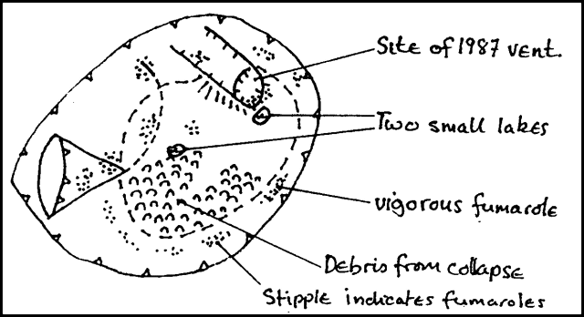 |
Figure 2. Sketch of the active crater of Telica, 5 June 1989. Courtesy of B. van Wyk de Vries and O. Castellón. |
Information Contacts: B. van Wyk de Vries and O. Castellón, INETER, Apartado 1761, Managua, Nicaragua.
Large vapor clouds; fumaroles to 246°C
"In February 1990, fumarolic activity had declined from 1989 levels, with no observed incandescence. On 29 May, large clouds were observed from León and El Limón mine (50 km away). Subsequent observations at the crater revealed a strong geyser-like steam vent in the 1984/1987 explosion pits (figures 3 and 4). The steam at the crater edge (200 m above the vent) was warm and highly toxic; respiration was impossible without a gas mask. Local inhabitants reported crop damage from acid rain up to 2 km from the crater.
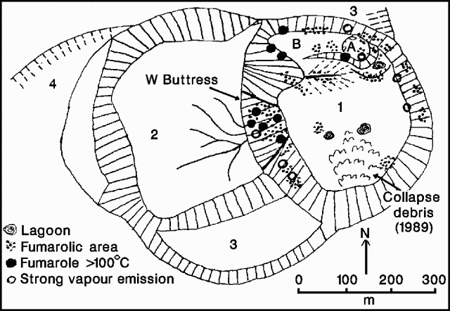 |
Figure 4. Sketch map of Telica's W craters, showing fumarole distribution 13 June 1990, drawn from on-site observation and aerial photographs. Courtesy of B. van Wyk de Vries. |
"Fumarole temperatures measured with an infrared radiometer on 13 June showed a maximum of 246°C in the SW side of the 1984/1987 explosion pits (figure 5). The steam vent was below 100°C. After heavy rain, the volume of steam increased enormously. The clear relationship between activity and precipitation was confirmed by local inhabitants, who claimed that such activity was common after storms, especially at the start of the wet season."
Information Contacts: B. van Wyk de Vries, O. Castellón, A. Murales, and V. Tenorio, INETER.
No significant plume emission
Although no detailed observations were made, no significant plume was emitted during 23-29 April fieldwork. Fumarolic activity that was vigorous in June 1989 (SEAN 14:02 and 14:06) had decreased notably by February 1990 (BGVN 16:02). Fumarole temperatures had also decreased, from around 550°C (9-10 March 1989) to <=246°C on 13 June 1990.
Information Contacts: S.N. Williams, Arizona State Univ.
No observed activity
There have been no reports of activity in the past year, and none was observed 6-7 January.
Information Contacts: Andrea Borgia, Instituto Nazionale di Geofisica, via di Vigna Murata 605, 00143 Roma, Italy; B. van Wyk de Vries, Open Univ; Peter J. Baxter, Dept of Community Medicine, Fenner's, Gresham Road, Cambridge, England.
Moderate fumarolic activity
On the afternoon of 2 September, the summit area of Telica was visited to gather data on fumarole temperatures and gas compositions. Fumaroles on the flank of a somma wall E of Telica measured 85°C. Fumaroles along angular fractures in the crater appeared strong, but were inaccessible.
Information Contacts: Michael Conway and Andrew Macfarlane, Florida International Univ; Charles Connor, Southwest Research Institute; Oscar Leonel Urbina and Cristian Lugo, INETER.
Collapse crater expands; incandescence observed
In late August a small collapse pit with an estimated diameter of 20 m was observed on the floor in the N zone of the 1982 central crater. An inspection of the vent on 23 October revealed a depth of 50 m and diameter of about 75-80 m. At night, the floor of the crater was partially incandescent. Maximum temperatures were estimated at 700-800°C based on the color of incandescence.
Information Contacts: Alain Creusot, Instituto Nicaraguense de Energía.
Passive fumarole and San Jacinto mud-pot temperatures remain stable; possible decrease in fumarole mass flux
Researchers from INETER and FIU visited Telica on 7 March 1994; Mike Conway submitted the following report. In late 1993, INETER deployed a seismic station about 500 m E of the crater, on the crest of an E-W trending ridge. Since the seismic station was deployed, the number of daily seismic events has ranged from 200 to 300. The unusually high seismicity led to concern that Telica was returning to an active phase.
Fumaroles feeding the plume rising from the Telica crater were inaccessible. A small field of passive fumaroles, situated in the E-W trending ridge wall almost immediately below the seismic station, yielded 78-84°C temperatures. These temperatures are similar to the 85°C temperature reported in September for the same fumaroles (BGVN 18:09). Mass flux from the fumaroles, however, appears to have decreased since September 1993. The change in mass flux may be related to seasonal variation in rainfall; the dry season in Nicaragua extends from November through March. Researchers at Telica are currently developing a program to study diffuse gases in soil.
San Jacinto Hot Springs. At the small village of San Jacinto there exist a number of boiling mud pots. San Jacinto is located along Nicaragua Highway 26, about 9 km NE of the town of Telica and 2 km E of Santa Clara volcano. Based on a 9 March 1994 visit by FIU researchers, Mike Conway submitted the following report.
The active mud-pot field measured about 35 x 100 m, elongate N to S. Alteration of basaltic lava flows to the E suggests that the geothermal field was much larger at one time, and probably equidimensional (225 x 225 m).
Individual mud pots ranged in size from 1 m to as much as 3-4 m in diameter. Many of the mud pots were actively spewing mud, and one, located at the SW corner of the field, had, according to local villagers, constructed a mud volcano (to 1-m height) during February-March 1994. For individual mud pots the ratio of mud or muddy water to relatively mud-free water varied. Mud-water temperatures throughout the field, however, were consistent and ranged from 98 to 100°C. These 100°C temperatures were similar to those measured in January 1988 (SEAN 13:01).
Eight soil gas samples, from sites distributed throughout the field, were analyzed for CO2 using a Hewlett Packard chromatograph. Soil gas CO2 ranged from 0.04 to 0.09 vol. %, with a mean value of 0.058 vol. % (standard deviation, 0.0184), well within the normal background range of about 0.04-0.1 vol. % typically found in many non-volcanic areas.
Information Contacts: Cristian Lugo and Martha Navarro, INETER; Michael Conway, Andrew Macfarlane, and Peter LaFemina, Florida International Univ (FIU); John B. Murray, Ben van Wyk de Vries, and Adam Maciejewski, Open Univ.
Explosive eruption causes ashfall >12 km SW of the summit
An eruption on 31 July produced a gas-and-ash column that rose ~800 m above the 1,060-m-high summit. Ashfall was reported SW of the volcano (figure 6). Phreatic activity continued until 12 August with gas emission and minor ash explosions. Seismicity has been recorded continuously since December 1993, when a permanent telemetered seismic station (TELN: short-period, vertical-component) was installed ~500 m E of the active crater rim (figure 7). Also since December 1993, the Instituto Nicaragüense de Estudios Territoriales (INETER) has collaborated with the government, local authorities, civil defense, and the media, to educate the population about the situation at the volcano. Due to the relatively low magnitude of this eruption, it was not necessary to carry out the prepared evacuation plans.
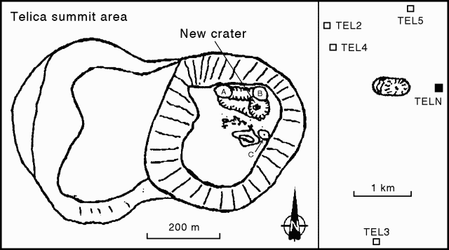 |
Figure 7. Sketch map of the summit area at Telica, showing locations of crater fumaroles (left) and seismic stations (right). Courtesy of INETER. |
A seismic event on 15 June 1994 was recorded by several stations of the Nicaraguan seismic network, up to distances of ~40 km from Telica. This event at a depth of 6 km had a maximum magnitude of 2.1. The 31 July eruption was preceded by a steady increase in seismicity during 15-25 July (figure 8), recorded by station TELN. Seismicity had increased from25 events/day at the end of May. By the end of July there were up to 150 events/day.
Crater and fumarole observations, March-June 1994. Beginning on 3 June, scientists from Florida International Univ (FIU) and INETER spent 15 days at Telica as part of an ongoing investigation to determine the areal extent and intensity of degassing, and the role of structural controls on degassing from the volcanic complex. A lacustrine deposit was observed in March at the S end of the crater, and a small, muddy brown lake was visible in May-June. All observations were made from the NE rim, where jetting sounds were clearly audible. Sulfur-rich steam from the crater sometimes moved down the slopes of the volcano, filling the NW valley with high concentrations of SO2; sulfur odor could occasionally be smelled on the NE slope. Residents on the flanks of the volcano stated that the activity was not unusual for this time of the year.
Fumarole temperatures near station TELN were in the 81-86°C range, similar to temperatures in September 1993 and March 1994. A low-temperature fumarole was discovered on the lower ESE slope of the ridge occupied by the seismic station. A data-logger recorded fumarole temperatures and barometric pressure for four days. Fumaroles near TELN and in the active crater exhibited increased flux since March. At times the crater fumaroles appeared to be emitting steam and gases in discrete clouds at intervals of several minutes. The most intense fumarole was in the upper NW corner of the crater (A on figure 7). Other fumaroles were observed in the lower NW corner, on the N, E, and SE crater walls, and in avalanche deposits on the S and SE parts of the crater floor. Fumarole A had temperatures of 150-160°C in July 1994 (figure 7). In the NE corner of the crater, fumarole B increased in temperature from 55°C in April to 174°C in July. Another fumarole area on the E side of the crater (C) had a temperature of 498°C in July, a significant increase from 246°C in 1990.
Eruptive activity. A relatively small explosive eruption at about 1645 on 31 July produced a gas-and-ash column that rose ~800 m above the summit. The light-gray ash cloud was driven SW by the wind, depositing about 2 mm of ash in the towns of Chichigalpa (20 km WSW), Quezalguaque (12.5 km SSW), and Posoltega (16 km SW) (figure 6). No seismic events were felt by residents near the volcano, but the sound of the explosion was heard at distances up to 10 km.
Following the 31 July eruption, phreatic activity continued in the next hours and days with varying intensity of gas emanation and ash expulsion. One of the strongest explosions, on 5 August, produced an ash column 1,200 m high. One phase of gas emission reached heights of 200-300 m above the crater rim. Gas also filled a valley W of the volcano with high concentrations of SO2, sometimes causing breathing problems for INETER scientists who traveled through the valley at a distance of ~2 km from the crater. Seismicity at shallow depths (~2 km) beneath the crater was recorded by TELN and four stations installed after the eruption began: telemetric stations TEL 2, 3, & 4, and local digital registration station TEL 5 (figure 7). The numerous weak events during the eruption were only recorded by the local seismic stations.
Chemical analyses of washed ash samples collected on different days indicated an increase of the SO42- and Cl- contents over time. Several very heavy rainfalls occurred during the eruptive period. Analyzed rainwater samples also showed high concentrations of SO42- with respect to Cl- and F2-, and a corresponding low pH level. Similar measurements two weeks before the eruption showed normal low concentrations of SO42- and Cl-.
Early eruption products consisted of very fine-grained, light-colored, blocky ash. INETER volcanologists believe that the ash was non-juvenile, and was ejected during phreatic or phreatomagmatic eruptions. Major explosions generally lasted for ~10-25 minutes. Early eruption columns were mostly white in color, and ranged from several hundred meters to 1,400 m above the vent. On 9 and 10 August, the ash was black, significantly darker than before, with correspondingly darker eruption plumes. The ash remained blocky and non-vesicular.On 10 August, 40-50 high-frequency seismic events were recorded, including one that lasted 4.5 hours. High-frequency events prior to 10 August occurred at a rate of ~70-90/day and were associated with more frequent explosions (10-20/day). The number of daily explosions also decreased to 6 on 10 August, including one major explosion that lasted for 16 minutes. An explosion at 1800 on 11 August generated a plume that rose 350 m, but only 16 high-frequency events were detected that day. On the early morning of 12 August one of the strongest explosions of this eruption occurred; activity then decreased throughout the day. By that evening the explosions had stopped and gas emanation and seismicity reached very low levels.
Seismicity had increased slightly by 16 August, five microseismic events were detected during 24 hours on 17-18 August, and on 20 August tremor lasted for 6.2 hours. However, no seismic events were detected on 21-22 August, and activity remained low as of 26 August.
On 23 August, Oto Matias (INSIVUMEH, Guatemala) arrived with a COSPEC instrument to assist INETER scientists in making SO2-flux measurements. Attempts to carry out COSPEC measurements of the SO2 concentration in the gas plume were made on 24 August, but low levels of gas emission and cloudy skies prevented good results.
Soil sampling. During three field surveys by FIU and INETER scientists in early June, >60 stations were deployed over 50 km2 to determine the concentration of radon (Rn), CO2, Hg, and He in soils. One identified anomaly had intensified between March and May/June 1994. This anomaly, ~750 m long and 250 m wide, surrounded the TELN seismic station. Along this anomaly, Hg values ranged from several tens of ppb to >2,900 ppb, He from 5,399 to 5,415 ppb, CO2 to 2.1 volume %, and Rn to 1,819 pico-Curies/liter.
San Jacinto Hot Springs. The village of San Jacinto, 9 km NE of the town of Telica and 2 km E of Santa Clara volcano, contains a field of boiling mudpots (BGVN 19:03). Soil samples for Hg and CO2 measurements were collected from the hydrothermal field in March and May/June 1994. The March samples contained CO2 concentrations up to 0.09 volume % and Hg from 6,710 to 21,512 ppb. The onset of the rainy season had resulted in an increase in both the size of the field and the steam flux since 9 March. Exploration for a new geothermal power plant was taking place approximately 250 m WNW.
Historical activity. Telica is a composite volcano located 19 km N of León at the NW end of a large volcanic complex. Known historical activity dates from a strong eruption that occurred in 1527-29. Strong activity was also noted in 1685, 1740-43, and at least 7 times in the 20th century. During several eruptions ash has damaged agricultural crops. In February 1982 several strong explosions generated ash columns of 3.5 km height and the ashfall affected nearby towns. The most recent eruption of Telica in November 1987 included Strombolian-type activity.
Eruptions in pre-historical times produced ash deposits of 50 cm thickness or more within a radius of 50 km. A volcanic hazard map (figure 9) suggests that ashfall poses the greatest threat to the local population. Lava flows have occurred, but with low frequency, most recently ~1,000 years ago. The hazard zone for pyroclastic eruptions lies within ~2 km of the crater. Lahars have occurred as a result of very strong eruptions during the rainy season.
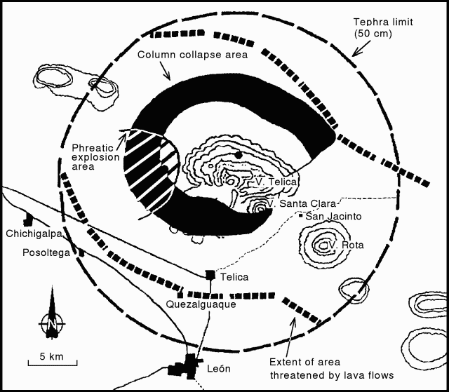 |
Figure 9. Volcanic hazards map of Telica. Hazard zones are shown for ashfall and tephra, lava flows, and column collapse. Courtesy of INETER. |
Information Contacts: H. Taleno, L. Urbina, M. Navarro, O. Canales, C. Guzman, C. Buitrago, A. Izaguirre, Christian Lugo M. (Vulcanology); W. Strauch (Seismology); C. Urbina, and A. Acosta (Electronics), INETER, Managua; Peter C. La Femina, Michael Conway, and Andrew MacFarlane, Florida International Univ, USA.
Explosion followed by decreased seismicity
A phreatic explosion on 12 August followed strong tremor two days earlier. Activity that began on 31 July produced a gas-and-ash column that rose ~800 m above the 1,060-m-high summit; detectable amounts of ash fell as far as ~17 km from the summit source vent (BGVN 19:07). Strong tremor again took place on 28 August. From that time until mid-September, weak tremor and few events of high or low frequency were recorded. Geochemical monitoring revealed decreases in SO2, Cl, and F gases. The most significant morphological change in the inner crater was the joining of crater fumaroles A and B (figure 7).
Information Contacts: H. Taleno, L. Urbina, C. Lugo, and O. Canales, INETER.
Low-level degassing and sulfur deposits observed in crater
Telica was visited on 17 March by a joint team from the Open University, the Universite de Montreal, Reading University, and the Instituto Nicaraguense de Estudios Territoriales (INETER). Low-temperature sulfur deposits were noted in many places within the crater. Low-level degassing was observed, particularly on the W side of the crater. Sulfur-rich gases appeared to be concentrated at the bottom, while more H2O-rich gases were being emitted at higher levels in the crater. Gas pressures were generally low, but there was a distinct gas column. SO2 flux measured by COSPEC on 17 March averaged 41 ± 20 t/d, based on nine measurements. Microgravity measurements showed no appreciable changes since the last survey in 1994.
An eruption on 31 July 1994 produced a gas-and-ash column to ~800 m above the summit; detectable ash fell as far as 17 km from the summit (BGVN 19:07). Phreatic explosions continued until 12 August 1994 when seismicity began decreasing (BGVN 19:09).
Information Contacts: Hazel Rymer and Mark Davies, Department of Earth Sciences, The Open University, Milton Keynes MK7 6AA, United Kingdom; John Stix, Dora Knez, Glyn Williams-Jones, and Alexandre Beaulieu, Departement de Geologie, Universite de Montreal, Montreal, Quebec H3C 3J7, Canada; Nicki Stevens, Department of Geography, University of Reading, Reading RG2 2AB, United Kingdom; Martha Navarro and Pedro Perez, INETER, Apartado Postal 2110, Managua, Nicaragua.
Seismicity increases and fumarolic activity continues
On 27 February, during a visit to the summit crater, scientists noted continuing minor fumarolic activity with maximum temperatures of 300-350°C and an active collapse zone on the E crater rim (figure 10). At this time a portable seismic station recorded microearthquakes at 30-40 minute intervals. Night observations of the crater confirmed the absence of any incandescence.
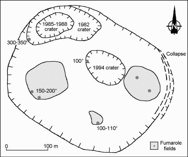 |
Figure 10. Sketch of the active crater at Telica indicating areas of fumarolic activity. Temperature is degrees C. Courtesy of Alain Creusot. |
During March 1997, seismicity was high with about 150 seismic signals/day recorded. Seismicity levels increased from December 1996, when there were less than 100 signals/day. Most March events had frequencies of 1.5-4.6 Hz and durations of 9-40 seconds. Visits to the summit crater showed the presence of fresh ashfall, numerous small landslides inside the crater, and moderate fumarolic activity in the walls and floor of the crater. Scientists also measured Telica's gas emissions, thermal infrared signals, and microgravity. Small amounts of gas were emitted from fumaroles on the E and W crater walls; however, COSPEC measurements failed to detect any SO2, although local farmers smelled sulfur in the afternoon when the wind shifted to the W. Thus, the amount of released gas appeared to be less than in March 1996.
Fumaroles located along a NE-SW trending fracture near the seismic station outside the active crater had maximum temperatures of 85°C. Soil gas measurements made along the fracture on 11 March 1997 showed maximum CO2 concentrations of 3.2%. This fracture first appeared in September 1996.
Infrared camera measurements on 20 March 1997 detected a zone of high temperatures near the base of the W crater wall. This zone had temperatures up to 190°C. Since this was a remote measurement, it should be considered as a minimum estimate. The crater fumaroles were at a lower temperature than those at the base of the W crater wall. Minimum temperatures measured with the infrared camera were 58°C for fumaroles on the W side, 47°C for fumaroles on the N wall, and 107°C for fumaroles on the E wall.
On 20 March, gravity measurements with a Lacoste and Roberg meter near the crater measured a repetitive signal with a periodicity of about 18 seconds. Also, on 23 March, a large gas emission from the crater was visible at the seismic station.
An eruption on 31 July 1994 produced a gas-and-ash column to ~ 800 m above the summit; detectable ash fell as far as 17 km from the summit (BGVN 19:07). Phreatic explosions continued until 12 August 1994 when seismicity began decreasing (BGVN 19:09).
Information Contacts: Hazel Rymer and Mark Davies, Department of Earth Sciences, The Open University, Milton Keynes MK7 6AA, United Kingdom; John Stix, Dora Knez, Glyn Williams-Jones, and Alexandre Beaulieu, Departement de Geologie, Universite de Montreal, Montreal, Quebec H3C 3J7, Canada; Nicki Stevens, Department of Geography, University of Reading, Reading RG2 2AB, United Kingdom; Martha Navarro and Pedro Perez, INETER, Apartado Postal 2110, Managua, Nicaragua; Alain Creusot, Instituto Nicaraguense de Energía, Managua, Nicaragua
Continued high levels of seismicity
Seismicity as of mid-May remained at a high level, similar to recent months. There have been ~160 daily volcano-seismic events detected, with little variation. During March there were ~150 seismic signals/day recorded; in December 1996 there were <100 signals/day (BGVN 22:03).
An eruption on 31 July 1994 produced a gas-and-ash column and detectable ash fell as far as 17 km from the summit (BGVN 19:07). Phreatic explosions continued until 12 August 1994 when seismicity began decreasing (BGVN 19:09).
Information Contacts: Wilfried Strauch, Department of Geophysics, Instituto Nicaraguense de Estudios Territoriales (INETER), P.O. Box 1761, Managua, Nicaragua.
June increase in both earthquakes and the extent of fumaroles
Seismicity and the extent of fumaroles increased slightly in June. Whereas in April and May the number of volcano-seismic events was near 160/day, during June this rose to ~220/day. Still, crater degassing remained very small. INETER volcanologists observed that NW-flank fissures had grown in number, extent, and apparent depth.
Information Contacts: Wilfried Strauch, Department of Geophysics, and Marta Navarro C., Department of Volcanoes, Instituto Nicaragüense de Estudios Territoriales (INETER), P.O. Box 1761, Managua, Nicaragua.
February visit reveals slight increase in fumarolic activity and collapse zone
Scientists visited Telica's crater on 7 February. They observed a slight increase in fumarolic activity and an active collapse zone on the S crater rim. Light incandescence seen at night had an estimated temperature of 550°C.
Information Contacts: Alain Creusot, Instituto Nicaraguense de Energía, Managua, Nicaragua.
Phreatic eruptions in May and June cause local ashfall
At about 0200 on 21 May a phreatic eruption marked by explosions began from the crater. At daybreak the gas plume extended to ~500 m in height. The following day observers on the crater rim noted a new 50-m-diameter vent on the crater floor. At the time of the observations, an intense gas stream was emanating from the new vent, accompanied by a jet engine-like sound. Fumarolic activity within Telica's crater was much stronger as well. Diminishing phreatic eruptions continued until 23 May. No ashfall was reported. INETER geologists who visited Telica on 18 May had not seen any evidence of increased activity; seismic monitoring did not show any precursors.
Wilfried Strauch reported that new phreatic eruptions took place on 5 June 1999, most notably between 1830 and 1900. These explosions were strong enough to register on nearby seismometers and resulted in minor ashfall in Chichigalpa, ~15 km WSW of Telica. Following the explosions, seismic activity rapidly declined. A 7 June article by La Prensa de Nicaragua stated that 6,000 people had to be evacuated in case of eruption. The article claimed that Telica discharged a cloud of ash to the SW that had bathed the bordering communities and part of Chichigalpa and scattered gas and ash caused adjacent inhabitants near the volcano to suffer irritation of eyes, throat, and nose. Observers noted a steaming area in the W sector of the volcano, 500 m from the crater border.
Crater observations March 1997-February 1998. During March 1997 (BGVN 22:03), INETER recorded high seismicity, ~150 events/day. During December 1996 there had been ~100 events/day. Visits to the summit crater revealed fresh ashfall, numerous small landslides inside the crater, and moderate fumarolic activity in the walls and floor of the crater. Fumaroles lying along a fracture trending NE-SW and located near the seismic station outside the active crater had maximum temperatures of 85°C. Infrared camera measurements on 20 March 1997 detected a zone of high temperatures near the base of the W crater wall.
Seismicity and the extent of fumaroles increased slightly in June 1997 (BGVN 22:06). Whereas in April and May the number of volcano-seismic events was near 160/day (BGVN 22:05), during June this rose to ~220/day. Still, crater degassing remained very small. INETER volcanologists observed that NW-flank fissures had grown in number, extent, and apparent depth. During a previously unreported crater visit by Alain Creusot on 29 September 1997, he observed both a small increase in the fumarolic activity and that an active collapse zone on the N crater rim had enlarged by ~15 m. A portable seismic station recorded both an absence of tremor and 10-15 microearthquakes every hour. A February 1998 visit to Telica's crater (BGVN 23:03) also revealed raised temperatures and an active collapse zone.
Information Contacts: Wilfried Strauch, Virginia Tenorio, and Julio Alvarez, Department of Geophysics, Instituto Nicaraguense de Estudios Territoriales (INETER), P.O. Box 1761, Managua, Nicaragua; La Prensa de Nicaragua, Managua, Nicaragua (URL: http://www.laprensa.com.ni); Alain Creusot, Instituto Nicaraguense de Energía, Managua, Nicaragua.
Lava lake seen in August; sporadic ash explosions August-December
As of late November 1999, microseismic activity had been occurring at Telica for more than a year. There were phreatic explosions in May and June 1999 (BGVN 24:06). An eruptive phase began in August 1999, generally producing only sporadic small and local ash falls. Intermittent gas-and-ash emissions continued to be reported through December 1999. One of the more vigorous events took place on 29 December, sending ash to several kilometers altitude and inducing falls detected 45 km away.
A noteworthy event began around 0200 on 10 August. Tremor and earthquakes increased abruptly. Small explosions took place in the crater, expelling gas and volcanic ash. Ash fell ~20 km WSW of Telica in the city of Chichigalpa. An interval of relative calm on 12 August lasted approximately one hour. It ended with the gas explosions and ash outbursts starting again at 1315 and continuing until 1515 with ongoing degassing afterwards. According to the summed seismic amplitudes (RSAM values), the greatest activity was between 2000 on 10 August until the morning of 11 August.
Observers saw a lava lake in the crater on 18 August. On that day, INETER's Wilfried Strauch and Armando Saballos, along with visiting North American specialists, climbed Telica to install GPS equipment. Taking advantage of periods of low degassing, they managed to observe the bottom of the new inner crater that had formed in the last few months (figure 11). To their surprise, they saw a lava lake there. In addition they listened to forceful jetting noises probably generated by the water contact with heated material.
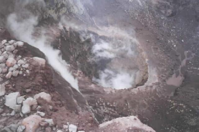 |
Figure 11.Photograph from the crater rim at Telica showing the new inner crater, 18 August 1999. Courtesy of Wilfried Strauch, INETER. |
On 21 August INETER's Virginia Tenorio and Julio Alvarez climbed the volcano and saw that the inner crater had enlarged; and, in addition they again heard jet-engine-like noises. Abundant escaping gases thwarted views into the inner crater so the visitors could not assess whether a lava lake remained. The same day between 0800 and 0900, residents who live on the SE flank of the volcano felt two rumblings from the volcano. Possibly, this caused the inner crater to enlarge even more.
Several days later seismic tremor increased, but the number of microearthquakes fluctuated, first dropping, then increasing again on the 25th. On 29 August seismic tremor began to drop substantially. Then, however, the number of microearthquakes increased. Telica's eruptive activity is typically associated with slightly increased tremor and over 200 to 300 microearthquakes per day.
During September, a month with 2,116 microearthquakes, gas emanations prevailed until the 10th. A seismic swarm at the beginning of October was followed by a series of explosions with tephra expulsions during 3-15 October. On the 5th, INETER staff on the crater's edge witnessed the discharge of both ash and lava (presumably in the form of bombs). The last similar lava-bearing explosion of this type was in 1988 (SEAN 13:01). On the 12th, W-flank residents reported that on the previous day (at about 1400 on the 11th) they had felt an unusually strong explosion shaking their houses. Later, they witnessed the fall of very fine gray ash. Observers also saw that the inner crater had grown wider than when seen in September. By 12 October the seismic amplitude had decreased to background levels. The number of earthquakes registered for October was 888.
During November the earthquake sum was comparatively low, 144, but that did not signify volcanic quiet. On 19 November, INETER's Julio Alvarez and Virginia Tenorio skirted the volcano along the León-Chinandega highway where they saw an ash column. Erminio Rojas, a farmer on Telica's S flank, told them that in the past few weeks the volcano had almost constantly been expelling gray ash. On 17 November he witnessed a very large explosion that caused an ashfall deposit reaching 2.5 cm thickness near his house, damaging his apples and beans. The observers further noticed that on the crater's SW a possible collapse feature had developed. Burned ash-covered plants lay in the area near the edge of the crater. Ash discharges on 17 November occasionally emitted a noise similar to a gunshot.
On 24 November, Civil defense of León reported a black cloud above Telica. An unusual seismic signal on 28 November prompted a visit to Telica by Tenorio and Strauch, along with Rafael Abelia of the Institute of Geomineras Investigations of Madrid, Spain. When they arrived at the volcano, the group found that a zone of disruption had spread over a great part of the N crater wall, and the edge of the crater was covered with a thick layer of fine dust. This indicated to them that there was no explosion and the cloud that the Civil Defense observed was due to the collapse of the N crater wall. COSPEC measurements conducted on 29 November indicated that the volcano was producing between 50 and 500 metric tons/day of SO2 per day.
During December 1999 there were 1,085 volcanic earthquakes, of which, four were located. INETER's seismic network located several earthquakes that took place underneath the volcano on 14 December with magnitudes between 2 and 2.5. During December, tremor stayed low until the 24th, when it was punctuated by sporadic degassing and smaller ash-bearing discharges. On the 25th, tremor began to rise slowly; on the 28th there occurred an abrupt increase in the seismic signal, four-fold larger than seen during previous days. The morning of 29 December seismicity was high. The same day reports were received describing almost continuous ash-bearing explosions, with WSW-directed tephra falls.
Two large explosions at 0900 on 29 December sent ash to heights of more than 1,000 m above the crater. Besides affecting cities adjacent the volcano, ash was later known to have affected the cities of Posoltega (~16 km SW), Chichigalpa (20 km WSW), Quezalguaque (20 km SSW), Chinandega (35 km WSW), and Corinto (~45 km SW). INETER noted that civil-aviation pilots reported that ash rose up to 5 km, although whether this was an altitude or the height over the 1-km-tall volcano remained undisclosed. Tremor initially stayed high on 30 December but dropped on 31 December. Activity continued into January 2000.
Information Contacts: Wilfried Strauch and Virginia Tenorio, Dirección General de Geofísica, Instituto Nicaragüense de Estudios Territoriales (INETER), Apartado 1761, Managua, Nicaragua (URL: http://www.ineter.gob.ni/).
Eruptive activity declines in February, but seismicity remains high
Seismic and eruptive activity consisting of gas-and-ash explosions continued during January. Observations from the León-Chinandega highway during fieldwork on 13 January showed that constant strong ash-and-gas emissions were continuing (figures 12 and 13). A resident on the S flank informed the scientists that strong rumblings had been heard at dawn on the 12th. The observers remained near the summit for several hours and witnessed moderate explosions every five minutes, with occasional periods of more frequent explosions (3/minute). The bottom of the crater could not be seen through the ash, but it appeared that the explosions did not come from the intercrater that formed in May 1999, but from a new vent in the NNW part of the crater. Evidence of collapses were present along all sides of the crater. In January the number of volcanic earthquakes was 3,950, and the RSAM (real-time seismic amplitude measurement) signal oscillated between the 40 and 120 units.
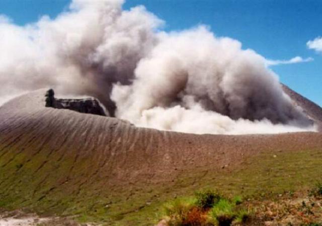 |
Figure 12. Photograph of the active crater during an ash explosion at Telica, 13 January 2000. View is from the south. Courtesy of INETER. |
Low-intensity eruptive activity with ash-and-gas emanations continued through 17 February, after which the activity began to gradually decline. However, seismicity stayed high with 3,670 earthquakes detected in February. The volcano maintained constant tremor during March, but despite the continued high number of registered earthquakes (2,892) there were no gas or ash expulsions.
Information Contacts: Wilfried Strauch and Virginia Tenorio, Dirección General de Geofísica, Instituto Nicaragüense de Estudios Territoriales (INETER), Apartado 1761, Managua, Nicaragua (URL: http://www.ineter.gob.ni/).
Gas-and-ash emissions in early 2000; fumarole temperature measurements
Seismic and eruptive activity consisting of gas-and-ash explosions continued during January and through 17 February 2000, after which the activity began to gradually decline (BGVN 25:03). Observers near the summit on 13 January witnessed moderate explosions every five minutes from a new vent in the NNW part of the crater. In January the number of volcanic earthquakes was 3,950, and seismicity stayed high in February with 3,670 events. The volcano maintained constant tremor during March, but despite the continued high number of detected earthquakes (2,892) there were no gas or ash explosions.
Weak gas-and ash emissions occurred in April. Fumarole temperatures in the interior of the main crater and SW of the seismic station were moderate (table 1). In the main crater, fumaroles 1 and 4 (internal crater and on the NW wall, respectively) exhibited temperature increases compared to the last measurement in both February and April. Near the seismic station, between December 1999 and January 2000 the fumarole temperatures changed by less than 3°C, whereas by February temperatures had apparently changed by as much as 14°C compared to January values. However, measurements in February were made using an infrared pistol, a change from the thermocouple used previously.
Table 1. Fumarole temperatures at Telica measured at the Main Crater and SW of the seismic station (500 m E of the crater) during June 1999-April 2000. The measurements in December 1999 and January 2000 near the seismic station were made using a thermocouple; all others were made with an infrared pistol. Courtesy of INETER.
| Fumarole | Jun 1999 | Jul 1999 | Dec 1999 | Jan 2000 | Feb 2000 | Apr 2000 |
| Main Crater | ||||||
| 1 | 107°C | 55°C | -- | -- | 60°C | 66°C |
| 2 | 58°C | -- | -- | -- | 59°C | -- |
| 4 | 104°C | 60°C | -- | -- | 71°C | 91°C |
| 6 | 69°C | 41°C | -- | -- | 67°C | 56°C |
| SW of the seismic station (500 m E of the crater) | ||||||
| 1 | -- | -- | 84°C | 85°C | 99°C | -- |
| 2 | -- | -- | 84°C | 84°C | 73°C | -- |
| 3 | -- | -- | 81°C | 84°C | 81°C | -- |
| 4 | -- | -- | 84°C | 83°C | 96°C | -- |
| 5 | -- | -- | 83°C | 84°C | 98°C | -- |
Information Contacts: Wilfried Strauch and Virginia Tenorio, Dirección General de Geofísica, Instituto Nicaragüense de Estudios Territoriales (INETER), Apartado 1761, Managua, Nicaragua (URL: http://www.ineter.gob.ni/).
Intermittent ash explosions and incandescence during 2000-2002
Explosions occurred at Telica during January and through February 2000, after which the activity began to gradually decline (BGVN 25:03 and 25:09). Intermittent ash explosions and crater incandescence were seen through 2002, along with high levels of seismicity related to degassing and constant low tremor. The Geophysics Department of the Nicaraguan Territorial Studies Institute (INETER) monitors activity; visits to the crater described below are by INETER staff unless otherwise noted. Many observations were also made by a local resident who maintains the local seismic station.
Activity during 2000. Tremor remained constant during April-June 2000, with no ash emissions. Visiting geologists reported incandescence in the crater on 5 July 2000. INETER workers who reached the crater on 14 July heard a noise like an airplane turbine coming from the crater and saw glow. They also noted that there had been a widening of the crater due to wall collapses, and an increase in its depth, although the crater floor could not bee seen. On 8 August a crater visit revealed strong fumarolic activity, and sounds resembling gun detonations from the bottom of a new opening.
Residents living near the crater reported on 6 September that ash explosions occurred during the evening and plumes drifted NE. Unfortunately INETER technicians found no traces of ash on 12 September, following rainfall. Small landslides inside the crater were observed. A characteristic strong smell of sulfur was detected in the crater area. Due to the change in wind direction that occurs during September and October, gases and acid rain affected areas to the N, NE, and E. Intense rainfall caused a mudflow down a W-flank drainage.
In the visit on 27 October there was no exhalation of gases, but landslides along the south wall sent material onto the crater floor. Crater visits on 5 and 22 November showed abundant gas output. Jet-like sounds came from fumaroles on the NE wall. Gas emissions were low during December. There were minor landslides in the crater, heard in the last days of November and beginning of December.
Activity during 2001. On the afternoon of 17 January 2001 there were rumbles and a plume of ash and gases 200 m high. On 19 January a visit to the crater found ashfall, to a depth of 1 mm, deposited within a radius of 500 m. The vicinity of the seismic station and SW from the crater had been affected by acid rain. On 22 January visiting scientists observed another small explosion. Activity was low during field visits on 20 and 26 February.
A visit on 3 and 16 March found variable levels of gas emissions. Incandescence was observed within the new crater early on 21 March along with increased output gases. Shortly thereafter a loud explosion was heard, followed by a dark plume about 30 m high and increased glow, but no ashfall. Activity remained low in April.
INETER staff visited the volcano on 6 June and heard a strong jet-like sound, but fumarolic emissions were not abundant. Another visit on the night of 26 June revealed incandescence and landslides inside the crater. Visits to the volcano were made on 13, 16, and 25 July, but no volcanic activity was noted. On 15 July the Civil Defense in Leon informed INETER of sporadic gray ash columns that began the previous day. A local resident reported hearing an explosion at 0315 on 14 July, and saw five emissions of gas-and-ash later that day. This activity lasted until 15 July.
A visit on 15 September revealed little gas emission from the crater, but explosion noises were heard. On 25 October Civil Defense Leon was informed by several farmers that between approximately 0600 and 1000 local time they had observed a column of ash that drifted NW. INETER staff working in the area that day observed strong ash accompanied by expulsion of gas. Rumbling noises and explosions continued until 1430. On 22 November a visitor observed no change in the volcano. Minor ashfall was reported on the morning of 18 December, and the next day explosions were heard coming from the crater.
Activity during 2002. On 17 January 2002 visitors observed strong gas fumes. Observations on 7 March indicated that the crater was wider and deeper than in February. On a 10 July visit there were abundant gas emissions from the crater, a strong smell of sulfur, jet sounds, and noises of breaking rocks. Gas emissions were abundant on 23 August, with columns up to 300 m high, but no landslides, noises, sulfur odor, or incandescence was noted. Rockslides on the N wall of the crater and sulfur odors, along with typical fumarolic activity, were seen during September.
Visitors on 17 October reported abundant gas emissions and strong sulfur odors; noises similar to the movement of waves came from the crater bottom, and some incandescent points were seen. From 7 to 11 October large quantities of gases blew SE, damaging vegetation. Landslides were observed SW of the old crater. Fumarole temperatures were the highest recorded since 1999. Incandescence inside the crater was also observed over several days. Webcam observations in November and December showed intermittent small gas emissions.
Information Contacts: Dirección General de Geofísica, Instituto Nicaraguense de Estudios Territoriales (INETER), Apartado Postal 2110, Managua, Nicaragua (URL: http://www.ineter.gob.ni//geofisica.html).
Intermittent incandescence and ash explosions through January 2005
Intermittent ash explosions and crater incandescence were seen during 2000-2002, along with high levels of seismicity related to degassing and constant low tremor (BGVN 34:05). Strong gas emissions were typical in the first half of 2003, with incandescence often noted later in the year. Activity during 2004 included occasional ash explosions as well as incandescence. After small ash explosions in late January 2005 no volcanism was noted for the remainder of the year, with observers primarily noting crater wall collapses and degassing. The Nicaraguan Territorial Studies Institute (INETER) monitors activity; visits to the crater described below are by INETER staff (primarily Pedro Perez) unless otherwise noted, though scientists from other institutions may have also been present. Some observations were also made by a local resident who maintains the local seismic station.
Activity during 2003. In January 2003 gas emissions at Telica fluctuated in their intensity. Dense gas prevented observations of incandescence. During a crater visit on 6 May an observer heard a pressurized sound, smelled sulfur, and saw blue gases. Eucalyptus trees 2 km E of the crater appeared to have been burned by the acidic gases. There was a bluish glow in the crater on 25 June and a strong smell of sulfur. To the W of the volcano several trees dropped the bulk of their leaves due to acid rain. Gas emissions remained almost constant at a moderate level.
On 31 July a high pressure noise was heard and incandescence was observed in the center of the crater. Pressurized gases emerging on 22 August from the vent at the bottom of the crater emitted a loud, jet-like sound. As in July, the vent also showed incandescence and emitted a sulfur odor. Satellite images on 24 September showed a column of gas. On 7 October incandescent was again observed, along with a strong odor of sulfur. There was a collapse of material in the SE sector.
Activity during 2004. On 20 January 2004 a wavelike sound was heard, open fissures emitted little gas, and glow was observed in the crater (figure 14). A small ash explosion on 31 March at about 0856 was reported by the caretaker of the Tel3 seismic station. On 28 April an observer noted that internal collapses had covered almost half of the southern part of the crater floor with debris. As a result incandescence in the crater was difficult to detect.
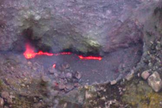 |
Figure 14. Photograph of the crater at Telica, showing incandescence on 20 January 2004. Courtesy of P. Perez (INETER). |
A seismic swarm N of Telica lasted from 9 to 14 June. The earthquakes had magnitudes up to 2.4 and depths between 1 and 9 km, with some being felt by local residents in the Aguas Calientes area. On 28 June a seismic signal similar to that of an explosion was detected. INETER received no reports of ashfall in surrounding areas. Reports for July-September were not available. Ash explosions occurred from the crater on 5 and 11 November. On 10 December there was significant gas and ash output, with sounds of breaking rocks inside the crater. Unlike the previous months, no incandescence was seen.
Activity during 2005. On 29 January 2005 the volcano produced small ash explosions with abundant gases. The next day when INETER technician Pedro Pérez visited he heard jet-like sounds and smelled strong gas emissions. Low gas emissions persisted during February-April. On 15 May a small earthquake swarm lasted about ten hours. Observers to the crater on 1 May noted small blue gas emissions and sulfur odor, but no incandescence. Collapses were also seen in the W and S portions of the crater.
On 30 June observers saw minor gas emissions and new material in the eruptive fissure from crater wall collapses. Activity was low on 9 August (figure 15), no sounds heard, but the crater walls had some precipitates from the gas emissions. On a 7 September visit additional collapses of the crater walls were observed along with significant gas emission. Small gas emissions were observed by a monitoring webcam for almost the entire month of December.
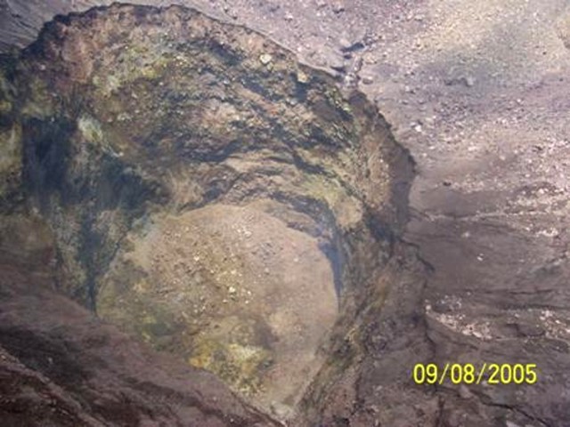 |
Figure 15. Photograph showing the Telica crater on 9 August 2005. Rockfall debris from crater wall collapses can be seen on the crater floor. Courtesy of P. Perez (INETER). |
Information Contacts: Wilfried Strauch, Instituto Nicaraguense de Estudios Territoriales (INETER), Apartado Postal 2110, Managua, Nicaragua (URL: http://www.ineter.gob.ni//geofisica.html).
Extensive degassing and sporadic ash explosions during 2006-2008
Activity at Telica during the second half of 2003 through January 2005 included incandescence and occasional ash explosions, after which only crater wall collapses and degassing occurred for the remainder of 2005 (BGVN 34:06). High seismicity and fumarolic activity continued in 2006, until a brief tremor episode accompanied by ash explosions in early August. Ash explosions during 2007 were reported in January-February, June, and October-November. Most observations in 2008 described degassing, but ash emissions were noted in February and July. The Nicaraguan Territorial Studies Institute (INETER) monitors activity; visits to the crater described below are by INETER staff.
Activity during 2006. Seismicity during January-November 2006 remained high, in the range of about 3,000-6,000 micro-earthquakes/month (100-200/day). Collapses in the southern part of the crater were seen during a visit on 18 April, along with new fumarole locations in that area and one new fumarole on the N side. Similar activity, with strong gas emmissions occurred on 27 April.
An unusual tremor episode that began on 3 August prompted a visit by INETER scientists the next day. The team found that small ash explosions on 4 August were coming from a new vent that had opened in the W part of the crater. Incandescent rocks were also being ejected. Ashfall was reported in the communities of Cristo Rey and Las María, NW of the volcano. In addition, gas emissions were rising from the area of an opening, since covered by landslides, that formed in May 1999. Tremor ended on the 5th, but another ash-and-gas explosion was reported on 6 August. Two more new fumaroles, in the N and W part of the crater floor, were seen on 6 and 28 September.
Seismicity changed character on 25 November, with increased tremor and volcano-tectonic earthquakes. The high but variable seismic activity continued during December, when micro-earthquakes were recorded at a rate of about 400/day. Small seismically-detected explosions took place on 11 and 27 December, although the amount of ash and it's distribution was not known.
Activity during 2007. The high levels of seismicity and swarm episodes that began in November 2006 declined during February 2007. Micro-earthquakes averaged 80-135/day in January-February. A small phreatic explosion was recorded on 9 January, followed on the 10th by explosions of gas and ash. The plume on 9 January reached an initial altitude of 1.5 km (500 m above the summit) and drifted W before rising further. More small explosions occurred on 6, 15, and 17 February. Continuous ash emissions rising to 1.5 km altitude were visible on a webcam during the 15 February activity; satellite imagery showed a plume drifting SW and a thermal hotspot at the summit.
Daily micro-earthquake counts throughout the rest of the year ranged from 64 to 180, until the seismic station ceased operating in December. INETER observers at the crater on 12 June saw abundant gas emissions from multiple areas within the crater, and explosions that may have contained ash. During a visit on 14 August landslides were noted from the NW side of the crater walls, as were 50-cm cracks in the S wall. Large volumes of gray gas emissions were reportedly causing acid rain damage to local vegetation, and affecting area residents. Sporadic gas-and-ash explosions were reported in the last week of October and during November, causing ashfall in Quezalguaque and other locations around the volcano.
Activity during 2008. A fieldwork visit to the crater on 16 January 2008 revealed only gas emissions with jet sounds; a local resident reported similar observations. A farmer near the volcano reported to INETER that there was a heavy outflow of gas and ash on 18 February that affected the W and NW flanks; by the time of a 22 February visit only gas emissions were occurring. Gas emissions accompanied by jetting sounds were the only activity noted during subsequent visits on 10 March and 25 April. Small gas-and-ash explosions took place in early July. However, again only gas output was observed during crater visits on 22 July, 18 August, 9 September, 26 November, and 16 December (figure 16).
Seismic data began being reported again in February 2008. Average daily micro-earthquake counts, reported monthly, were 90-150 from February through July. August seismicity was not reported, but there were only 80 events/day in September, and 50 events/day in October. The seismograph was not operational in November or December.
Information Contacts: Wilfried Strauch, Instituto Nicaraguense de Estudios Territoriales (INETER), Apartado Postal 2110, Managua, Nicaragua (URL: http://www.ineter.gob.ni//geofisica.html); Washington Volcanic Ash Advisory Center, Satellite Analysis Branch (SAB), NOAA/NESDIS E/SP23, NOAA Science Center Room 401, 5200 Auth Rd, Camp Springs, MD 20746, USA (URL: http://www.ospo.noaa.gov/Products/atmosphere/vaac/).
Incandescent crater floor areas seen in November 2009 and March 2010
Telica exhibited extensive degassing and sporadic ash explosions during 2006-2008 (BGVN 34:08). Activity since then had decreased to a relatively low level, but degassing was continuing. This report discusses activity in 2009 and January-February 2010 based on reports from the Instituto Nicarag?ense de Estudios Territoriales (INETER) and from fieldwork by Mel Rodgers (University of South Florida) in November 2009 and March 2010.
INETER publishes a monthly bulletin on earthquakes and volcanic activity in Nicaragua. For Telica, most of the monthly data consists of in-field temperature measurements. An observation camera situated 20 km from the crater has not been functional for more than a year. The seismic instrument at Telica was frequently out of order during 2009.
On 20 May 2009, the sulfur dioxide output in the crater ranged from 106-251 tons per day. The maximum temperature of the crater was about 90-112°C in April and May 2009, but rose to 201°C in July, 251°C in August, and 302-317°C during September through November 2009. The maximum temperature of four fumaroles was also measured, which generally ranged from 67-72°C. These temperatures decreased in June 2009 and increased in August 2009 (to 76-105°C). The temperature of fumarole 4 decreased to 59°C in October; gas emission at that fumarole ceased altogether in November.
Visits in November 2009 and March 2010. Mel Rodgers detailed observations during fieldwork at the volcano in November 2009 and March 2010 conducted with Diana Roman (University of South Florida), Peter La Femina and Halldor Geirsson (Pennsylvania State University), and Alain Morales (INETER). On 24-25 November 2009, the group observed a set of elongated fractures flanking the crater floor through which incandescence and/or lava were clearly visible. A high concentration of gas and a steady gas-and-vapor plume were also observed in the crater. Multiple vigorous fumaroles were observed on the W side of the crater close to the top of the crater wall, and an intermittent jetting noise that appeared to be coming from the crater floor was audible from their position at the crater rim. A broadband seismometer was installed and, during the 24-hour visit, a high rate of long-period (LP) seismicity was recorded.
On 15 March 2010, the researchers returned and again observed incandescence within the crater. Incandescence was clearly visible through a C-shaped crack or skylight, SE of the 25 November 2009 location (figures 17 and 18). A high concentration of gas and a steady gas-and-vapor plume in the crater continued and vigorous degassing of the fumaroles on the crater floor was observed (figure 19). Intermittent jetting noises and rockfalls were audible coming from the crater, and at 2202 UTC a loud, low popping noise from the crater was heard. Data retrieved from the single station installed in November 2009 showed a high rate of LP seismicity from November 2009-March 2010.
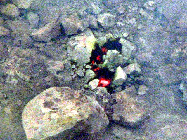 |
Figure 18. Photograph taken 15 March 2010 showing incandescence visible in the C-shaped crack/skylight at Telica volcano. Courtesy of Mel Rodgers. |
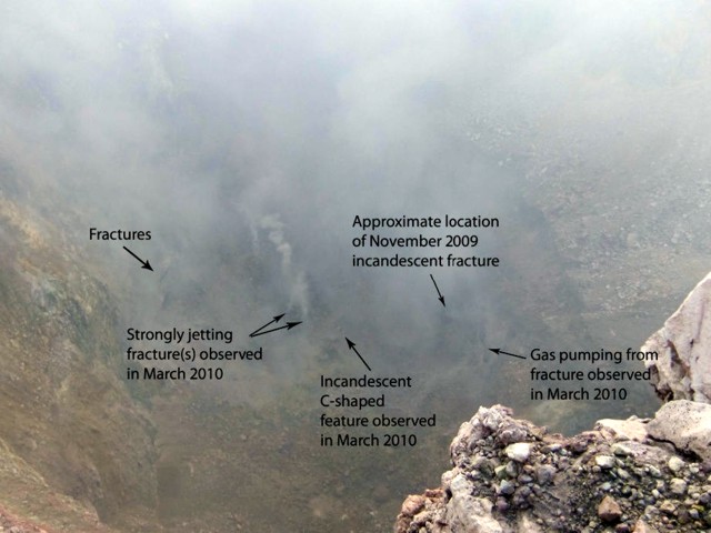 |
Figure 19. Photograph taken 15 March 2010 showing a view of the entire Telica crater floor. Locations of sightings of incandescence and of vigorous gas jets are indicated. Courtesy of Mel Rodgers. |
A successful installation of the TESAND (Telica Seismic and Deformation) network was completed in March 2010. This network, consisting of six broadband seismometers and eight high-rate (1 Hz) continuous global positioning system stations, will be deployed for 3 years to document background LP seismicity and magmatic processes associated with quiescent volcanism.
According to the Hawai'i Institute of Geophysics and Planetology (HIGP) Thermal Alerts System, no satellite thermal alerts were measured over Telica during 2008, 2009, and through 30 April 2010.
Information Contacts: Instituto Nicaraguense de Estudios Territoriales (INETER), Apartado Postal 2110, Managua, Nicaragua; Mel Rodgers, University of South Florida; Hawai'i Institute of Geophysics and Planetology (HIGP) Thermal Alerts System, School of Ocean and Earth Science and Technology (SOEST), Univ. of Hawai'i, 2525 Correa Road, Honolulu, HI 96822 (URL: http://modis.higp.hawaii.edu/).
Degassing in 2011; seismic crisis leading to explosive eruption in May 2011
Our last report discussed Telica volcano's intermittent gas emissions from 2009 through early 2010 as well as installation of an early warning system (Sistema de Alerta Temprana, SAT) in March 2010 (BGVN 35:03). New information has been released by INETER (the Instituto Nicaragüense de Estudios Territoriales) detailing the escalation of activity that culminated in a major eruption in May 2011. This report also covers the field investigations from April 2010 through October 2011, seismic data from January 2010 through October 2011, SO2 monitoring from 25 May 2011 through 13 September, and regular thermal measurements from the crater and flank fumaroles.
Volcanic activity at Telica during 2010 was characterized by diffuse degassing. Persistent gas emissions from this volcano have caused a legacy of hazards for local communities and have been linked to acute respiratory infections (Bellos and others, 2010; Freundt and others, 2006; Malilay and others, 1996). Field investigations in 2010 conducted by INETER focused on measuring temperatures from the crater as well as fumaroles located near the flanks (figure 20). Heavy rain and inaccessible roads limited visual and thermal monitoring to short field excursions in April, July, and August 2010.
Using a thermal camera, INETER determined the maximum temperatures within Telica's crater on 28 July and 18 August were 259°C and 251°C respectively. The four fumaroles located near seismic station TELN were measured three times in 2010. With a digital thermocouple, INETER determined that maximum temperatures from the flank fumaroles gradually increased from April to August: 72.3°C, 81°C, and 105°C. Minimum measured temperatures were irregular and ranged from 66.4 to 76°C.
Few earthquakes were sufficiently large to registered and be located during 2010 (table 2), but INETER reported that those recorded were smaller, and there was frequent tremor. The seismic network for this volcano was installed in 1994. The two local seismic stations, TEL3 and TELN, operated with 3-component sensors but during this reporting interval TELN was offline until July 2010. Microseismicity was reported during four months in 2010 (March, September, November, and December). The highest rate occurred in March, exceeding 150 events per day. In September, more than 120 events were recorded per day, and in November and December, the rate was 80 microseisms per day.
Table 2. Located earthquakes at Telica recorded in the interval from January 2010 through October 2011. Only months with earthquakes reported are shown. High values in May-June were during an eruption. Values are based on monthly reports from INETER.
| Month | Number of Events | Magnitudes | Depths |
| Apr 2010 | 4 | 1.7-2.5 | 0-3 km |
| Oct 2010 | 1 | 1.4 | 0 km |
| Feb 2011 | 1 | 2.9 | 3 km |
| Apr 2011 | 5 | 0.2-1.5 | 0-1 km |
| May 2011 | ~175 | 0.3-4.0 | 0-4 km |
| Jun 2011 | ~100 | 0.1-2.8 | 0-28 km |
| Jul 2011 | ~20 | 0.8-1.8 | 0-1 km |
| Aug 2011 | ~22 | 0.3-2.3 | 0-1 km |
INETER reported that field investigators encountered significant gas plumes from Telica's summit in April and July. The W edge of the crater and a small vent on the E interior wall were constant sources. There were notable rockfalls from the crater rim; an observation from 28 July 2010 mentioned the NE and SE walls in particular experience rockfalls of sufficient magnitude to increase the summit crater's size.
January 2011. Investigators from INETER visited Telica this month for instrument maintenance and monitoring activities. Rockfalls from the S crater wall were noted on 11 January by staff. According to Halldor Geirsson, Mel Rodgers (Univ. of South Florida) was in the vicinity during 25-31 January and noted strong degassing and occasional rockfalls. On 14 January thermal data was collected from the central crater and fumaroles on the outer flank. The maximum temperature recorded from the crater was 295°C. The four fumaroles located on the W flank (figure 20a) had recorded temperatures ranging from 68°C to 72°C.
Seismicity during January 2011 was generally high, with ~ 907 earthquakes recorded. Most were long-period (LP) with dominant frequencies of 1-3 Hz. From 19 to 23 January events were absent. Seismic tremor was recorded throughout January at 30-40 RSAM units with scattered intervals of greater than 100 RSAM units.
February 2011. Collaborative fieldwork was conducted on 26 February between INETER and scientists from the Institute of Renewable Energy (Spain). This team measured temperatures and took thermal images of the fumaroles located both within the crater and on the W flank. Maximum temperatures within the crater ranged from 62-75°C.
Elevated seismicity continued through February with 676 recorded events. These events were similar to those recorded in previous months; LP events had dominant frequencies of 1-3 Hz. Figure 21 presents an example of frequency analysis for one earthquake at Telica. Volcanic-tectonic (VT) events rarely occurred. Tremor was recorded at 30-40 RSAM units.
Ashfall in March 2011. On 6 March residents living near Telica felt an earthquake during the night and during the following day they observed small plumes rising from the volcano. INETER scientists visited on 8 March for routine data collection and to investigate reports of fresh ashfall. Light ash was still visible on leaves and rooftops and appeared directed towards the N and SE. Residents also reported strong sulfurous odors during the explosive events. Field investigators found evidence of juvenile material along the SE rim of the crater.
INETER collected thermal data on 8 March from fumaroles located within the crater and near the seismic station (TELN) on the E flank. The maximum temperature measured within the crater was 137°C. Two fumaroles were identified within the crater on the W side; these sites had recorded temperatures in the range of 47-71°C. Thermal measurements near TELN ranged from 51-60°C. This site did not emit steam or other gases.
The INETER field crew noticed that degassing appeared to be more intense during the 8 March field visit compared to their previous 26 February visit. The view to the crater was often obscured from the point of view of seismic station TELN (figure 20b).
In their March report, INETER discussed the relevance of the new temperatures measured during the 8 March field campaign. The issue was the apparent decrease compared to temperatures recorded from Telica in January. INETER staff acknowledged the limits of monthly temperature readings but looked forward to longer-term correlations with seismic data.
Seismicity in March remained high with ~ 572 events recorded. The majority of the earthquakes were LP events with dominant frequencies between 1-3 Hz. Few VT events were recorded. Seismic tremor was between 30-40 RSAM units.
April 2011. New seismic data from an early warning system (Sistema de Alerta Temprana, SAT) was presented for the first time in INETER's April report. The new 6-station network contained five stations with 3-component sensors and one station with a single-component sensor. The network included two short-period stations, TEL3 and TEL4 (note that TEL4 was TELN), that continued to send data.
From late March through the second week of April, small explosions, LP earthquakes, and seismic swarms were detected. There was a three-day lull in early April, but VT earthquakes began occurring with increasing magnitudes and small explosions from the summit occurred at least once per week throughout the month. By 30 April, explosions were registered having 30-minute durations and were followed by periods of degassing and low-altitude ash plumes. For an interval in late April, seismicity was very high, with more than 600 events recorded each day with a range of M 0.1-3.3. A maximum of 380 RSAM units was recorded and seismic tremor ranged between 30-40 RSAM. The VT earthquakes were strong enough to be noticed by residents in local communities.
During field investigations on 11 April, INETER measured temperatures within the crater, recording a of maximum 254°C. One fumarole within the W wall of the crater had decreased temperature by 10°C while the other had increased by 1°C compared to values from March. The four fumaroles near TEL4 had recorded temperatures in the range of 53-69°C.
Eruptions in May 2011. The escalation of seismic activity and recurrence of ash plumes seen since March prompted INETER to issue an alert to civil defense on 13 May warning that eruptive activity was possible. During the first week of May seismicity increased to 500 microseismic events per day (in general, microseismic events in April occurred at a rate of ~ 220 per day) and VT events suddenly became rare (figure 22).
Large explosions from Telica were registered at midnight on 13 May. After that, INETER reported that residents in three different communities observed pink-colored ash had fallen, and residents had also felt earthquakes. Frequent explosions of abundant gas and falls of coarse-to-fine ash occurred 14-15 May. Seismicity during 14 May was dominated by M 1.0-3.3 events with depths between 1 and 5 km (figure 23). Ash fell over the community of La Quemada, located 4 km N of the volcano. Residents heard loud noises from the volcano.
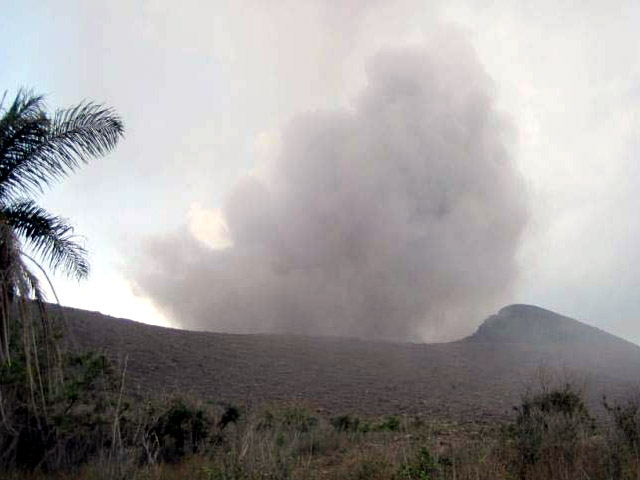 |
Figure 23. This minor explosion at Telica was observed on 16 May 2011. Courtesy of Halldor Geirsson (Pennsylvania State University). |
On 16 May observers first saw gray ash clouds rising from Telica's summit. Later, this activity visibly escalated and ashfall was observed in continuous plumes (figure 23). The highest plumes reached 1.2 km altitude and ash fell to the SE over communities. By mid-May the number of seismic events had increased to 800 microseismic events per day, most of which were explosions with a few VT events (figure 24). INETER noted that seismic stations recorded up to 140 RSAM units on 16 May.
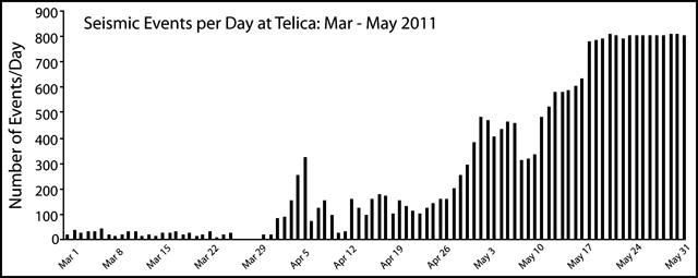 |
Figure 24. The number of seismic events registered per day during March-May 2011. This record was dominated by microseismicity and explosions from Telica. Courtesy of INETER. |
Fieldworkers from INETER and others, deployed a large tarp, collected ~ 80 kg of tephra during 16-18 May. Preliminary assessments determined the nature of material that landed on the tarp included dominant lithics, fragmented rock and crystalline material of 0.5-1.0 mm diameter, and round fragments of pink-colored tephra (as opposed to the gray, sand-size grains from a small event on 12 May). These observations were also reported in field notes by Halldor Geirsson and in an abstract by Witter and others (2011). During a lull in activity on 16 May 2011, the team visited Telica's summit. Upon approaching the N rim, they heard no sounds coming from the crater, and they measured temperatures on the crater floor of ~ 395°C. They observed fresh, inward-directed rockfalls from the crater's rim and found the N wall unstable and dangerous, seemingly on the verge of falling. The team also observed a dark area on the SE wall and floor of the crater, which suggested that recent explosions had concentrated tephra on these surfaces.
Washington VAAC 15 and 17 May. The Washington Volcanic Ash Advisory Center (VAAC) reported that the GOES-13 satellite detected at least two plumes on 15 and 17 May 2011. This satellite imagery confirmed gas-rich plumes on both days at ~ 1.8 km altitude, but ash content could not be determined from available images. INETER reported that these events were accompanied by elevated seismicity on 15 May and associated ashfall occurred 4 km N of the summit. After three emissions of gas on 17 May, ash and tephra fell SE of the summit. The last time plumes from Telica appeared in VAAC reports was in early months of 2007 when plumes reached an altitude of ~ 1.5 km for three days in January and February drifting SW.
Explosion with sustained ash plumes. On 18 May INETER posted two online reports ("Volcanic Communications" 5 and 6) indicating the peak of activity starting on that day. After two hours of sustained explosive activity producing ash plumes ~ 600 m high, the largest explosion suddenly occurred at 1350 on the 18th. A column of ash rose to an altitude of 2.6 km and was maintained for six minutes (figure 25). More than 15 explosions were seismically recorded (with a maximum of 350 RSAM units). The episodic explosions produced ash, steam, and, at times, lightning within the plume. Temperatures within the crater were gauged at a maximum 432°C, and flank fumaroles were measured to be 60-126°C.
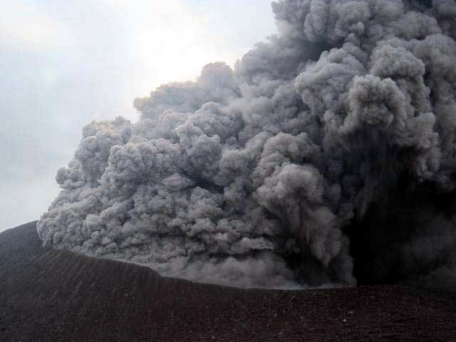 |
Figure 25. A sustained ash plume issued from Telica during the peak of activity in 21 May 2011. Courtesy of Halldor Geirsson. |
In a 19 May statement to news agencies, the municipal committee for disaster prevention and mitigation (COMUPRED) reported the evacuation of 390 families from nine villages near the volcano. The villages included Agua Fría (150 m from the edifice) and Los Patos, the most distant of the villages at 8 km from the edifice.
On 19 May, public meetings were held that included INETER, civil defense, and national disaster response (SINAPRED) representatives. A widely discussed issue was how the heavy ashfall and volcanic gases were affecting water quality. Officials favored monitoring local wells within 5 km of Telica's edifice.By 20 May, Telica's explosions became infrequent: three were registered that day. Only ash and resulting plumes rose to 500-800m altitude. Microseismicity remained high (850 events) and 60 earthquakes (M 0.8-2.2) were located at depths of 0.7-2.2 km (table 2).
On 20 May, explosions were also infrequent but four large events from the crater emitted plumes with heights of 500-700 m. In addition, at 1500 on the 20th, one large, continuous explosion occurred that lasted 36 minutes. Observers described a plume containing gas, steam, tephra, and small rocks. The largest ballistics did not reach farther than the crater rim and lightning was observed in the plume. INETER noted that wind conditions allowed the plume to reach 2 km altitude. Nine hundred microseismic events were recorded on 21 May and 57 earthquakes (M 0.5-2.0) were located with average depth of 1 km.
Well monitoring on 21 May revealed slight changes in local water quality. Sites located NE and within 5 km of the summit showed elevated quantities of sulfates, chlorides, alkalinity and PH.
New SO2 monitoring efforts. On 22 May, Universidad Tecnológica de Chalmers (Switzerland) and SNET (El Salvador) installed two portable Mini-DOAS stations (Differential Optical Absorption Spectrometer) at Los Angeles and Mendoza to measure SO2 levels.. These stations were installed downwind from Telica, SW of the edifice (figure 26). While the fixed stations collected data, traverses were made across the plume with mobile Mini-DOAS.
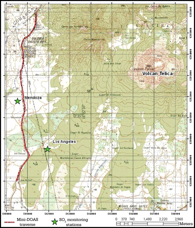 |
Figure 26. Location map of SO2 monitoring stations, Los Angeles and Mendoza, located SW of Telica Volcano (green stars). The 22 May 2011, Mini-DOAS traverse is highlighted in red. Courtesy of INETER. |
The first Mini-DOAS results from fixed stations were obtained on 24 May. Data from the Los Angeles and Mendoza monitoring stations showed that flow of SO2 oscillated between 50 and 150 tons/day. Data collected from traverses below the plume on 23-27 May were processed by the Universidad Tecnológica de Chalmers (Switzerland). The traverse results compared well with the fixed stations: reported values ranged from 40 to 130 tons/day. Peak SO2 values from the fixed stations appeared as follows: Mendoza station, 420 tons/day on (28 May); Los Angeles station, 194 tons/day (30 May).
May 2011 eruption declines. INETER reported that ash explosions became infrequent during 23-30 May. That said, a cluster of eight explosions occurred sequentially on 24 May and created plumes reaching 600 m above the crater. Microseismicity remained high throughout the rest of the month. During 23-24 May, the largest number of earthquakes were located. Approximately 100 earthquakes (M 0.7-2.5) occurred with hypocenters at depths of 1-15 km.
According to the information supplied by the Directiorate of Meteorology of INETER, on 24 May ash expelled from Telica drifted SE at 8-15 km/hour at altitudes of 1.5 km. In their 24 May report, INETER warned that eruptive conditions could continue during the remainder of the month. They recommended the authorities of the Institute Nicargüense of Aeronaútica Civil (INAC) to caution air traffic about persistent and dispersed volcanic ash.
SO2 monitoring in June. On 3 June INETER conducted field investigations and measured SO2 with Mini-DOAS and Mobile DOAS. There were eight successful on-land traverses below the plume, each covering 18 km. Mobile DOAS data indicated a decrease in SO2: the maximum value recorded was 39 tons/day. SO2 flux from the two fixed stations, Mendoza and Los Angeles, also showed reduced levels during the early part of the month but an increase appeared from both sites in 13-15 June. INETER suggested that the low SO2 flux in early June may have been influenced by local wind patterns. Observers in the area noticed that the summit plume was very dispersed during this time. Wind velocities reported by NOAA were as low as 1.2 m/s on 3 June.
During a field visit by INETER on 14 June, the investigators managed to count 17 explosions that expelled ash and gas. The explosions occurred within short intervals of time, from two to three minutes and the longest interim was 10 minutes. The field team visited fumaroles S of the TEL4 seismic station and recorded temperatures from three fumaroles with values ranging from 64-76°C.
Field data collected on 30 June included a maximum temperature of 590°C from the crater (figure 27). The team observed incandescence within the crater and from a new vent near the NE wall. There were jetting and collapse sounds emitting from the crater.
During June the number of earthquakes diminished but seismicity remained high. Approximately 500 earthquakes were registered per day. Approximately 100 earthquakes (up to M 2.8) were located (half the number located in May) at a maximum depth of 28 km (table 2). The majority of the events were volcanic-tectonic (VT) and doublet earthquakes (paired events). The dominant frequencies of the earthquakes shifted in June to 4.0-8.0 Hz.
Routine monitoring in July. During fieldwork on 12 July, INETER measured SO2 flux with Mobile DOAS. Five traverses, each one 8.5 km in distance, were recorded. The average value of SO2 was higher than the previous month, 484 tons/day. In their monthly report, INETER discussed the strong impact of inferred wind speed on their new gas measurements. During the month wind patterns were variable with speeds average ~ 5.8 m/s. They commented that the plume was noticeably less dispersed when they conducted the gas measurements.
On 22 July routine fieldwork was conducted at Telica. Residents of La Joya had heard loud jetting noises and at night saw incandescence at the summit. During the day, the team also heard jetting but did not see any explosive activity or feel earthquakes. Crater temperatures averaged 265°C (five measurements), very low compared to the previous month (figure 27). Temperatures taken from fumaroles S of the seismic station ranged from 68-72°C (three fumaroles).
Incandescence during August to October 2011. Halldor Geirsson noted that incandescence was seen in August 2011 (by Mel Rodgers and INETER staff). Further anomalous activity was not reported that month. A night visit took place on 9 September. The INETER team observed incandescence from the crater and measured temperatures with a thermal camera recording a maximum 458?C. No jetting sounds were heard.
On 13 September INETER measured SO2 with Mobile DOAS. There were seven traverses along an 8.5-km stretch of road to cross below Telica's gas plume. SO2 flux was significantly lower than the previous month with an average of 81 tons/day.
On 13 October, SO2 traverses were attempted, but no gas was detected. Wind patterns had been disrupted by a low-pressure system that caused major flooding along Nicaragua's W coast.
During INETER's 27 October field visit, the team observed incandescence during the day and fragments of molten spatter were released during moderate gas explosions (figure 28). They also observed minor gas emissions and loud jetting persisted from the crater. INETER took five measurements of crater temperature, which averaged 280?C. Temperatures from three fumaroles S of seismic station TEL4 were 66-72°C. Vegetation was noticeably affected by volcanic gases; numerous dead plants were photographed during the 27 October visit.
References. Bellos, A., Mulholland, K., O'Brien, K.L., Qazi, S.A., Gayer, M., Checchi, F., 2010, The burden of acute respiratory infections in crisis-affected populations: a systematic review: Conflict and Health, v. 4, no. 3.
Freundt, A., Kutterolf, S., Schmincke, H.-U., Hansteen, T., Wehrmann, H., Peréz, W., Strauch, W., Navarro, M., 2006, Volcanic hazards in Nicaragua: Past, present, and future, in Rose, W.I., Bluth, G.J.S., Carr, M.J., Ewert, J.W., Patino, L.C., and Vallance, J.W., eds., Volcanic hazards in Central America: Geological Society of America Special Paper 412, p. 141-165.
Malilay, J., Real, M.G., Vanegas, A.R., Noji, E., and Sinks, T., 1996, Public Health Surveillance after a Volcanic Eruption: Lessons from Cerro Negro, Nicaragua, 1992: Bulletin of Pan American Health Organization, v. 30, no. 3.
Witter, M.R., Geirsson, H., La Femina, P.C., Roman, D.C., Rodgers, M., Muñoz, A., Morales, A., Tenorio, V., Chavarria, D., Feineman, M.D., Furman, T., and Longley, A., 2011, May 2011 eruption of Telica Volcano, Nicaragua: Multidisciplinary observations, Abstract V53E-2670, Fall Meeting, AGU, San Francisco, California.
Information Contacts: Instituto Nicaragüense de Estudios Territoriales (INETER), Apartado Postal 2110, Managua, Nicaragua (URL: http://www.ineter.gob.ni/); Washington Volcanic Ash Advisory Center, Satellite Analysis Branch (SAB), NOAA/NESDIS E/SP23, NOAA Science Center Room 401, 5200 Auth Rd, Camp Springs, MD 20746, USA (URL: http://www.ospo.noaa.gov/Products/atmosphere/vaac/); Halldor Geirsson, The Pennsylvania State University, Department of Geosciences, 536 Deike Building, University Park, PA 16802, USA; La Prensa: (URL: http://www.laprensa.com.ni/2011/05/19/departamentos/60948); Mel Rodgers, University of South Florida, Department of Geology, 4202 East Fowler Ave., SCA528, Tampa, FL 33620, USA.
Degassing continues in 2012; increased micro-earthquake activity in March 2013
Degassing that followed the May 2011 explosive eruption of Telica (figure 29; see also BGVN 36:11) continued through 2012 and into 2013. The following information summarizes observations by the Nicaraguan Institute of Territorial Studies (INETER) for 2012 and through March 2013.
INETER issues a monthly bulletin, Boletín mensual Sismos y Volcanes de Nicaragua (Newsletter, Earthquakes and Volcanoes in Nicaragua), reporting on monitoring of Nicaraguan volcanoes including San Cristóbal, Telica, Cerro Negro, Momotombo, Masaya, and Concepcion (figure 30). In the Boletín, INETER presents monitoring data for Telica crater and adjacent fumarol temperatures, seismic activity, and sulfur dioxide (SO2) fluxes. In addition, visual observations are made during periodic field trips. Generally, the time difference between the arrival of P (primary) and S (secondary) waves from local earthquakes ranges from 0.5 to 2 sec, suggesting a source depth of 4 to 10 km.
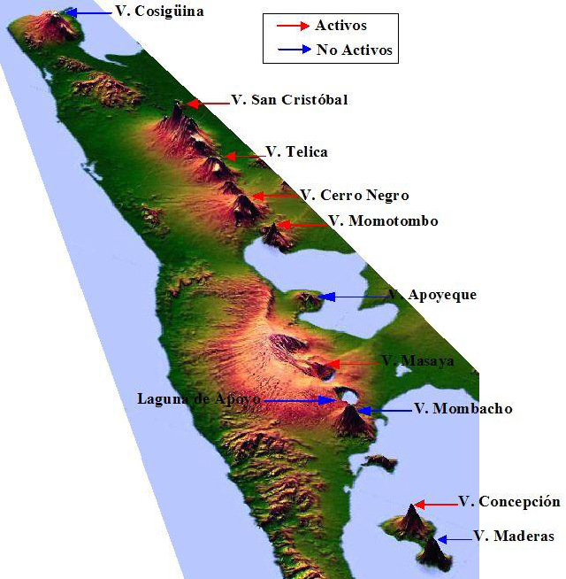 |
Figure 30. An oblique view of a schematic map of Nicaragua with high vertical exaggeration highlights the locations of Nicaraguan volcanoes. Courtesy of INETER. |
As an example of normal ongoing activity at Telica, INETER reported that during 10-11 September 2012, 'jet' sounds were heard from the volcano, and two incandescent fumaroles were observed, along with gas-and-steam plumes rising 100-200 m above the crater. On 11 September two small explosions occurred in the crater. During 12-14 and 17 September gas plumes rose 30-150 m and incandescence from the crater was observed. Gas measurements on 14 and 17 September showed normal levels of SO2 flux.
2012 Sulfur dioxide flux. Average daily SO2 flux measurements made using the Mini-DOAS (differential optical absorption spectroscopy) mobile technique in 2012 were 303 metric tons per day in April, 627 metric tons per day in June, 377 metric tons per day in August, and 130 metric tons per day in October.
2012 Seismic Events. INETER has developed some novel ways for grouping seismic events at Telica. The types of seismic events monitored at Telica and activity during 2012 are shown in tables 5 and 6, respectively.
Table 5. Types of seismic activity monitored at Telica volcano, with characteristics as recorded and interpreted during 2012. Courtesy of Virginia Tenorio, INETER.
| Activity type nomenclature (abbreviations) | Frequency range/peak (Hz) | Duration | Possible explanation for 2012 events |
| Long period (LP) | 1.0-4.5/4.0 | 20-40 sec | Magma movement at depth 6-10 km |
| Tremor | 5.0-7.0 | short | Degassing and magma movement |
| Volcano-tectonic (VT; VTA+VTB) | 10.0-20.0+/12 | 1+ min | Rupture of rock at depth 6-10 km |
| Double earthquake (S.DO) | 4.0-7.0/4.0 and 7.0 | 40-60 sec | Fracture of brittle soil followed by magma displacement |
| Gas explosion (E.G) | 4.0-10.0 Hz | 1-2 min | Release of gas in volcano duct |
| Swarms of seismic events (trenes de sismos) (TS) | 5.0-7.0 Hz | 1-3 min | Breaking rocks combined with LP-type events (average of 10 events per swarm) |
| Degasification signal (S.D) | 5.0-10.0 | 1 min | -- |
Table 6. Total volcano-seismic events and numbers of various types of events (see table 5 for descriptions) that were reported at Telica during 2012; percentages indicate the contribution of each type of event to the total recorded number of events during that month. Courtesy of INETER.
| Activity type | 18-31 March | April | May | June | July |
| Total events | 1,986 | 3,222 | 3,544 | 5,754 | 4,112 |
| LP | 535 (27%) | 953 (30%) | 1,077 (30%) | 827 (14%) | 332 (8%) |
| S.DO | 658 (33%) | 638 (20%) | 635 (18%) | -- | -- |
| Tremor | 0 (0%) | 72 (2%) | 78 (2%) | 0 (0%) | 125 (3%) |
| E.G | 625 (32%) | 609 (19%) | 686 (19%) | -- | -- |
| VT (VTA + VTB) | 168 (8%) | 299 (9%) | 315 (9%) | 2,418 (42%) | 997 (24%) |
| S.D | -- | 651 (20%) | 753 (21%) | -- | -- |
| TS | -- | -- | -- | 2,519 (44%) | 2,658 (65%) |
2012 Temperature measurements. Figure 31 shows INETER staff members measuring crater and fumarole vent temperatures at Telica; temperatures are measured approximately once per month (figure 32). Temperatures measured during 2012 at the 4 fumaroles (figure 33), vents located E and outside of Telica crater, ranged between 52° and 79°C.
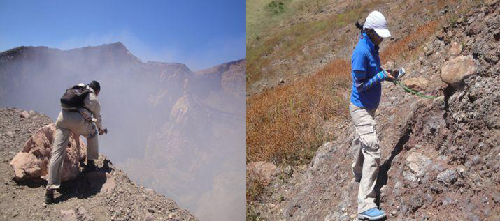 |
Figure 31. INETER staff measuring temparatures at the Telica crater using a thermal imaging camera (left) and one of the fumarole vents using an IR thermometer (right). Courtesy of INETER. |
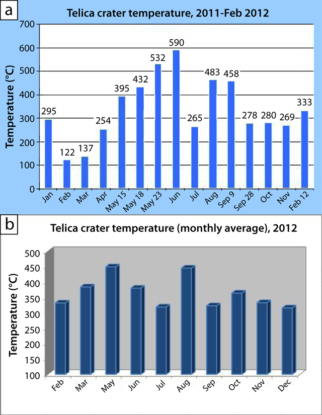 |
Figure 32. (a) Maximum monthly temperatures for Telica crater during January 2011-February 2012, and (b) average monthly temperatures during 2012. Courtesy of INETER. |
2013 activity. The Costa Rica News reported on 24 March 2013 that Virginia Tenorio of INETER announced that Telica was experiencing increased micro-earthquakes. According to the INETER report, dozens of micro-earthquakes had occurred per day since 17 March. The increase continued to at least 24 March; 20 earthquakes occurred on 22 March, but only one reached as high as M 2.1. Tenorio was reported to state that, although earthquakes were located within the volcano's structure, an imminent eruption was not indicated. She further stated that while some changes may occur in the magmatic system and in the expulsion of gases, conditions were stable. Local observers reported elevated vapor and gas emissions associated with the spike in seismicity and incandescence in a fissure at the bottom of the active crater. Since 21 March 2013, the member institutions of the National System for Prevention, Mitigation and Attention to Disasters (SINAPRED), have been ordered to monitor Telica's activity and keep it under close observation.
Information Contacts: Virginia Tenorio, Instituto Nicaragüense de Estudios Territoriales (INETER), Apartado Postal 2110, Managua, Nicaragua (URL: http://www.ineter.gob.ni); Costa Rica News, San Jose, Costa Rica (URL: http://thecostaricanews.com); Sistema Nacional para la Prevención, Mitigación y Atención de Desastres (SINAPRED), Managua, Nicaragua (URL: http://www.sinapred.gob.ni/); MODVOLC, Hawai'i Institute of Geophysics and Planetology (HIGP) Thermal Alerts System, School of Ocean and Earth Science and Technology (SOEST), Univ. of Hawai'i, 2525 Correa Road, Honolulu, HI 96822, USA (URL: http://modis.higp.hawaii.edu/).
Small explosions in September 2013; a new intracrater vent
INETER reported that during 2013, Telica was one of the main contributors to Nicaragua's volcanic seismicity (along with Momotombo, San Cristóbal, Cerro Negro, and Concepción). Of the total seismicity detected in Nicaragua, 28% was associated with the volcanic chain.
Throughout 2013, white, low-level gas plumes rose over 200 m above the crater. Field observers saw incandescence from the crater floor and heard jetting sounds. This activity was slightly diminished in May and peaked in late September.
In March 2013, a group of students from Chalmers University of Technology, Switzerland, surveyed the crater with an FTIR spectrometer to determine SO2 flux (figure 34). Overall, during 5-21 March, SO2 flux averaged 175 tons/day with the maximum value of 250 tons/day recorded on 17 March. The group returned to Telica in March 2014 and found fluxes of similar levels (figure 34).
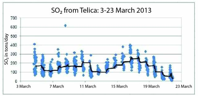 |
Figure 34. SO2 flux measured from Telica during 5-22 March 2013 by students from the Chalmers University of Technology, Switzerland. Courtesy of Vladimir Conde, Chalmers University of Technology. |
On 25 September 2013, small explosions were detected from the crater that released gas and ash. There were four explosions during 0725-1605; the largest occurred at 0725 and generated a plume 50 m above the crater rim. The other three explosions were less energetic and did not eject material beyond the crater. During a field visit that day, INETER scientists observed incandescence from a new vent within the crater as well as small fractures crossing the crater floor. An infrared thermometer measured a maximum of 505°C from the active vent.
A field survey team observed strong degassing from the crater on 8 October. The main source of the gas was the SW wall and jetting sounds were also noted.
2014. Low-level degassing continued during January-June 2014. Jetting sounds and incandescence from the crater occurred less frequently based on field visits by INETER scientists. Seismicity in January and February was elevated; 11,182 and 26,355 volcano-tectonic (VT) earthquakes were detected respectively. In April 2014, seismicity was greatly reduced (2,454 earthquakes) and was dominated by paired earthquakes known as doublets (also detected in January 2014).
During a field visit on 22 May 2014, INETER scientists noted that, while incandescence was still visible, gas emissions were greatly reduced and the jetting sounds were absent. The active vent within the crater appeared to be covered and possibly blocked by rockfalls originating from the crater walls. Emissions, jetting sounds, and incandescence were also reduced in June 2014.
Information Contacts: Virginia Tenorio, Instituto Nicaragüense de Estudios Territoriales (INETER), Apartado Postal 2110, Managua, Nicaragua (URL: http://www.ineter.gob.ni).
Multiple explosive ash-and-gas episodes; May 2015, and September 2015 through May 2016
Small explosions have been recorded at Nicaragua's Telica volcano regularly since early in the 20th century. The last major eruptive episode began with a series of small explosions in March 2011 and culminated in greatly increased seismicity and several larger explosions during May that deposited ashfall in communities within 8 km of the volcano, and caused a small number of evacuations. Ash-bearing explosive activity died down by mid-June 2011, although steady degassing with gas-and-steam plumes continued. A small ash-and-gas explosion was reported on 25 September 2013.
On 7 May 2015 a new series of larger ash-and-gas explosions began. Nicaragua's Instituto Nicaragüense de Estudios Territoriales (INETER) provides monthly reports on seismic activity and monitoring of thermal and geochemical data as well as daily informational bulletins of volcanic activity; aviation advisories are also provided by the Washington Volcanic Ash Advisory Center (VAAC). Activity from June 2014 through August of 2016 is covered in this report.
A decrease in seismicity and increase in temperature within the summit crater at Telica in April 2015 preceded an ash-and-gas explosion on 7 May 2015 after several years of relative quiet. This was followed by a series of over 100 ash-bearing explosions in the following three weeks, the last on 28 May. Degassing from fumaroles continued without ash during June and the crater had cooled significantly by August. A new series of ash-and-gas explosion between 23 and 26 September 2015 sent ashfall to nearby communities and a few large volcanic bombs several hundred meters from the crater. The next series of explosions between 22 and 29 November sent ashfall to over 70 communities within 20 km of Telica. Incandescence was observed in a crack in the floor of the summit crater in December, but lava wasn't observed in the vent until 25 February 2016 after a sequence of gas explosions that lasted until 1 March. The lava and incandescence were observed until early May when explosions on 7-8 May 2016 were observed from a new vent in the N part of the crater. No further ash emissions were observed, and seismicity dropped significantly and remained quiet through August 2016.
Activity between June 2014 and May 2015. Remote temperature measurements of the summit crater floor at Telica showed a steady decline between May and July 2014 from an average of 417°C to 350°C, continuing a decline from values measured in 2013 that had been as much as 100°C hotter. During this time, few noises were heard and little incandescence from the crater was observed. There were no further reports until February 2015 when fresh landslides along the SE inner wall were observed blocking the vent; on a 25 February summit crater visit there was no noise, and few emissions from fumaroles were observed. Temperatures at the fumaroles on the SE, S and SW walls of the crater were around 150°C, and the floor of the crater was measured at 123°C with the Testo IR 820 thermometer. Gas emissions were more variable in March 2015, but again there was no noise or incandescence observed. The numbers of daily seismic events in March 2015, 3982, were generally within normal levels, ranging from a few to a few hundred per day, depending on type of seismicity.
The temperature at the floor of the crater in April 2015 had risen significantly to 412°C. The seismicity was also changed, with fewer total events (1,973). There was a noticeable drop in the number of events in the second half of April. As reported by INETER seismologist Virginia Tenorio, this decrease in number of events, accompanied by a narrowing of the frequency range to between 3 and 11 Hz, from a normally larger range of 3 to 30 Hz, also occurred prior to the last significant eruption in 2011.
Activity during May-August 2015. On 7 May 2015 at 1609 and 1615, INETER reported that Telica broke its "relative calm" since 26 September 2013 with two gas and ash explosions which rose about 200 m above the rim of the crater. This was the beginning of an eruptive period that included 902 seismically-detected explosions between 7 and 28 May, of which 104 were accompanied by volcanic ash (figure 35). Some also involved ejection of large incandescent lava blocks. Towns within 40 km in a generally W direction were affected by ashfall from these explosions.
An explosion on 12 May ejected rocks 400 m high to the W. Minor ashfall was reported during May in El Realejo (35 km WSW), Corinto (40 km WSW), Posoltega (16 km SW), Guanacastal (20 km WSW), Quezalguaque (12 km SW), Chinandega (30 km W), El Viejo (35 km WNW), and Chichigalpa (20 km WSW). On 20 and 21 May, a series of explosions ejected one-m-diameter blocks up to 500 m from the crater. Many ash plumes were photographed by the INETER web camera located at the TELN seismic station on the E flank; others by INETER scientists at the volcano (figures 36-40).
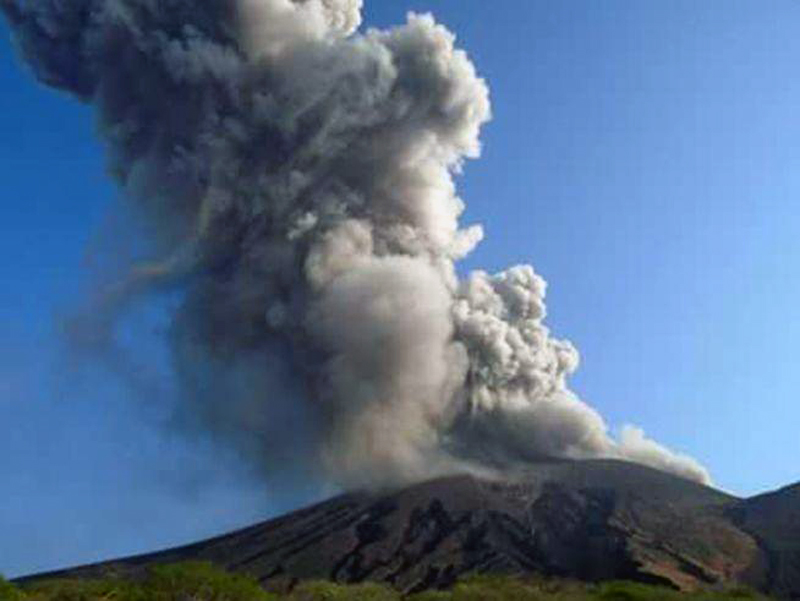 |
Figure 36. Explosion at Telica on 8 May 2015 at 1002 local time. Courtesy INETER (Boletin mensual Sismos Y Volcanes de Nicaragua, Mayo 2015). |
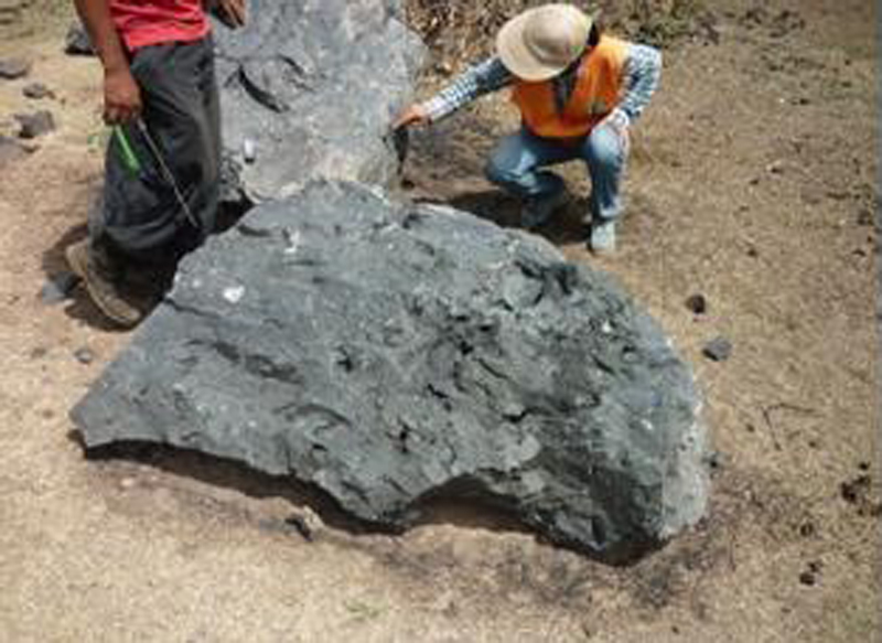 |
Figure 39. Block ejected from Telica on 23 May 2015. Courtesy INETER (Boletin mensual Sismos Y Volcanes de Nicaragua, Mayo 2015). |
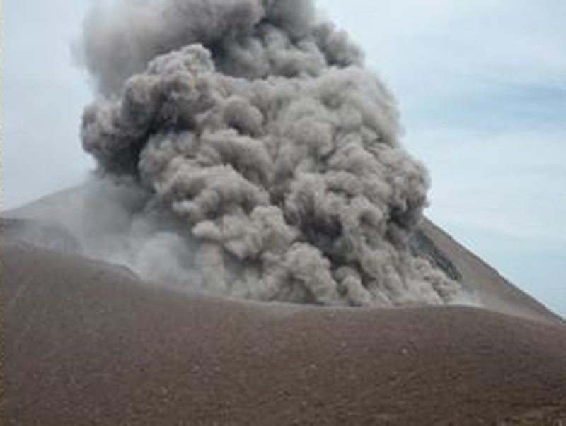 |
Figure 40. Ash explosion at Telica, 1000 local time 27 May 2015. Courtesy INETER (Boletin mensual Sismos Y Volcanes de Nicaragua, Mayo 2015). |
On only two dates during May did these explosions initiate reports from the Washington VAAC; they reported ash emissions on 11 May rising to 1.8 km and drifting W, and twice on 26 May. The first plume on 26 May extended 75 km W below 3 km altitude, and a second drifted 117 km WNW of the summit at 4.3 km before dissipating.
Visits to the crater on 8 and 14 May revealed a new vent at the base of the S wall of the crater that formed during the 7 May explosion (figure 41). There was a substantial increase in temperature inside the crater from 150°C to 377°C between these dates. The first explosion with incandescent material was observed on 10 May. SO2 measurements of 1,000-1,500 tons per day (t/d) were taken during an explosion on 26 May (figure 42), and values were significantly higher than previous levels of around 300 t/d.
Seismicity in May was high, with 18,858 recorded events. The high number of volcano-tectonic events (VT) during the month (605) was associated with the ruptures that triggered explosions; they have a characteristic frequency of 4.5 to 10.0 Hz. Most of the VT events were located between 6 and 10 km below the surface. The majority of the total seismic events in May were related to degassing and gas explosions (18,087). Screw-type "tornillo" earthquakes are usually rare at Telica, but about 46 of them were observed in May.
The volcano remained relatively calm during June, with the number of daily seismic events typically at 10 or lower, far fewer than May. Even fewer seismic events (71) were recorded in July along with gas emissions that were variable but generally light. The most degassing came from fumaroles located on the inner walls of the crater where the temperature was measured at 298°C. On a 25 August visit to the crater, INETER technicians noted that the points where incandescence had been observed prior to May had disappeared, and temperatures at the fumaroles on the SW and NE walls ranged from 50°C to 160°C.
Activity during September 2015-August 2016. A new gas-and-ash explosion at 0800 on 23 September 2015 sent ash to the NW, W, and SW. The plume rose to 400 m above the crater. Other smaller explosions with small quantities of ash continued that day and the next. Ashfall was reported in the community of Guanacastal (20 km WSW). Additional medium-intensity explosions on 26 September ejected gas, ash, and rock fragments up to 500 m from the crater. Ash plumes reached 1,000 m above the crater and drifted W and NW. The Washington VAAC reported these emissions at 4.3 km altitude, drifting N and W about 45 km (figure 43). This second series of explosions opened a new vent on the N side of the crater floor, and gas emissions continued from both vents. Seismic events in September numbered 775.
During October, no ash explosions were recorded, although 2,921 total seismic events were reported. On 22 November 2015 a new series of explosions began, lasting for eight days. That day, the Washington VAAC reported an ash plume to 2.4 km that drifted about 185 km W. According to a news article published by el19, two explosions, at 0847 and 0848, generated ash plumes that rose 2 km and ejected tephra at least 900 m away (figure 44). Residents in Agua Fría (900 m away) noted it was the first time lapilli and blocks had reached their community. La Prensa reported that ash fell in at least 70 communities in the municipalities of Quezalguaque (13 km SW), Posoltega (16 km WSW), Chichigalpa (20 km WSW), and Chinandega (30 km W).
INETER reported that during 25-27 November numerous small explosions were recorded, most of which generated volcanic ash, with the highest plume reaching 800 m above the crater. Satellite imagery reported from the Washington VAAC showed a faint plume extending about 16 km WSW at 1.2 km altitude on 26 November. Occasional emissions continued until 29 November with several VAAC reports indicating plumes at 1.5 km altitude visible in satellite imagery drifting up to 45 km W and SW.
While no explosions were reported during December 2015, the INETER volcano observer (René Dávila) noted that incandescence was observed in a N-S trending fracture on the crater floor during a visit to the summit. Seismicity was low in December, with a total of 1,342 events recorded, although there was an increase in micro-seismicity during the second half of the month. Even fewer seismic events were reported in January 2016 (171 events), along with few gas emissions that seldom rose above the crater rim.
On 13 February 2016 emissions were observed in visible satellite imagery by the Washington VAAC moving WSW from the summit that likely contained ash. This was preceded by a burst of seismic activity reported by INETER. They noted intermittent high micro-seismicity between 16 February and 1 March. Incandescence from the vent on the crater floor increased during February; lava on the crater floor was first observed by INETER on 25 February. Small gas explosions were observed inside the crater during 24- 26 February followed by five gas-and-ash explosions recorded during 29 February-1 March which generated plumes that rose 300 m above the crater and drifted W and SW. Gas-and-ash emissions lasted for 14 minutes during the strongest of these events.
A visit to the crater on 15 March 2016 by INETER scientists provided additional evidence of incandescence within the crater and a temperature reading of 485° C (figure 45).
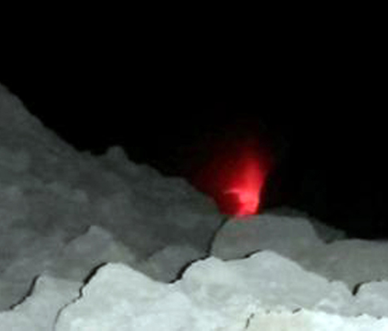 |
Figure 45. Night view of the incandescence in the crater of Telica taken on 15 March 2016. Courtesy INETER (Boletin mensual Sismos Y Volcanes de Nicaragua, Marzo 2016). |
From late March through early May, INETER reported incandescence and lava inside a vent on the crater floor, and micro-seismicity remained high even though gas emissions and RSAM values were low. The last report of incandescence from the vent on the crater floor was during the second week of May. RSAM values had dropped to 80 units by 14 May.
Based on information from INETER, SINAPRED reported that 30 explosions occurred during 7-8 May 2016, producing gas-and-ash plumes that rose 600 m and drifted S and SW. The explosions originated from a new vent in the N part of the crater. Seismic RSAM amplitudes spiked to several hundred units between 8 and 12 June, but there were no reports of ash emissions after 8 May from either the Washington VAAC or INETER.
In late July 2016 scientists visited the Las Quemadas, Aguas Frías, (Hot Spring) located 1.7 km north-east of Telica to study temperature and chemistry of the geothermal waters. Seismicity and RSAM values remained low through August 2016 with no further reports of ash emissions or lava in the crater.
Information Contacts: Instituto Nicaragüense de Estudios Territoriales (INETER), Apartado Postal 2110, Managua, Nicaragua (URL: http://webserver2.ineter.gob.ni/vol/dep-vol.html); Washington Volcanic Ash Advisory Center (VAAC), Satellite Analysis Branch (SAB), NOAA/NESDIS OSPO, NOAA Science Center Room 401, 5200 Auth Rd, Camp Springs, MD 20746, USA (URL: http://www.ospo.noaa.gov/Products/atmosphere/vaac/ , archive at: http://www.ssd.noaa.gov/VAAC/archive.html); Sistema Nacional para la Prevencion, Mitigacion y Atencion de Desastres, (SINAPRED), Edificio SINAPRED, Rotonda Comandante Hugo Chávez 50 metros al Norte, frente a la Avenida Bolívar, Managua, Nicaragua (URL: http://www.sinapred.gob.ni/); El19digital, https://www.el19digital.com/articulos/ver/titulo:35988-volcan-telica-registra-fuerte-explosion; La Prensa, http://www.laprensa.com.ni/2015/11/22/departamentales/1940877-volcan-telica-lanza-piedras-cenizas-dos-mil-metros-altura .
Explosions on 21 June and 15 August 2018; local ashfall from June event
The Telica volcano complex, which consists of several cones and craters, has had intermittent eruptions since the Spanish conquest, with emissions of gas and ash. According to The Instituto Nicaragüense de Estudios Territoriales (INETER), the volcano is monitored in real time by a permanent seismic station near the crater. It is also visited several times per year for visual observations, to measure sulfur dioxide emissions, and measure temperatures in the crater and fumaroles near the seismic station. A gas-and-ash explosion occurred in early May 2016 (BGVN 42:01). This report covers activity from September 2016 through June 2018.
INETER reported that local residents heard a small gas explosion on 10 September 2017, and warned the public to stay at least 2 km away from the crater. No ash emissions were reported related to this event.
According to INETER and the Sistema Nacional para la Prevención, Mitigación y Atención de Desastres (SINAPRED), an eruption began at 0708 on 21 June 2018. Explosions produced an ash plume that rose 500 m above the crater and drifted E, S, and SW. Ejected tephra was deposited within a 1-km-radius of the volcano, and ashfall was reported in nearby areas, including La Joya, Las Marías (7 km NNW), Pozo Viejo (10 km NNW), Ojo de Agua, San Lucas (11 km NNW), Las Higueras, Las Grietas (12 km NNW), and Posoltega (16 km WSW).
Another explosion on 15 August 2018 was reported by SINAPRED that generated an ash plume to 200 m above the crater rim.
Seismicity. INETER monthly reports indicated that during September through December 2016, between 3,500 and 3,900 monthly seismic events took place, with the majority having hybrid signatures. During 2017, the monthly number of seismic events ranged from 40,584 (September) to 105,555 (November), of which 50-90% were hybrid events, 9-10% long-period events (but 23 percent in January), and 0-35% multiple events. A few scattered volcanic-tectonic events occurred, and tremor was usually low. Seismic data for January and March consisted of percentages of different earthquake types similar to those during 2017.
About 5% of the monthly seismic signals between April 2017 and January 2018 were doublets, or paired earthquakes with two predominant frequencies. INETER did not mention doublets in their March 2018 report, and did not include seismic data in their February or April 2018 reports.
Sulfur dioxide measurements. According to INETER, during fieldwork on 8 and 11 May 2017 the sulfur dioxide level was measured at 368 ± 194 metric tons/day. This value was lower than those in November 2015 with an average of 765 ± 94 tons/day. On 28 February and 1 March 2018, measurements using the Mobile-DOAS technique found levels greater than 426 tons/day and a minimum value of 152 tons/day, with an average of 260 tons/day, higher than the value measured in September 2017 with 183 tons/day. On 16 and 19 April 2018, the minimum and maximum values were 229 and 567 tons/day, with an average of 353 tons/day.
Information Contacts: Instituto Nicaragüense de Estudios Territoriales (INETER), Apartado Postal 2110, Managua, Nicaragua (URL: http://webserver2.ineter.gob.ni/vol/dep-vol.html); Sistema Nacional para la Prevencion, Mitigacion y Atencion de Desastres (SINAPRED), Edificio SINAPRED, Rotonda Comandante Hugo Chávez 50 metros al Norte, frente a la Avenida Bolívar, Managua, Nicaragua (URL: http://www.sinapred.gob.ni/).
Thermal anomalies persist with explosions in August 2018, July 2020, and September-October 2020
Telica, located in Nicaragua, is a volcano complex that consists of several cones and craters and includes a 700-m-wide double crater; the southern crater, measuring 120 m deep, is the source of recent eruptions. The latest eruptions, during June-August 2018 and July-October 2020, have been characterized by seismicity, fumaroles, persistent thermal anomalies, and occasional explosions and ash plumes. The primary source of information comes from the Instituto Nicaragüense de Estudios Territoriales (INETER), the Sistema Nacional para la Prevencion, Mitigacion y Atencion de Desastres (SINAPRED), and various satellite data.
Summary of activity during July 2018-October 2020. Activity during this reporting period was relatively low, consisting of frequent earthquakes, SO2 emissions, and fumarolic activity; explosions and resulting ash plumes were reported during August 2018, July 2020, and late September-October 2020. During October 2018 through early March 2019 the Sentinel-2 MODIS Thermal Volcanic Activity graph provided by the MIROVA system identified a strong cluster of frequent thermal anomalies in the summit area, followed by a period of quiescence from mid-March 2018 through mid-March 2020 (figure 46). By then, a single thermal hotspot was detected, followed by intermittent thermal anomalies from July to early September 2020. Sentinel-2 thermal satellite imagery showed a persistent thermal anomaly in the summit crater during the reporting period, with a possible new lava flow that migrated from the E side of the summit crater to the W on 30 December 2018 (figure 47). The thermal anomaly was visible on clear days, dominantly on the E side of the summit crater.
Activity during July-December 2018. Activity as reported by INETER was relatively low during 2018 with the exception of August, which was characterized by explosions and ash plumes. Seismicity, which included a low number of volcanic earthquakes, was reported throughout the year. On 15 August an explosion generated an ash plume that rose 200 m above the crater (figure 48). Sulfur dioxide emissions were measured during August and September, with a daily average in the 293-451 tons range. During September, INETER scientists observed fumaroles on the S wall of the crater.
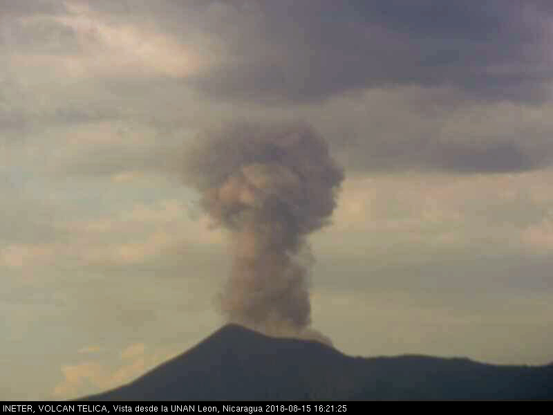 |
Figure 48. Webcam image (color corrected) of an ash plume rising 200 m above Telica on 15 August 2018. Courtesy of SINAPRED. |
Activity during 2019. Similar low activity was reported in 2019, primarily consisting of volcanic earthquakes, fumaroles, and sulfur dioxide emissions. During the year, just over 1 million seismic events were recorded, which included hybrid-type and volcano-tectonic events. SO2 emissions were measured using the Mobile-DOAS technique in February-April and June-November, with averages of 153-380 tons/day. On 14 May fumaroles were visible in the crater on the W wall. INETER scientists noted internal collapses were observed in the SE and S walls. A fracture about 25 m long and 2 m wide on the N edge of the crater exhibited gas-and-steam emissions. On 19 November field work was carried out by INETER scientists to measure the temperature of the fumaroles; the maximum temperature was 170°C, which was less than the temperature recorded in May (346°C).
Activity during January-October 2020. During January-October 2020, activity remained similar to the previous years, consisting of fumarolic activity and seismicity; activity increased beginning in late July through October. Seismicity continued to be reported each month, totaling about 816,000 events, which included hybrid and volcano-tectonic events. Fieldwork by INETER on 11 February showed that the main crater had been obstructed by landslides on the S and W walls due to continued fumarolic activity. The temperature of these gas-and-steam emissions was 101°C, which was lower compared to their previous measurements in November 2019. SO2 emissions measured during February-October had daily averages of 129-370 tons. On 11 March field scientists noted that the main crater continued to be obstructed by landslides on the S and SW walls and that gas-and-steam emissions rose from the E, S, and W crater wall, creating greater collapses and fractures in the surrounding rock. During April-July and September-October, similar observations were made.
Beginning on 7 July 2020 eruptive activity increased, according to INETER; five seismic stations recorded explosions and volcanic tremors, which generated gas-and-ash emissions in the main crater that rose 500-600 m above the crater. On 20 July at 1659 small explosions were detected that produced gas-and-ash plumes that rose 200 m above the crater rim (figure 49). At the time of the explosions, RSAM values increased from 57 to 153 and remained at 144 units after the events. On 29 July seven to ten gas-and-ash explosions generated plumes that rose 30-60 m above the crater rim and drifted N. According to a Washington VAAC advisory, an ash plume rose to 1.5 km altitude and drifted W. Sporadic explosions and gas-and-ash emissions, accompanied by fumarolic plumes, continued during August through October, according to INETER.
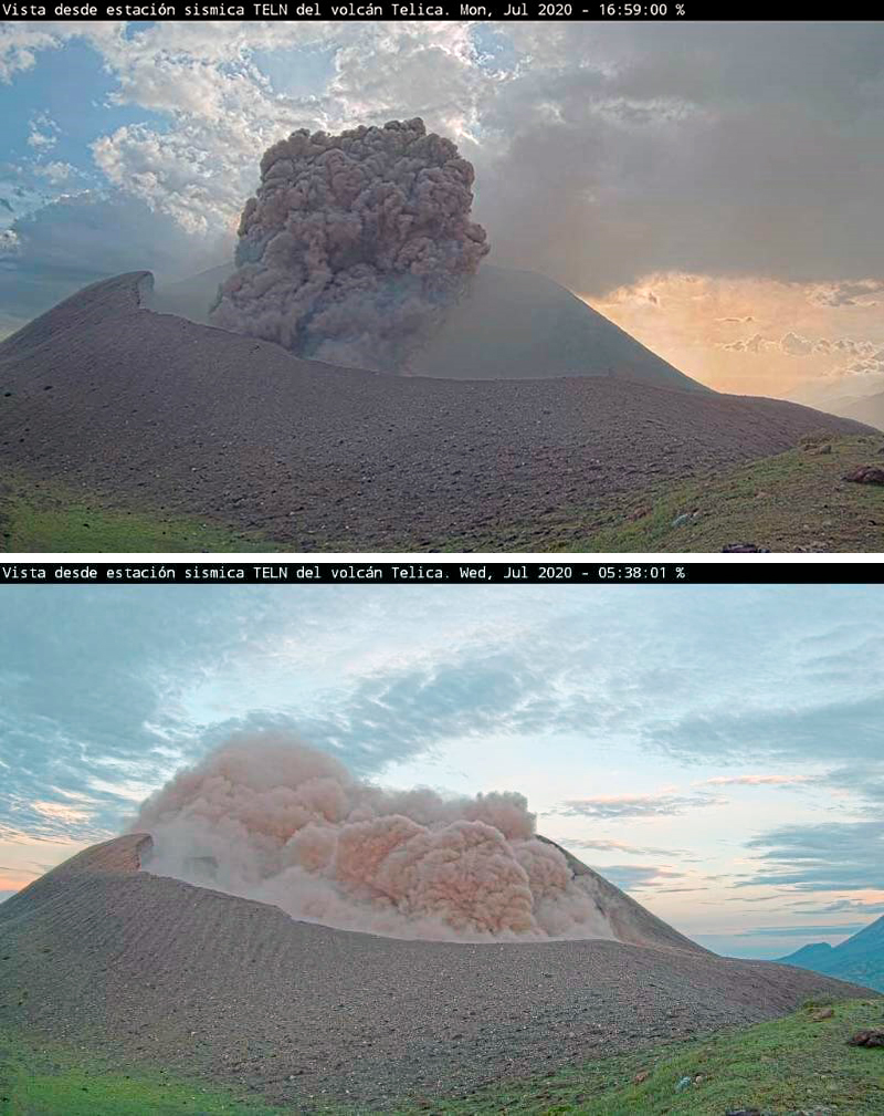 |
Figure 49. Webcam images of an ash explosion at Telica rising 200 m above the crater on 20 July (top) and 30-60 m above the crater and drifting N on 29 July 2020 (bottom). Courtesy of SINAPRED. |
Explosions on 27 September resulted in a collapse in the crater wall, with more defined fractures on the S and W walls. On 29 September gray ash emissions were observed rising to a low height above the crater rim (figure 50). A seismic swarm on 4 October was registered by a seismic station N of the volcano. During 6-7 October five explosions were recorded, according to INETER, the largest of which occurred on 7 October at 0742 and generated an ash plume that rose 600 m above the crater and drifted SW (figure 51). This event resulted in ashfall around the crater. Another explosion on 8 October produced a gas-and-ash plume that rose 500 m above the crater and drifted E and SE, depositing some ash near the crater. New fumarolic emissions were observed rising above the N crater wall. On 29 October a series of three explosions began at 1910 and ended at 2137. These explosions ejected rock fragments onto the flanks of the volcano, producing gas-and-ash plumes that rose as high as 1 km above the crater and drifted W. Resulting ashfall was reported in communities of El Bosque, Jacinto Baca (15 km WSW), Filiberto Morales (15 km WSW), Carlos Huete, Linda Vista, Divino Niño (31 km W). During 30-31 October three explosions were detected, producing gas-and-ash plumes that rose 250-600 m above the crater, which caused a minor amount of ashfall on the flanks.
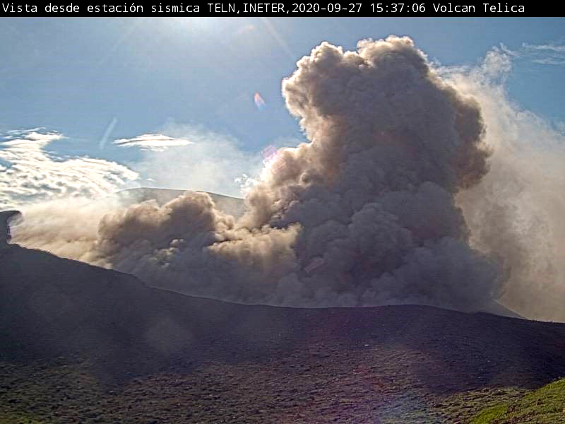 |
Figure 50. Webcam image showing gray ash plumes rising above Telica on 29 September 2020. Courtesy of INETER. |
 |
Figure 51. Photos of the explosion and resulting ash plume at Telica on 6 October (left) and 7 October 2020 (right). Photos by Chavarría D.; courtesy of INETER. |
Information Contacts: Instituto Nicaragüense de Estudios Territoriales (INETER), Apartado Postal 2110, Managua, Nicaragua (URL: http://www.ineter.gob.ni/); Sistema Nacional para la Prevencion, Mitigacion y Atencion de Desastres (SINAPRED), Edificio SINAPRED, Rotonda Comandante Hugo Chávez 50 metros al Norte, frente a la Avenida Bolívar, Managua, Nicaragua (URL: http://www.sinapred.gob.ni/); Washington Volcanic Ash Advisory Center (VAAC), Satellite Analysis Branch (SAB), NOAA/NESDIS OSPO, NOAA Science Center Room 401, 5200 Auth Rd, Camp Springs, MD 20746, USA (URL: www.ospo.noaa.gov/Products/atmosphere/vaac, archive at: http://www.ssd.noaa.gov/VAAC/archive.html); MIROVA (Middle InfraRed Observation of Volcanic Activity), a collaborative project between the Universities of Turin and Florence (Italy) supported by the Centre for Volcanic Risk of the Italian Civil Protection Department (URL: http://www.mirovaweb.it/); Sentinel Hub Playground (URL: https://www.sentinel-hub.com/explore/sentinel-playground).
Numerous explosions and ash plumes during late November-early December 2020
During January-October 2020, activity at Telica consisted of frequent seismicity, fumarolic emissions, and beginning in July, explosions that generated gas-and-ash plumes (BGVN 45:11). The following report describes activity between November 2020 and February 2021 using monthly and special bulletins published by the Instituto Nicaragüense de Estudios Territoriales (INETER) and satellite images.
Following some small ash explosions in late October, activity decreased in November 2020. INETER scientists visiting the volcano on 24 November observed small pulses of gas and ash originating from the SW walls and flanks, and heard jet sounds inside the crater. The team also noted abundant gas emissions on the N and NW walls and subsidence inside the crater.
A new series of ash explosions began at 0538 on 30 November (figure 52). Similar activity later that morning ejected incandescent ballistics and generated a small gas-and-ash plume (figure 53). Almost continuous explosions for more than three days produced gas-and-ash plumes that rose 50-400 m above the crater rim, depositing most of the ash on the SW slope. The explosive activity on 2 December was visible in satellite imagery (figure 54), and ash plumes the next day reached the ocean (figure 55). After more than three days of almost continuous explosions, explosions became sporadic until 1450 on 8 December. A total of 1,315 small explosions were recorded between 30 November and 8 December. Ashfall during this period was reported in communities to the SW, including Zarandaj (6 km WSW), Cristo Rey (6 km W), Las Colinas (7 km WSW), Garrobo Empinado (8 km SSW), El Panal (9 km SSW), Canta Rana (10 km SW), Ceibo Chachagua (10 km SW), Las Mercedes (10 km SW), Punta Arena (10 km SW), La Virgen (12 km WSW), Filiberto Morales (15 km WSW), Los Cocos (9 km SSW), Verónica Lacayo (10 km SW), and Nuevo Belén.
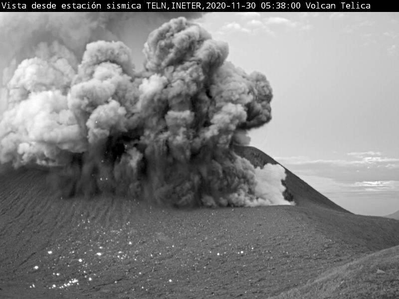 |
Figure 52. Webcam photo of an explosion at Telica at 0538 on 30 November 2020. This event was the first in a series of explosions that continued until 8 December. Courtesy of INETER. |
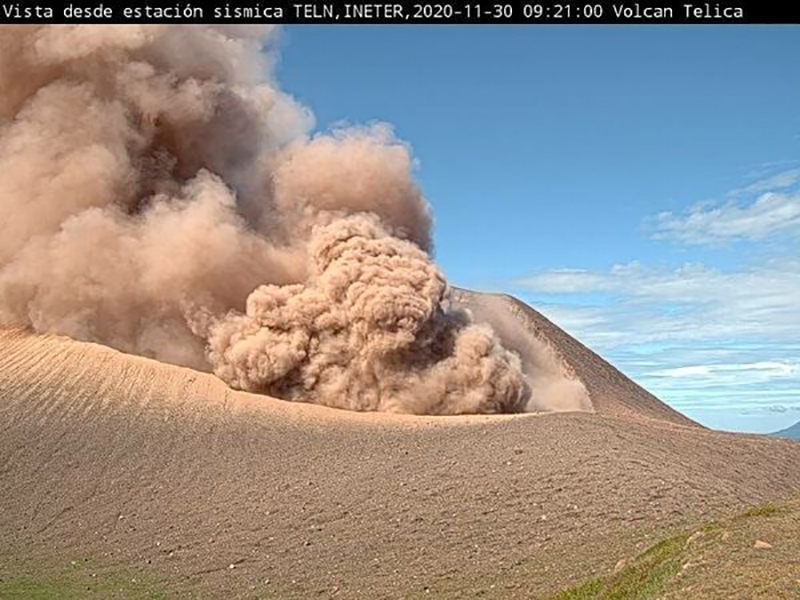 |
Figure 53. Webcam photo of an explosion at Telica at 0921 on 30 November 2020 that generated a dense brown ash plume. Courtesy of INETER. |
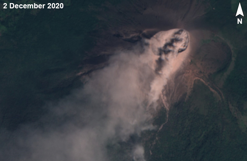 |
Figure 54. Sentinel-2 images of Telica on 2 December 2020 in natural color (bands 4, 3, 2) showing a brown gas-and-ash plume streaming SW. Courtesy of Sentinel Hub Playground. |
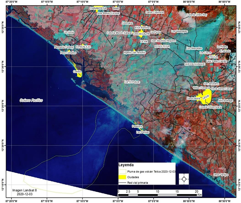 |
Figure 55. Landsat 8 false-color image (bands B4, B7, B1) of a gas plume (light blue) from Telica extending SW over the Pacific Ocean on 3 December 2020. Courtesy of INETER. |
Thermal anomalies seen in Sentinel-2 satellite images were identified again starting on 14 December 2020, for the first time since 10 September. The hotspot in the eastern part of the crater was detected intermittently through 22 February 2021.
SO2 emissions measured by the Mobile-DOAS technique using 5-7 transects, averaged 99 metric tons/day for November and 821 metric tons/day for December. These values were outside the normal range and represented among the lowest and highest averages, respectively, since at least 2009. SO2 emissions averaged 129 metric tons/day during January. Small landslides were heard in February, and weak degassing was evident.
According to INETER, about 907,863 seismic events were recorded during 2020, of which 51,275 were long-period (LP) earthquakes; the source of which was 6-10 km deep. In December alone, seismicity was dominated by volcano-tectonic (VT) earthquakes, of which 262,549 were counted. Tremor remained between 20-50 RSAM units. Seismicity continued in early 2021, though INETER did not report any explosive activity. In January 2021 about 140,000 seismic events occurred, of which 24,652 were LP earthquakes. In February about 86,243 seismic events occurred, of which 1,725 were LP earthquakes, 431 were VT earthquakes, and 15,093 were hybrid earthquakes. During both months, tremor remained between 20-50 RSAM units.
During a field visit on 19 January 2021, INETER observed that the crater had increased in diameter to 20 m and in depth to 5 m. The main crater displayed weak gas emissions. During the visit, temperatures of the four fumaroles on the eastern rim were 55-57°C, somewhat lower than the previous three months and significantly lower than during February-July 2020. Temperatures during a visit on 11 February were even lower.
Information Contacts: Instituto Nicaragüense de Estudios Territoriales (INETER), Apartado Postal 2110, Managua, Nicaragua (URL: http://www.ineter.gob.ni/); Sentinel Hub Playground (URL: https://www.sentinel-hub.com/explore/sentinel-playground).
Weak explosions and minor ash plumes during April-July 2021
A series of weak ash explosions during 30 November-8 December resulted in ashfall in neighboring communities (BGVN 46:03). The following report describes activity between March and August 2021, based on monthly and special bulletins published by the Instituto Nicaragüense de Estudios Territoriales (INETER) and satellite images.
According to INETER, the volcano was quiet during March through 21 April, when two small gas-and-ash explosions occurred on that date at 0527 and 0610. Ash rose about 400 m above the crater and fell on the volcano’s slopes. Satellite images during the last week of April showed dark emissions.
On 1 May 2021 a Sentinel-2 satellite image showed a weak ash plume extending W over the crater. Weak ash plumes were also recorded by Sentinel-2 on 3 May and 6 May. Then, according to INETER, a total of 60 weak explosions occurred during 6-8 May. The plumes reached a height of 300 m and drifted S and SW, with ash falling primarily on the volcano’s slopes (figure 56). Sentinel-2 images showed weaker dark emissions through the rest of May. INETER reported 19 more weak explosions during 16-17 May and 16 explosions on 22 May, starting at 0508. On 24 May, 15 new explosions occurred, averaging once every 15 minutes. Gas-and-ash columns reached 250 m above the crater, and tephra from the plumes dropped back into the crater. After the activity on 5 May, INETER scientists visited the volcano and observed strong degassing (figure 57).
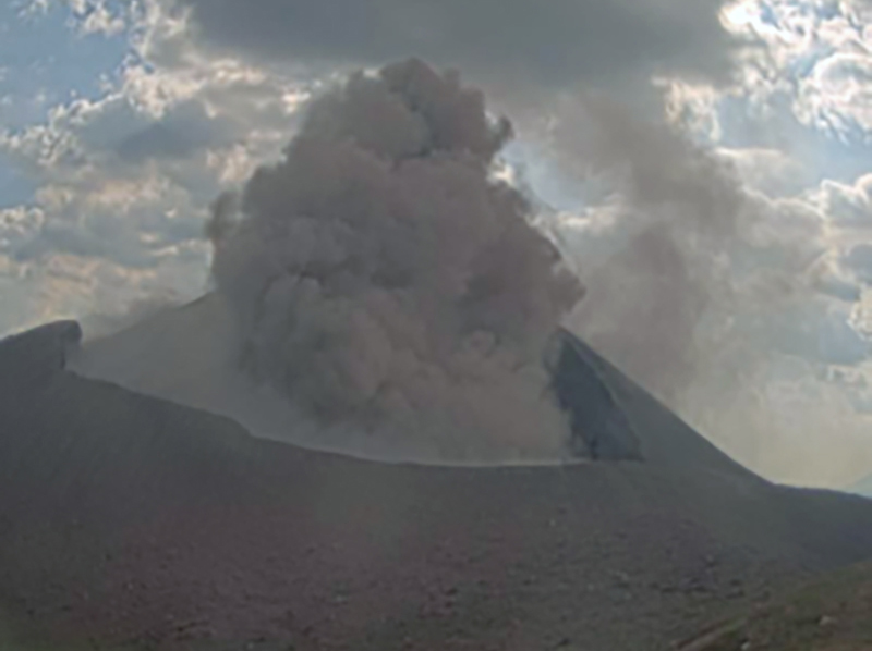 |
Figure 56. Webcam image showing an ash explosion at Telica on 7 May 2021. Courtesy of INETER (Boletín mensual Sismos y Volcanes de Nicaragua, Mayo, 2021). |
According to INETER, on 20-21 June, four small gas and ash explosions occurred. Ash rose to a maximum height of 150 m above the crater and fell on the NW slope. Sentinel-2 images recorded only modest emissions during these explosions, including a dark plume extending S on 25 June (figure 58). INETER reported that on 29 June gas-and-ash emissions began at 0500, with ash reaching a maximum height of about 200 m above the crater and falling on the SW slope.
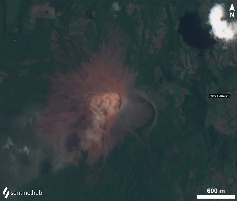 |
Figure 58. Ash plume on 25 June 2021, as captured by a Sentinel-2 satellite (natural color, bands 4, 3, 2). Courtesy of Sentinel Hub Playground. |
The Washington Volcanic Ash Advisory Center (VAAC) reported ash plumes during 2-3 July. A few discrete emissions and ash near the crater were visible in webcam images on 2 July, and possible diffuse ash near and W of the crater was identified in satellite images. Plumes likely rose to about 200-500 m above the crater. Another steam-and-ash plume drifted SW and then turned N. On 3 July possible ash plumes rose about 500 m above the crater and drifted WSW. Sentinel-2 imagery showed an ash plume within the crater on 20 July. No additional ash plumes were detected or reported through August.
Additional observations. According to INETER, SO2 emissions measured with Mobile-DOAS using 7-8 transects ranged from an average of 47 metric tons/day (April) to 286 metric tons/day (August). The monthly values were generally lower during the first half of 2021 compared to March-December 2020 (figure 59). Seismic activity diminished every month between April (85,198 seismic events) and July (47,762 events), continuing a decreasing trend from January 2021 (about 140,000 seismic events). Most events during April-July were hybrid earthquakes. Tremor was 50-70 RSAM units in March and 10-30 RSAM units during April-July.
Information Contacts: Instituto Nicaragüense de Estudios Territoriales (INETER), Apartado Postal 2110, Managua, Nicaragua (URL: http://www.ineter.gob.ni/); MIROVA (Middle InfraRed Observation of Volcanic Activity), a collaborative project between the Universities of Turin and Florence (Italy) supported by the Centre for Volcanic Risk of the Italian Civil Protection Department (URL: http://www.mirovaweb.it/); Hawai'i Institute of Geophysics and Planetology (HIGP) - MODVOLC Thermal Alerts System, School of Ocean and Earth Science and Technology (SOEST), Univ. of Hawai'i, 2525 Correa Road, Honolulu, HI 96822, USA (URL: http://modis.higp.hawaii.edu/); NASA Global Sulfur Dioxide Monitoring Page, Atmospheric Chemistry and Dynamics Laboratory, NASA Goddard Space Flight Center (NASA/GSFC), 8800 Greenbelt Road, Goddard MD, USA (URL: https://so2.gsfc.nasa.gov/); Sentinel Hub Playground (URL: https://www.sentinel-hub.com/explore/sentinel-playground); Washington Volcanic Ash Advisory Center (VAAC), Satellite Analysis Branch (SAB), NOAA/NESDIS OSPO, NOAA Science Center Room 401, 5200 Auth Rd, Camp Springs, MD 20746, USA (URL: www.ospo.noaa.gov/Products/atmosphere/vaac).
Weak explosions and minor ash plumes continue into late March 2022
Weak gas-and-ash explosions have been recorded from the summit crater complex of steep-sided Telica, in NW Nicaragua, since the early 20th century (BGVN 42:01). Its current eruption began in April 2021 and has recently consisted of weak ash explosions and ash plumes, activity which continued from August 2021 into late March 2022. Information primarily comes from monthly and special bulletins posted by the Instituto Nicaragüense de Estudios Territoriales (INETER), Washington Volcanic Ash Advisory Center (VAAC), and satellite images.
Sentinel-2 satellite images during this period showed frequent gas-and-ash emissions from the active eastern crater, intermittent ash plumes, and occasional thermal signals (figure 60). Ash plumes were last seen on satellite images on 27 March, and last reported by INETER on 29 March 2022.
INETER did not report any explosive activity during August 2021. According to INETER, at 0525 on 1 September an explosion generated an ash plume that rose 250 m above the crater rim and drifted N and NW. Emissions periodically continued later that day, without explosions, and caused minor ashfall in areas to the NW, W, and SW, including in the communities of Aguas Frías, San Pedro Nuevo, and Las Marías (7 km NNW). On 4 September, a diffuse ash plume rose to an altitude of 1.2 km (~160 m above the crater rim) and drifted less than 10 km WSW, based on satellite images and model data.
An ash plume was reported by the Washington VAAC on 4 October to 1.2 km altitude that drifted W and SW. During a field excursion on 12 October, several ejected bombs were observed in the crater ranging in diameter from 0.5-30 cm, accompanied by dark gray ash deposits. In the W part of the crater, a particularly large bomb that measured 1.5 x 0.5 m was ejected 65 m from the crater rim. According to INETER, at 1650 on 28 October a minor explosion generated an ash plume that rose 150 m above the crater rim and deposited ash on the NW flank. The event was followed by a short series of weak, low-energy explosions that generated ash plumes that rose 300 m high and drifted N and NE. Minor ashfall was reported in Aguas Frías.
Based on satellite and webcam images, the Washington VAAC reported that during 21-24 and 27-28 February, multiple brown ash emissions rose to an altitude of 1.5 km (~460 m above the crater rim) and drifted as far as 55 km W, WSW, and SW (figure 61). Intermittent ash plumes were also reported on 1, 24, and 29 March that rose to 1.2, 1.5, and 1.5 km altitude, respectively, and drifted SW and W.
 |
Figure 61. Webcam image (color corrected) of an ash explosion at Telica on 22 February 2022 at 1530, taken from seismic station TELN on the E flank. Courtesy of INETER. |
Sulfur dioxide measurements. Sulfur dioxide measurements using the mobile-DOAS technique at Los Mendoza, a fixed station about 7 km W of the volcano, found higher concentrations during July 2021 of 30 tons/day (t/d), an increase from April-June (13-18 t/d). Emissions increased further in August (36 t/d), November (41 t/d), and December (43 t/d), which INETER correlated with greater intermittent eruptive activity.
Other sulfur dioxide measurements using the mobile-DOAS technique and up to 19 transepts around the volcano found much greater average concentrations than the Los Mendoza site. The average concentration in November 2021 (544 t/d) was much greater than previous months: 286 t/d in August, 163 t/d in September, 161 t/d in October. Values dropped again in 2022 to 369 t/d in February and 118 t/d in March. In contrast, the temperatures at the crater decreased August-November, compared to January-April 2021 (figure 62).
 |
Figure 62. Histogram of temperatures taken in the crater of Telica during January-November 2021. Courtesy of INETER (Boletín mensual Sismos y Volcanes de Nicaragua, Noviembre, 2021). |
Information Contacts: Instituto Nicaragüense de Estudios Territoriales (INETER), Apartado Postal 2110, Managua, Nicaragua (URL: http://www.ineter.gob.ni/); Washington Volcanic Ash Advisory Center (VAAC), Satellite Analysis Branch (SAB), NOAA/NESDIS OSPO, NOAA Science Center Room 401, 5200 Auth Rd, Camp Springs, MD 20746, USA (URL: www.ospo.noaa.gov/Products/atmosphere/vaac); Sentinel Hub Playground (URL: https://www.sentinel-hub.com/explore/sentinel-playground).
This compilation of synonyms and subsidiary features may not be comprehensive. Features are organized into four major categories: Cones, Craters, Domes, and Thermal Features. Synonyms of features appear indented below the primary name. In some cases additional feature type, elevation, or location details are provided.
Cones |
||||
| Feature Name | Feature Type | Elevation | Latitude | Longitude |
| Aguero, Cerro de | Cone | 726 m | 12° 37' 49" N | 86° 50' 42" W |
| Liston, El | Stratovolcano | 903 m | 12° 36' 25" N | 86° 49' 16" W |
| Montoso, Cerro | Cone | 721 m | 12° 36' 50" N | 86° 52' 5" W |
| Portillos, Los | Cone | 670 m | 12° 37' 0" N | 86° 52' 0" W |
|
Santa Clara
San Jacinto |
Stratovolcano | 834 m | 12° 34' 50" N | 86° 48' 48" W |
| Telica | Stratovolcano | 1036 m | 12° 36' 17" N | 86° 50' 39" W |
Thermal |
||||
| Feature Name | Feature Type | Elevation | Latitude | Longitude |
| Najo, El | Thermal | 355 m | 12° 38' 4" N | 86° 48' 34" W |
| San Jacinto, Hervideros de | Thermal | 194 m | 12° 34' 54" N | 86° 46' 45" W |
| Tizate, Hervideros de | Thermal | 172 m | 12° 36' 18" N | 86° 46' 34" W |
|
|
||||||||||||||||||||||||||
There is data available for 46 confirmed Holocene eruptive periods.
2021 Apr 21 - 2022 Mar 29 Confirmed Eruption VEI: 1
| Episode 1 | Eruption | |||||||||||||||||||||||||
|---|---|---|---|---|---|---|---|---|---|---|---|---|---|---|---|---|---|---|---|---|---|---|---|---|---|
| 2021 Apr 21 - 2022 Mar 29 | Evidence from Observations: Reported | ||||||||||||||||||||||||
|
List of 3 Events for Episode 1
| |||||||||||||||||||||||||
2020 Jul 20 - 2020 Dec 9 Confirmed Eruption VEI: 1
| Episode 1 | Eruption | |||||||||||||||
|---|---|---|---|---|---|---|---|---|---|---|---|---|---|---|---|
| 2020 Jul 20 - 2020 Dec 9 | Evidence from Observations: Reported | ||||||||||||||
|
List of 1 Events for Episode 1
| |||||||||||||||
2018 Jun 21 - 2018 Aug 15 Confirmed Eruption VEI: 1
| Episode 1 | Eruption | |||||||||||||||
|---|---|---|---|---|---|---|---|---|---|---|---|---|---|---|---|
| 2018 Jun 21 - 2018 Aug 15 | Evidence from Observations: Reported | ||||||||||||||
|
List of 1 Events for Episode 1
| |||||||||||||||
2015 Sep 23 - 2016 May 11 Confirmed Eruption VEI: 2
| Episode 1 | Eruption | Telica crater | |||||||||||||||||||||||||||||||||||||||||||||||||||||||||||
|---|---|---|---|---|---|---|---|---|---|---|---|---|---|---|---|---|---|---|---|---|---|---|---|---|---|---|---|---|---|---|---|---|---|---|---|---|---|---|---|---|---|---|---|---|---|---|---|---|---|---|---|---|---|---|---|---|---|---|---|---|
| 2015 Sep 23 - 2015 Sep 26 | Evidence from Observations: Reported | |||||||||||||||||||||||||||||||||||||||||||||||||||||||||||
|
List of 10 Events for Episode 1 at Telica crater
| ||||||||||||||||||||||||||||||||||||||||||||||||||||||||||||
| Episode 2 | Eruption | Telica crater | ||||||||||||||||||||||||||||||||||||||||||||||||||||||||||||||||||||||||||
|---|---|---|---|---|---|---|---|---|---|---|---|---|---|---|---|---|---|---|---|---|---|---|---|---|---|---|---|---|---|---|---|---|---|---|---|---|---|---|---|---|---|---|---|---|---|---|---|---|---|---|---|---|---|---|---|---|---|---|---|---|---|---|---|---|---|---|---|---|---|---|---|---|---|---|---|
| 2015 Nov 22 - 2015 Dec 15 ± 15 days | Evidence from Observations: Reported | ||||||||||||||||||||||||||||||||||||||||||||||||||||||||||||||||||||||||||
|
List of 13 Events for Episode 2 at Telica crater
| |||||||||||||||||||||||||||||||||||||||||||||||||||||||||||||||||||||||||||
| Episode 3 | Eruption | Telica crater | ||||||||||||||||||||||||||||||||||||||||||||||||||||||||||||||||||||||||||||||||||||
|---|---|---|---|---|---|---|---|---|---|---|---|---|---|---|---|---|---|---|---|---|---|---|---|---|---|---|---|---|---|---|---|---|---|---|---|---|---|---|---|---|---|---|---|---|---|---|---|---|---|---|---|---|---|---|---|---|---|---|---|---|---|---|---|---|---|---|---|---|---|---|---|---|---|---|---|---|---|---|---|---|---|---|---|---|---|
| 2016 Feb 13 - 2016 May 11 | Evidence from Observations: Reported | ||||||||||||||||||||||||||||||||||||||||||||||||||||||||||||||||||||||||||||||||||||
|
List of 15 Events for Episode 3 at Telica crater
| |||||||||||||||||||||||||||||||||||||||||||||||||||||||||||||||||||||||||||||||||||||
2015 May 7 - 2015 May 28 Confirmed Eruption VEI: 2
| Episode 1 | Eruption | Telica crater | ||||||||||||||||||||||||||||||||||||||||||||||||||||||||||||||||||||||||||||||||||||||||||||||||||||||||||||||||||
|---|---|---|---|---|---|---|---|---|---|---|---|---|---|---|---|---|---|---|---|---|---|---|---|---|---|---|---|---|---|---|---|---|---|---|---|---|---|---|---|---|---|---|---|---|---|---|---|---|---|---|---|---|---|---|---|---|---|---|---|---|---|---|---|---|---|---|---|---|---|---|---|---|---|---|---|---|---|---|---|---|---|---|---|---|---|---|---|---|---|---|---|---|---|---|---|---|---|---|---|---|---|---|---|---|---|---|---|---|---|---|---|---|---|---|---|
| 2015 May 7 - 2015 May 28 | Evidence from Observations: Reported | ||||||||||||||||||||||||||||||||||||||||||||||||||||||||||||||||||||||||||||||||||||||||||||||||||||||||||||||||||
|
List of 21 Events for Episode 1 at Telica crater
| |||||||||||||||||||||||||||||||||||||||||||||||||||||||||||||||||||||||||||||||||||||||||||||||||||||||||||||||||||
2013 Sep 25 - 2013 Sep 25 Confirmed Eruption VEI: 1
| Episode 1 | Eruption | Telica crater | |||||||||||||||||||||||||||||
|---|---|---|---|---|---|---|---|---|---|---|---|---|---|---|---|---|---|---|---|---|---|---|---|---|---|---|---|---|---|---|
| 2013 Sep 25 - 2013 Sep 25 | Evidence from Observations: Reported | |||||||||||||||||||||||||||||
|
List of 4 Events for Episode 1 at Telica crater
| ||||||||||||||||||||||||||||||
2011 Mar 7 - 2011 Jun 14 Confirmed Eruption VEI: 2
| Episode 1 | Eruption | Southern crater | ||||||||||||||||||||||||||||||||||||||||||||||||||||||||||||||||||||||||||||||||||||||||||||||||||||||||||||||||||||||||||||||||||||||||||||||||||||||||||||||||||||||||||||||
|---|---|---|---|---|---|---|---|---|---|---|---|---|---|---|---|---|---|---|---|---|---|---|---|---|---|---|---|---|---|---|---|---|---|---|---|---|---|---|---|---|---|---|---|---|---|---|---|---|---|---|---|---|---|---|---|---|---|---|---|---|---|---|---|---|---|---|---|---|---|---|---|---|---|---|---|---|---|---|---|---|---|---|---|---|---|---|---|---|---|---|---|---|---|---|---|---|---|---|---|---|---|---|---|---|---|---|---|---|---|---|---|---|---|---|---|---|---|---|---|---|---|---|---|---|---|---|---|---|---|---|---|---|---|---|---|---|---|---|---|---|---|---|---|---|---|---|---|---|---|---|---|---|---|---|---|---|---|---|---|---|---|---|---|---|---|---|---|---|---|---|---|---|---|---|---|
| 2011 Mar 7 - 2011 Jun 14 | Evidence from Observations: Reported | ||||||||||||||||||||||||||||||||||||||||||||||||||||||||||||||||||||||||||||||||||||||||||||||||||||||||||||||||||||||||||||||||||||||||||||||||||||||||||||||||||||||||||||||
|
List of 33 Events for Episode 1 at Southern crater
| |||||||||||||||||||||||||||||||||||||||||||||||||||||||||||||||||||||||||||||||||||||||||||||||||||||||||||||||||||||||||||||||||||||||||||||||||||||||||||||||||||||||||||||||
2008 Jul 5 ± 4 days - 2008 Jul 5 ± 4 days Confirmed Eruption VEI: 1
| Episode 1 | Eruption | |||||||||||||||||||||||||
|---|---|---|---|---|---|---|---|---|---|---|---|---|---|---|---|---|---|---|---|---|---|---|---|---|---|
| 2008 Jul 5 ± 4 days - 2008 Jul 5 ± 4 days | Evidence from Observations: Reported | ||||||||||||||||||||||||
|
List of 3 Events for Episode 1
| |||||||||||||||||||||||||
2007 Oct 28 ± 3 days - 2008 Feb 18 Confirmed Eruption VEI: 1 (?)
| Episode 1 | Eruption | ||||||||||||||||||||||||||||||
|---|---|---|---|---|---|---|---|---|---|---|---|---|---|---|---|---|---|---|---|---|---|---|---|---|---|---|---|---|---|---|
| 2007 Oct 28 ± 3 days - 2008 Feb 18 | Evidence from Observations: Reported | |||||||||||||||||||||||||||||
|
List of 4 Events for Episode 1
| ||||||||||||||||||||||||||||||
[ 2007 Jun 12 - 2007 Jun 12 ] Uncertain Eruption
| Episode 1 | Eruption | |||||||||||||||||||||||||
|---|---|---|---|---|---|---|---|---|---|---|---|---|---|---|---|---|---|---|---|---|---|---|---|---|---|
| 2007 Jun 12 - 2007 Jun 12 | Evidence from Unknown | ||||||||||||||||||||||||
|
List of 3 Events for Episode 1
| |||||||||||||||||||||||||
2006 Dec 11 (?) - 2007 Feb 17 Confirmed Eruption VEI: 1
| Episode 1 | Eruption | |||||||||||||||||||||||||||||||||||
|---|---|---|---|---|---|---|---|---|---|---|---|---|---|---|---|---|---|---|---|---|---|---|---|---|---|---|---|---|---|---|---|---|---|---|---|
| 2006 Dec 11 (?) - 2007 Feb 17 | Evidence from Observations: Reported | ||||||||||||||||||||||||||||||||||
|
List of 5 Events for Episode 1
| |||||||||||||||||||||||||||||||||||
2006 Aug 4 - 2006 Aug 6 Confirmed Eruption VEI: 1
| Episode 1 | Eruption | |||||||||||||||||||||||||||||||||||||||||||||
|---|---|---|---|---|---|---|---|---|---|---|---|---|---|---|---|---|---|---|---|---|---|---|---|---|---|---|---|---|---|---|---|---|---|---|---|---|---|---|---|---|---|---|---|---|---|
| 2006 Aug 4 - 2006 Aug 6 | Evidence from Observations: Reported | ||||||||||||||||||||||||||||||||||||||||||||
|
List of 7 Events for Episode 1
| |||||||||||||||||||||||||||||||||||||||||||||
2004 Nov 5 - 2005 Jan 29 Confirmed Eruption VEI: 1
| Episode 1 | Eruption | ||||||||||||||||||||||||||||||
|---|---|---|---|---|---|---|---|---|---|---|---|---|---|---|---|---|---|---|---|---|---|---|---|---|---|---|---|---|---|---|
| 2004 Nov 5 - 2005 Jan 29 | Evidence from Observations: Reported | |||||||||||||||||||||||||||||
|
List of 4 Events for Episode 1
| ||||||||||||||||||||||||||||||
2004 Mar 31 - 2004 Mar 31 Confirmed Eruption VEI: 1
| Episode 1 | Eruption | |||||||||||||||||||||||||
|---|---|---|---|---|---|---|---|---|---|---|---|---|---|---|---|---|---|---|---|---|---|---|---|---|---|
| 2004 Mar 31 - 2004 Mar 31 | Evidence from Observations: Reported | ||||||||||||||||||||||||
|
List of 3 Events for Episode 1
| |||||||||||||||||||||||||
2002 Oct 17 Confirmed Eruption VEI: 0
| Episode 1 | Eruption | ||||||||||||||||||||
|---|---|---|---|---|---|---|---|---|---|---|---|---|---|---|---|---|---|---|---|---|
| 2002 Oct 17 - Unknown | Evidence from Observations: Reported | |||||||||||||||||||
|
List of 2 Events for Episode 1
| ||||||||||||||||||||
2001 Jan 17 - 2001 Dec 19 (?) Confirmed Eruption VEI: 1
| Episode 1 | Eruption | ||||||||||||||||||||||||||||||
|---|---|---|---|---|---|---|---|---|---|---|---|---|---|---|---|---|---|---|---|---|---|---|---|---|---|---|---|---|---|---|
| 2001 Jan 17 - 2001 Dec 19 (?) | Evidence from Observations: Reported | |||||||||||||||||||||||||||||
|
List of 4 Events for Episode 1
| ||||||||||||||||||||||||||||||
1999 May 21 - 2000 Sep 6 Confirmed Eruption VEI: 2
| Episode 1 | Eruption | |||||||||||||||||||||||||||||||||||||||||||||||||||||||||||||||||
|---|---|---|---|---|---|---|---|---|---|---|---|---|---|---|---|---|---|---|---|---|---|---|---|---|---|---|---|---|---|---|---|---|---|---|---|---|---|---|---|---|---|---|---|---|---|---|---|---|---|---|---|---|---|---|---|---|---|---|---|---|---|---|---|---|---|
| 1999 May 21 - 2000 Sep 6 | Evidence from Observations: Reported | ||||||||||||||||||||||||||||||||||||||||||||||||||||||||||||||||
|
List of 11 Events for Episode 1
| |||||||||||||||||||||||||||||||||||||||||||||||||||||||||||||||||
1994 Jul 31 - 1994 Aug 12 Confirmed Eruption VEI: 2
| Episode 1 | Eruption | |||||||||||||||||||||||||||||||||||
|---|---|---|---|---|---|---|---|---|---|---|---|---|---|---|---|---|---|---|---|---|---|---|---|---|---|---|---|---|---|---|---|---|---|---|---|
| 1994 Jul 31 - 1994 Aug 12 | Evidence from Observations: Reported | ||||||||||||||||||||||||||||||||||
|
List of 5 Events for Episode 1
| |||||||||||||||||||||||||||||||||||
1987 Nov 16 ± 15 days - 1987 Nov 16 ± 15 days Confirmed Eruption VEI: 1
| Episode 1 | Eruption | Vent in NE corner of crater | ||||||||||||||||||||||||
|---|---|---|---|---|---|---|---|---|---|---|---|---|---|---|---|---|---|---|---|---|---|---|---|---|---|
| 1987 Nov 16 ± 15 days - 1987 Nov 16 ± 15 days | Evidence from Observations: Reported | ||||||||||||||||||||||||
|
List of 3 Events for Episode 1 at Vent in NE corner of crater
| |||||||||||||||||||||||||
1981 Nov 25 ± 5 days - 1982 Mar 2 Confirmed Eruption VEI: 2
| Episode 1 | Eruption | ||||||||||||||||||||||||||||||||||||||||||||||||||||||||||||
|---|---|---|---|---|---|---|---|---|---|---|---|---|---|---|---|---|---|---|---|---|---|---|---|---|---|---|---|---|---|---|---|---|---|---|---|---|---|---|---|---|---|---|---|---|---|---|---|---|---|---|---|---|---|---|---|---|---|---|---|---|
| 1981 Nov 25 ± 5 days - 1982 Mar 2 | Evidence from Observations: Reported | |||||||||||||||||||||||||||||||||||||||||||||||||||||||||||
|
List of 10 Events for Episode 1
| ||||||||||||||||||||||||||||||||||||||||||||||||||||||||||||
1981 Feb 16 (?) ± 15 days Confirmed Eruption VEI: 1
| Episode 1 | Eruption | |||||||||||||||||||||||||
|---|---|---|---|---|---|---|---|---|---|---|---|---|---|---|---|---|---|---|---|---|---|---|---|---|---|
| 1981 Feb 16 (?) ± 15 days - Unknown | Evidence from Observations: Reported | ||||||||||||||||||||||||
|
List of 3 Events for Episode 1
| |||||||||||||||||||||||||
1976 Nov 3 - 1978 Jan 16 (in or after) ± 15 days Confirmed Eruption VEI: 1
| Episode 1 | Eruption | |||||||||||||||||||||||||
|---|---|---|---|---|---|---|---|---|---|---|---|---|---|---|---|---|---|---|---|---|---|---|---|---|---|
| 1976 Nov 3 - 1978 Jan 16 (in or after) ± 15 days | Evidence from Observations: Reported | ||||||||||||||||||||||||
|
List of 3 Events for Episode 1
| |||||||||||||||||||||||||
1975 May 16 ± 15 days - 1976 Mar 16 ± 15 days Confirmed Eruption VEI: 0
| Episode 1 | Eruption | ||||||||||||||||||||
|---|---|---|---|---|---|---|---|---|---|---|---|---|---|---|---|---|---|---|---|---|
| 1975 May 16 ± 15 days - 1976 Mar 16 ± 15 days | Evidence from Observations: Reported | |||||||||||||||||||
|
List of 2 Events for Episode 1
| ||||||||||||||||||||
1969 Feb 11 - 1971 Dec 16 (in or after) ± 15 days Confirmed Eruption VEI: 2
| Episode 1 | Eruption | |||||||||||||||||||||||||||||||||||||||||||||
|---|---|---|---|---|---|---|---|---|---|---|---|---|---|---|---|---|---|---|---|---|---|---|---|---|---|---|---|---|---|---|---|---|---|---|---|---|---|---|---|---|---|---|---|---|---|
| 1969 Feb 11 - 1971 Dec 16 (in or after) ± 15 days | Evidence from Observations: Reported | ||||||||||||||||||||||||||||||||||||||||||||
|
List of 7 Events for Episode 1
| |||||||||||||||||||||||||||||||||||||||||||||
1966 Jun 16 ± 15 days - 1966 Jun 16 ± 15 days Confirmed Eruption VEI: 1
| Episode 1 | Eruption | |||||||||||||||||||||||||
|---|---|---|---|---|---|---|---|---|---|---|---|---|---|---|---|---|---|---|---|---|---|---|---|---|---|
| 1966 Jun 16 ± 15 days - 1966 Jun 16 ± 15 days | Evidence from Observations: Reported | ||||||||||||||||||||||||
|
List of 3 Events for Episode 1
| |||||||||||||||||||||||||
1965 Jan 16 - 1965 Jan 28 Confirmed Eruption VEI: 1
| Episode 1 | Eruption | ||||||||||||||||||||||||||||||
|---|---|---|---|---|---|---|---|---|---|---|---|---|---|---|---|---|---|---|---|---|---|---|---|---|---|---|---|---|---|---|
| 1965 Jan 16 - 1965 Jan 28 | Evidence from Observations: Reported | |||||||||||||||||||||||||||||
|
List of 4 Events for Episode 1
| ||||||||||||||||||||||||||||||
1962 Jan 16 ± 15 days - 1962 Jan 16 ± 15 days Confirmed Eruption VEI: 1
| Episode 1 | Eruption | |||||||||||||||||||||||||
|---|---|---|---|---|---|---|---|---|---|---|---|---|---|---|---|---|---|---|---|---|---|---|---|---|---|
| 1962 Jan 16 ± 15 days - 1962 Jan 16 ± 15 days | Evidence from Observations: Reported | ||||||||||||||||||||||||
|
List of 3 Events for Episode 1
| |||||||||||||||||||||||||
1951 Jul 15 ± 45 days - 1951 Oct 15 ± 5 days Confirmed Eruption VEI: 2
| Episode 1 | Eruption | |||||||||||||||||||||||||
|---|---|---|---|---|---|---|---|---|---|---|---|---|---|---|---|---|---|---|---|---|---|---|---|---|---|
| 1951 Jul 15 ± 45 days - 1951 Oct 15 ± 5 days | Evidence from Observations: Reported | ||||||||||||||||||||||||
|
List of 3 Events for Episode 1
| |||||||||||||||||||||||||
1948 Jun - 1949 Nov Confirmed Eruption VEI: 2
| Episode 1 | Eruption | ||||||||||||||||||||||||||||||||||||||||
|---|---|---|---|---|---|---|---|---|---|---|---|---|---|---|---|---|---|---|---|---|---|---|---|---|---|---|---|---|---|---|---|---|---|---|---|---|---|---|---|---|
| 1948 Jun - 1949 Nov | Evidence from Observations: Reported | |||||||||||||||||||||||||||||||||||||||
|
List of 6 Events for Episode 1
| ||||||||||||||||||||||||||||||||||||||||
1948 Jan - 1948 Jan Confirmed Eruption VEI: 2
| Episode 1 | Eruption | |||||||||||||||||||||||||
|---|---|---|---|---|---|---|---|---|---|---|---|---|---|---|---|---|---|---|---|---|---|---|---|---|---|
| 1948 Jan - 1948 Jan | Evidence from Observations: Reported | ||||||||||||||||||||||||
|
List of 3 Events for Episode 1
| |||||||||||||||||||||||||
1946 Apr - 1946 Aug Confirmed Eruption VEI: 2
| Episode 1 | Eruption | |||||||||||||||||||||||||||||||||||
|---|---|---|---|---|---|---|---|---|---|---|---|---|---|---|---|---|---|---|---|---|---|---|---|---|---|---|---|---|---|---|---|---|---|---|---|
| 1946 Apr - 1946 Aug | Evidence from Observations: Reported | ||||||||||||||||||||||||||||||||||
|
List of 5 Events for Episode 1
| |||||||||||||||||||||||||||||||||||
1943 Dec - 1944 Apr Confirmed Eruption VEI: 2
| Episode 1 | Eruption | ||||||||||||||||||||||||||||||
|---|---|---|---|---|---|---|---|---|---|---|---|---|---|---|---|---|---|---|---|---|---|---|---|---|---|---|---|---|---|---|
| 1943 Dec - 1944 Apr | Evidence from Observations: Reported | |||||||||||||||||||||||||||||
|
List of 4 Events for Episode 1
| ||||||||||||||||||||||||||||||
[ 1941 ] Uncertain Eruption
| Episode 1 | Eruption | |||||||||||||||
|---|---|---|---|---|---|---|---|---|---|---|---|---|---|---|---|
| 1941 - Unknown | Evidence from Unknown | ||||||||||||||
|
List of 1 Events for Episode 1
| |||||||||||||||
1940 Jun - 1940 Oct Confirmed Eruption VEI: 2
| Episode 1 | Eruption | ||||||||||||||||||||||||||||||
|---|---|---|---|---|---|---|---|---|---|---|---|---|---|---|---|---|---|---|---|---|---|---|---|---|---|---|---|---|---|---|
| 1940 Jun - 1940 Oct | Evidence from Observations: Reported | |||||||||||||||||||||||||||||
|
List of 4 Events for Episode 1
| ||||||||||||||||||||||||||||||
1939 Nov - 1939 Nov Confirmed Eruption VEI: 2
| Episode 1 | Eruption | |||||||||||||||||||||||||
|---|---|---|---|---|---|---|---|---|---|---|---|---|---|---|---|---|---|---|---|---|---|---|---|---|---|
| 1939 Nov - 1939 Nov | Evidence from Observations: Reported | ||||||||||||||||||||||||
|
List of 3 Events for Episode 1
| |||||||||||||||||||||||||
1939 Jan - 1939 Jun Confirmed Eruption VEI: 2
| Episode 1 | Eruption | |||||||||||||||||||||||||
|---|---|---|---|---|---|---|---|---|---|---|---|---|---|---|---|---|---|---|---|---|---|---|---|---|---|
| 1939 Jan - 1939 Jun | Evidence from Observations: Reported | ||||||||||||||||||||||||
|
List of 3 Events for Episode 1
| |||||||||||||||||||||||||
1937 Nov - 1938 Aug Confirmed Eruption VEI: 2
| Episode 1 | Eruption | ||||||||||||||||||||||||||||||
|---|---|---|---|---|---|---|---|---|---|---|---|---|---|---|---|---|---|---|---|---|---|---|---|---|---|---|---|---|---|---|
| 1937 Nov - 1938 Aug | Evidence from Observations: Reported | |||||||||||||||||||||||||||||
|
List of 4 Events for Episode 1
| ||||||||||||||||||||||||||||||
1934 Jan Confirmed Eruption VEI: 2
| Episode 1 | Eruption | |||||||||||||||||||||||||
|---|---|---|---|---|---|---|---|---|---|---|---|---|---|---|---|---|---|---|---|---|---|---|---|---|---|
| 1934 Jan - Unknown | Evidence from Observations: Reported | ||||||||||||||||||||||||
|
List of 3 Events for Episode 1
| |||||||||||||||||||||||||
1929 Jan - 1929 Jan Confirmed Eruption VEI: 1 (?)
| Episode 1 | Eruption | |||||||||||||||||||||||||
|---|---|---|---|---|---|---|---|---|---|---|---|---|---|---|---|---|---|---|---|---|---|---|---|---|---|
| 1929 Jan - 1929 Jan | Evidence from Observations: Reported | ||||||||||||||||||||||||
|
List of 3 Events for Episode 1
| |||||||||||||||||||||||||
1928 Confirmed Eruption VEI: 2
| Episode 1 | Eruption | ||||||||||||||||||||
|---|---|---|---|---|---|---|---|---|---|---|---|---|---|---|---|---|---|---|---|---|
| 1928 - Unknown | Evidence from Observations: Reported | |||||||||||||||||||
|
List of 2 Events for Episode 1
| ||||||||||||||||||||
1927 Aug - 1927 Nov Confirmed Eruption VEI: 2
| Episode 1 | Eruption | ||||||||||||||||||||||||||||||
|---|---|---|---|---|---|---|---|---|---|---|---|---|---|---|---|---|---|---|---|---|---|---|---|---|---|---|---|---|---|---|
| 1927 Aug - 1927 Nov | Evidence from Observations: Reported | |||||||||||||||||||||||||||||
|
List of 4 Events for Episode 1
| ||||||||||||||||||||||||||||||
[ 1919 Oct 26 ± 5 days ] Uncertain Eruption
| Episode 1 | Eruption | |||||||||||||||||||||||||
|---|---|---|---|---|---|---|---|---|---|---|---|---|---|---|---|---|---|---|---|---|---|---|---|---|---|
| 1919 Oct 26 ± 5 days - Unknown | Evidence from Unknown | ||||||||||||||||||||||||
|
List of 3 Events for Episode 1
| |||||||||||||||||||||||||
[ 1918 Jan ] Uncertain Eruption
| Episode 1 | Eruption | ||||||||||||||||||||||||||||||
|---|---|---|---|---|---|---|---|---|---|---|---|---|---|---|---|---|---|---|---|---|---|---|---|---|---|---|---|---|---|---|
| 1918 Jan - Unknown | Evidence from Unknown | |||||||||||||||||||||||||||||
|
List of 4 Events for Episode 1
| ||||||||||||||||||||||||||||||
1907 Nov Confirmed Eruption VEI: 2
| Episode 1 | Eruption | |||||||||||||||||||||||||
|---|---|---|---|---|---|---|---|---|---|---|---|---|---|---|---|---|---|---|---|---|---|---|---|---|---|
| 1907 Nov - Unknown | Evidence from Observations: Reported | ||||||||||||||||||||||||
|
List of 3 Events for Episode 1
| |||||||||||||||||||||||||
[ 1850 ] Discredited Eruption
1791 Jan 24 Confirmed Eruption
| Episode 1 | Eruption | ||||
|---|---|---|---|---|
| 1791 Jan 24 - Unknown | Evidence from Observations: Reported | |||
1765 Confirmed Eruption VEI: 2
| Episode 1 | Eruption | ||||||||||||||||||||||||||||||
|---|---|---|---|---|---|---|---|---|---|---|---|---|---|---|---|---|---|---|---|---|---|---|---|---|---|---|---|---|---|---|
| 1765 - Unknown | Evidence from Observations: Reported | |||||||||||||||||||||||||||||
|
List of 4 Events for Episode 1
| ||||||||||||||||||||||||||||||
[ 1743 Apr ] Uncertain Eruption
| Episode 1 | Eruption | |||||||||||||||||||||||||
|---|---|---|---|---|---|---|---|---|---|---|---|---|---|---|---|---|---|---|---|---|---|---|---|---|---|
| 1743 Apr - Unknown | Evidence from Unknown | ||||||||||||||||||||||||
|
List of 3 Events for Episode 1
| |||||||||||||||||||||||||
1685 Aug Confirmed Eruption VEI: 2
| Episode 1 | Eruption | ||||||||||||||||||||
|---|---|---|---|---|---|---|---|---|---|---|---|---|---|---|---|---|---|---|---|---|
| 1685 Aug - Unknown | Evidence from Observations: Reported | |||||||||||||||||||
|
List of 2 Events for Episode 1
| ||||||||||||||||||||
1613 Confirmed Eruption VEI: 2 (?)
| Episode 1 | Eruption | ||||||||||||||||||||
|---|---|---|---|---|---|---|---|---|---|---|---|---|---|---|---|---|---|---|---|---|
| 1613 - Unknown | Evidence from Observations: Reported | |||||||||||||||||||
|
List of 2 Events for Episode 1
| ||||||||||||||||||||
1529 Confirmed Eruption VEI: 4
| Episode 1 | Eruption | ||||||||||||||||||||||||||||||
|---|---|---|---|---|---|---|---|---|---|---|---|---|---|---|---|---|---|---|---|---|---|---|---|---|---|---|---|---|---|---|
| 1529 - Unknown | Evidence from Observations: Reported | |||||||||||||||||||||||||||||
|
List of 4 Events for Episode 1
| ||||||||||||||||||||||||||||||
1527 (?) Confirmed Eruption VEI: 3 (?)
| Episode 1 | Eruption | |||||||||||||||||||||||||
|---|---|---|---|---|---|---|---|---|---|---|---|---|---|---|---|---|---|---|---|---|---|---|---|---|---|
| 1527 (?) - Unknown | Evidence from Observations: Reported | ||||||||||||||||||||||||
|
List of 3 Events for Episode 1
| |||||||||||||||||||||||||
There is no Deformation History data available for Telica.
There is data available for 1 emission periods. Expand each entry for additional details.
| Start Date: 2015 Nov 22 | Stop Date: 2015 Nov 22 | Method: Satellite (Aura OMI) |
| SO2 Altitude Min: 2 km | SO2 Altitude Max: 2 km | Total SO2 Mass: 1 kt |
Data Details
| Date Start | Date End | Assumed SO2 Altitude | SO2 Algorithm | SO2 Mass |
| 20151122 | 2.4 | 1.000 |
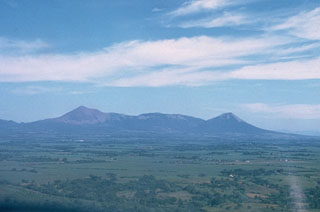 This low-angle aerial view from the south shows the profile of the Telica volcanic complex, which consists of several interlocking cones and vents with a general NW alignment. Telica itself, the high peak at the left, is a steep-sided cone with a 700-m-wide double crater. El Liston, immediately E of Telica (at center), has several nested craters. Santa Clara volcano is the symmetrical cone at the right.
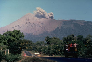 A small ash cloud from an eruption in 1977 rises from the crater of Telica volcano as seen from the outskirts of the city of León. Intermittent explosions began in November 1976, and continued at a rate of one sizeable explosion a month until November 1977, when activity increased. On November 11 ashfall reached the Pacific Ocean. The eruption continued into January 1978.
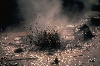 Mud pots boil in this 1978 view of the San Jacinto thermal area at El Salvador's Telica volcanic complex. The alignment of fumaroles and mud pots suggests an underlying fault running NNE. Magmatic steam and gases have been emitted from the thermal area for many years at a fairly constant rate.
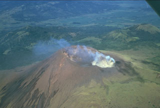 A prominent fumarole on the NE rim of the summit crater of Telica volcano produces a diffuse plume in this 1981 view. The double summit crater is viewed from the SE with the grassy cone of Cerro de Aguero, the northernmost cone of the Telica volcanic complex, at the upper right. The flanks of La Pelona caldera, part of the neighboring San Cristóbal volcanic complex, can be seen at the top of the photo across a low saddle.
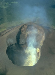 This photo taken on July 1987 looks into the double summit crater of Telica volcano in Nicaragua. An older shallower crater is located on the SW side (top). A plume rises from fumaroles in the 120-m-deep NE crater (bottom), which is the source of recent eruptions.
 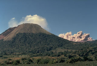 An ash column rises in 1977 from the crater of Telica volcano, behind the ridge at the right. This was one of many explosive eruptions that took place between November 1976 and January 1978. The steep-sided symmetrical peak at the left is Santa Clara, one of several overlapping volcanoes of the Telica volcanic complex. Reports of historical eruptions from Santa Clara, located at the south end of the Telica complex, have not been substantiated. This view is from the SE.
 Cerro Negro volcano provides a vantage point for a NW-looking view down the Marrabios Range volcanic chain. The forested slopes in the foreground are part of Rota volcano. The light-colored conical peak in the center is Volcán Santa Clara, part of the Telica volcanic complex, whose principal peak, Telica itself, just pokes its head above the horizon behind and to the right of Santa Clara. The large conical peak on the center horizon is San Cristóbal, the highest peak of the Marrabios Range. The satellitic peak of El Chonco is on the left horizon.
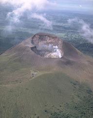 Telica, one of Nicaragua's most active volcanoes, has erupted frequently since the time of the Spanish conquest. The Telica volcano group consists of several interlocking cones and vents with a general NW alignment. Telica itself, seen here in an aerial view from the NE, is a steep-sided cone with a 700-m-wide double crater. The steaming NE crater, the source of recent eruptions, is 120 m deep. The rim of an older crater of the Telica complex forms the ridge at the lower left.
 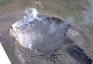 Most recent eruptions of Telica have occurred from the lower NE summit crater. Fumarolic plumes rise from its floor and just below its rim. The double summit crater is about 300 x 700 m wide. Erosional gullies extend into the NE crater from the shallower SW crater. It lies below the summit, which is out of view below the bottom of the photo.
 Steam fills the large double crater of Telica volcano in this 1968 aerial view from the NE. The crater is about 300 x 700 m wide; its morphology suggests several generations of crater formation. Most recent eruptions have occurred from the lower NE crater.
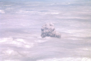 A convecting ash-bearing eruption cloud from Telica volcano punches through a low cloud layer in February 1982. Continuous white vapor columns with occasional ash were observed beginning in late November 1982, and small gas-and-ash eruptions took place in late December and early January. Large eruptions on February 12 and 19 sent clouds to 3.7-4.3 and 3.5 km above sea level, respectively. Eruptive activity ended on March 2.
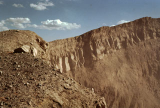 A jointed lava flow underlain and capped by pyroclastic ejecta is exposed in the western crater wall of Telica's NE summit crater, the source of most of the volcano's recent eruptions. The crater is about 300 m wide and several hundred meters deep.
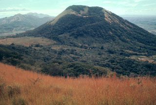 Volcán Santa Clara lies across a 400-m-high saddle (left) from Telica volcano. The crater rim of 834-m-high Santa Clara is higher on its far SE side and is breached to the NW. Santa Clara was considered to be active during the 16th century, but these reported eruptions more likely originated from Telica.
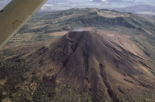 Telica's impressive summit crater is not visible in this aerial view from the west. Erosional gullies scar the flanks of the unvegetated cone. The broad ridge in the background is El Liston, an older part of the Telica volcanic complex. An E-W-trending line of shallow craters extends from Telica to the broad summit of El Liston.
 The 700-m-wide double summit crater of Telica volcano is seen here in an aerial view from the north with farmlands of the Nicaraguan depression in the background. The 1061-m-high volcano is the highest and most recently active of the Telica volcanic complex. The Telica volcano group consists of several interlocking cones and vents with a general NW alignment. The bench at the lower right and the ridge at the left are remnants of older craters of the complex.
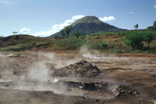 Mud pots and steaming vents of the San Jacinto thermal area lie at an elevation of 140 m at the eastern end of the Telica volcanic complex. Thermal manifestations cover a broad area here and along a N-S-trending fault at Tizate, about 2 km to the NNE. Conical Santa Clara volcano rises to 834 m in the background.
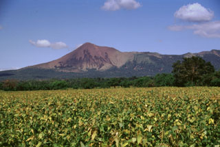 Telica volcano, seen here from the León-Chinandega highway, is one of a group of interlocking cones and vents along a NW trend. The summit of Telica, which is one of Nicaragua's most active volcanoes, is unvegetated, and deep erosional gulleys have been dissected into the lower flanks of the cone. Frequent historical eruptions have been recorded at Telica since the 16th century.
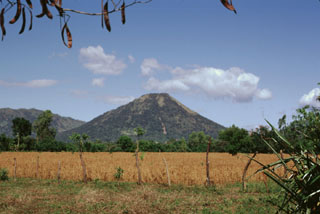 Conical Santa Clara volcano lies at the SE end of the Telica volcanic complex. The 834-m-high stratovolcano, seen here from the south, has a small summit crater about 150 m in diameter. Santa Clara was considered to have been active during the 16th century, and early explorers reported the volcano to be smoking, but no specifically dated eruptions have been recorded.
 The San Jacinto-Tizate geothermal prospect at the eastern end of the Telica volcanic complex has undergone intermittent exploration by a Nicaraguan-Russian consortium. During the 1993-1995 period, seven exploration-production wells were drilled in the San Jacinto-Tizate geothermal area. The wells had total depths between 724 and 2235 m and encountered temperatures from 264 to 289 degrees Centigrade. Subsequent development by Polaris Geothermal resulted in inauguration of the first 10 MW production well in June 2005.
 Forested Rota volcano rises above steaming ground of the San Jacinto thermal area at the eastern end of the Telica volcanic complex. Highway 26 between Telica and Malpaisillo crosses the low saddle between Rota and the Telica complex and provides easy access to the mud pots and steaming vents of the thermal area. Visitors to San Jacinto are accompanied by groups of vendors who live in settlements near the thermal area.
 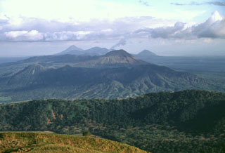 A view from Casita volcano to the SE along the Marrabios Range shows the Telica volcanic complex covering much of the center of the photo. A thin steam plume rises from the summit of Telica itself (right-center), while the cone of Cerro de Aguero lies at the left-center, with shadows defining older, more dissected parts of the Telica complex. The forested ridge of La Pelona caldera (part of the San Cristóbal complex) cuts across the lower part of the photo, while Momotombo (left), Las Pilas, and Cerro Asososco (right) lie on the horizon.
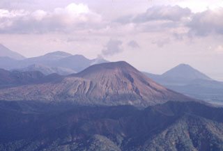 Telica volcano is seen here in a telephoto view looking down the Marrabios Range from near the summit of Casita volcano. A thin steam plume rises from a fumarole in the summit crater. Behind Telica on the left horizon is Las Pilas volcano, and the conical peak at the extreme right is Cerro Asososca, at the south end of the Las Pilas complex.
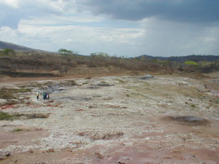 Mudpots and fumaroles mark the San Jacinto - Tizate geothermal area on the NE side of the Telica volcanic complex, the first geothermal power facility in Nicaragua to be fully developed by the private sector. Feasibility studies suggest possible power generation of 173-240 MW. Inauguration and reliability testing of the first 10 MW of power generation began in June 2005.
Maps are not currently available due to technical issues.
There are no samples for Telica in the Smithsonian's NMNH Department of Mineral Sciences Rock and Ore collection.
| Copernicus Browser | The Copernicus Browser replaced the Sentinel Hub Playground browser in 2023, to provide access to Earth observation archives from the Copernicus Data Space Ecosystem, the main distribution platform for data from the EU Copernicus missions. |
| MIROVA | Middle InfraRed Observation of Volcanic Activity (MIROVA) is a near real time volcanic hot-spot detection system based on the analysis of MODIS (Moderate Resolution Imaging Spectroradiometer) data. In particular, MIROVA uses the Middle InfraRed Radiation (MIR), measured over target volcanoes, in order to detect, locate and measure the heat radiation sourced from volcanic activity. |
| MODVOLC Thermal Alerts | Using infrared satellite Moderate Resolution Imaging Spectroradiometer (MODIS) data, scientists at the Hawai'i Institute of Geophysics and Planetology, University of Hawai'i, developed an automated system called MODVOLC to map thermal hot-spots in near real time. For each MODIS image, the algorithm automatically scans each 1 km pixel within it to check for high-temperature hot-spots. When one is found the date, time, location, and intensity are recorded. MODIS looks at every square km of the Earth every 48 hours, once during the day and once during the night, and the presence of two MODIS sensors in space allows at least four hot-spot observations every two days. Each day updated global maps are compiled to display the locations of all hot spots detected in the previous 24 hours. There is a drop-down list with volcano names which allow users to 'zoom-in' and examine the distribution of hot-spots at a variety of spatial scales. |
|
WOVOdat
Single Volcano View Temporal Evolution of Unrest Side by Side Volcanoes |
WOVOdat is a database of volcanic unrest; instrumentally and visually recorded changes in seismicity, ground deformation, gas emission, and other parameters from their normal baselines. It is sponsored by the World Organization of Volcano Observatories (WOVO) and presently hosted at the Earth Observatory of Singapore.
GVMID Data on Volcano Monitoring Infrastructure The Global Volcano Monitoring Infrastructure Database GVMID, is aimed at documenting and improving capabilities of volcano monitoring from the ground and space. GVMID should provide a snapshot and baseline view of the techniques and instrumentation that are in place at various volcanoes, which can be use by volcano observatories as reference to setup new monitoring system or improving networks at a specific volcano. These data will allow identification of what monitoring gaps exist, which can be then targeted by remote sensing infrastructure and future instrument deployments. |
| Volcanic Hazard Maps | The IAVCEI Commission on Volcanic Hazards and Risk has a Volcanic Hazard Maps database designed to serve as a resource for hazard mappers (or other interested parties) to explore how common issues in hazard map development have been addressed at different volcanoes, in different countries, for different hazards, and for different intended audiences. In addition to the comprehensive, searchable Volcanic Hazard Maps Database, this website contains information about diversity of volcanic hazard maps, illustrated using examples from the database. This site is for educational purposes related to volcanic hazard maps. Hazard maps found on this website should not be used for emergency purposes. For the most recent, official hazard map for a particular volcano, please seek out the proper institutional authorities on the matter. |
| IRIS seismic stations/networks | Incorporated Research Institutions for Seismology (IRIS) Data Services map showing the location of seismic stations from all available networks (permanent or temporary) within a radius of 0.18° (about 20 km at mid-latitudes) from the given location of Telica. Users can customize a variety of filters and options in the left panel. Note that if there are no stations are known the map will default to show the entire world with a "No data matched request" error notice. |
| UNAVCO GPS/GNSS stations | Geodetic Data Services map from UNAVCO showing the location of GPS/GNSS stations from all available networks (permanent or temporary) within a radius of 20 km from the given location of Telica. Users can customize the data search based on station or network names, location, and time window. Requires Adobe Flash Player. |
| DECADE Data | The DECADE portal, still in the developmental stage, serves as an example of the proposed interoperability between The Smithsonian Institution's Global Volcanism Program, the Mapping Gas Emissions (MaGa) Database, and the EarthChem Geochemical Portal. The Deep Earth Carbon Degassing (DECADE) initiative seeks to use new and established technologies to determine accurate global fluxes of volcanic CO2 to the atmosphere, but installing CO2 monitoring networks on 20 of the world's 150 most actively degassing volcanoes. The group uses related laboratory-based studies (direct gas sampling and analysis, melt inclusions) to provide new data for direct degassing of deep earth carbon to the atmosphere. |
| Large Eruptions of Telica | Information about large Quaternary eruptions (VEI >= 4) is cataloged in the Large Magnitude Explosive Volcanic Eruptions (LaMEVE) database of the Volcano Global Risk Identification and Analysis Project (VOGRIPA). |
| EarthChem | EarthChem develops and maintains databases, software, and services that support the preservation, discovery, access and analysis of geochemical data, and facilitate their integration with the broad array of other available earth science parameters. EarthChem is operated by a joint team of disciplinary scientists, data scientists, data managers and information technology developers who are part of the NSF-funded data facility Integrated Earth Data Applications (IEDA). IEDA is a collaborative effort of EarthChem and the Marine Geoscience Data System (MGDS). |