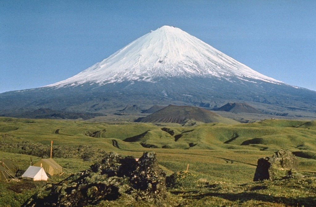
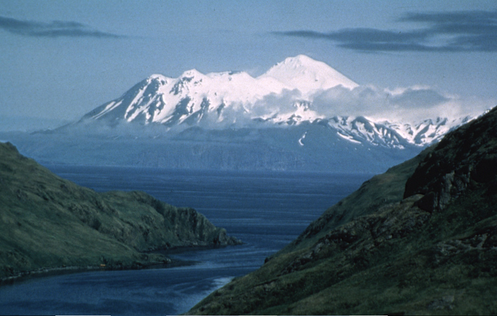
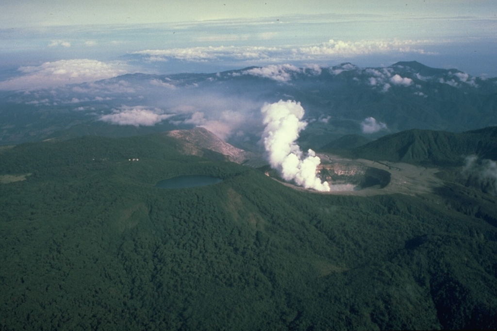
Dempo (Indonesia) | 13 August-19 August 2025 | New Activity / Unrest
 Cite this Report Cite this Report
|
 Dempo Dempo
Sunda Volcanic Arc
|
The Pusat Vulkanologi dan Mitigasi Bencana Geologi (PVMBG) reported that an eruptive event at Dempo was recorded at 0748 on 19 August and lasted nearly two minutes based on the seismic network. A dense white steam, gas, and ash plume rose 1.3 km above the summit and drifted S. The number of deep volcanic earthquakes had increased in early July, and deformation networks indicated inflation beneath the W flank, especially during the week prior to the eruption. According to news articles about 60 climbers were at or near the summit when the eruption occurred. The Alert Level remained at 2 (on a scale of 1-4), and the public were reminded to stay 1 km away from the crater and as far as 2 km on the N flank.
Sources: Pusat Vulkanologi dan Mitigasi Bencana Geologi (PVMBG, also known as CVGHM), Antara News, Kompas.com
|
Karymsky (Russia) | 13 August-19 August 2025 | New Activity / Unrest
Cite this Report
|
 Karymsky Karymsky
Eastern Kamchatka Volcanic Arc
|
The Kamchatkan Volcanic Eruption Response Team (KVERT) reported that moderate steam-and-gas activity continued at Karymsky during 7-14 August. A weak thermal anomaly over the volcano was observed in satellite images during 13-14 August; the volcano was quiet or obscured by clouds on the other days of the week. Explosions began at 2140 on 14 August producing an ash plume that rose 2 km (6,600 ft) a.s.l., or about 700 m above the summit. The ash plume was 12 x 12 km and had drifted about 26 km SE by 2140 based on satellite observations. The Aviation Color Code was raised to Orange (the third level on a four-color scale) at 2351. A daily thermal anomaly was identified in satellite images during 15-19 August. Dates and times are provided in Coordinated Universal Time (UTC); specific events are indicated in local time where specified.
Source: Kamchatkan Volcanic Eruption Response Team (KVERT)
|
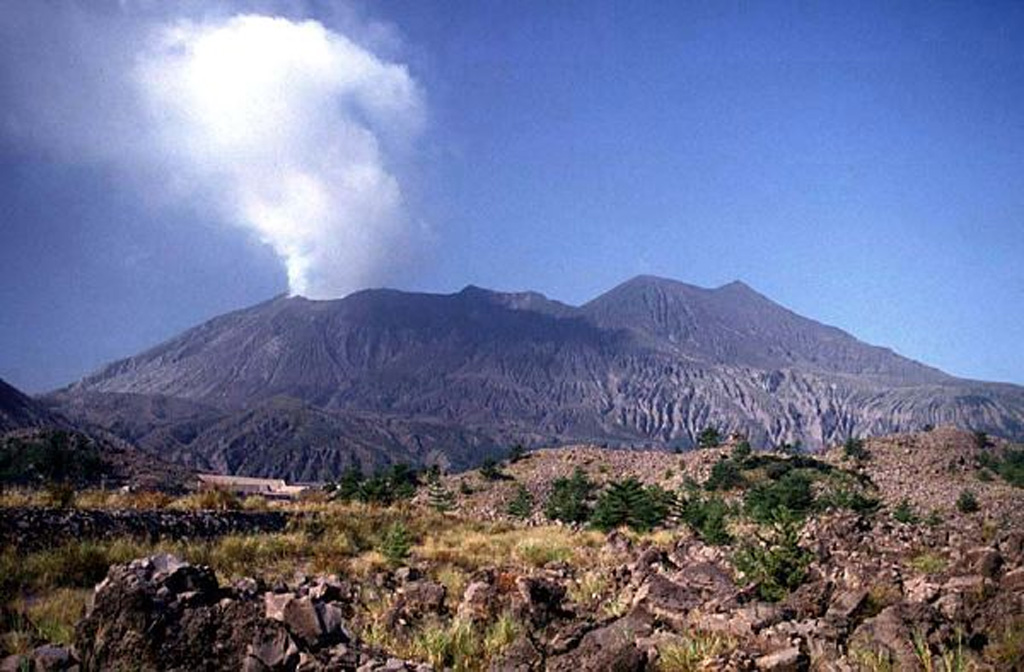
Kirishimayama (Japan) | 13 August-19 August 2025 | New Activity / Unrest
Cite this Report
|
 Kirishimayama Kirishimayama
Ryukyu Volcanic Arc
|
The Japan Meteorological Agency (JMA) reported that eruptive activity continued at Shinmoedake (Shinmoe peak, a stratovolcano of the Kirishimayama volcano group) during 11-18 August. The number of volcanic earthquakes located beneath Shinmoedake, first detected in late October 2024, continued to be frequent; volcanic tremor was also occasionally detected, notably during eruptive events. Sulfur dioxide emissions on 12 August were characterized as high, averaging 1,000 tons per day. Ash plumes were continuously emitted during 0100-1650 on 13 August rising as high as 500 m above the crater rim and drifting N and NW. At 1050 and 1422 on 15 August ash plumes rose 300 m above the crater rim into weather clouds. The Alert Level remained at 3 (on a 5-level scale) and the public was warned to exercise caution within 3 km from Shinmoedake Crater.
Source: Japan Meteorological Agency (JMA)
|
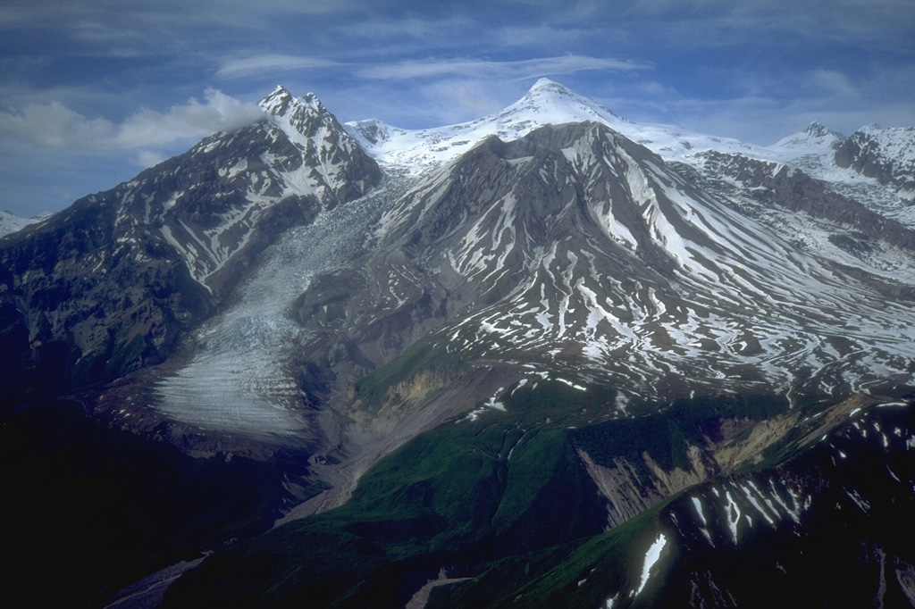
Klyuchevskoy (Russia) | 13 August-19 August 2025 | New Activity / Unrest
Cite this Report
|
 Klyuchevskoy Klyuchevskoy
Eastern Kamchatka Volcanic Arc
|
The Kamchatkan Volcanic Eruption Response Team (KVERT) reported that the eruption at Klyuchevskoy’s summit crater continued at variable levels during 13-15 August and then ended by 18 August. During 13-14 August lava advanced down the snowy W flank, causing phreatic explosions and lahars. Explosions at the summit produced ash plumes that rose as high as 6.5 km (21,300 ft) a.s.l., or about 1.8 km above the summit, and drifted as far as 300 km SW. Some ash plumes rose higher, 7.5 km (24,600 ft) a.s.l., as they drifted downwind. Taller ash plumes were visible in webcam images at 0432 on 14 August rising to 8.5 km (27,900 ft) a.s.l., or about 3.7 km above the summit, and drifting 95 km E. The Aviation Color Code (ACC) was raised to Red (the highest level on a four-color scale) at 0438. Within two hours, ash plume altitudes decreased to 6 km (19,700 ft) a.s.l., or about 1.2 km above the summit, and drifted 100 km E; at 0624 the ACC was lowered back to Orange. Explosions later that day generated ash plumes, that were visible in webcam images at 2150, rising 7-8 km (23,000-26,200 ft) a.s.l., or 2.2-3.2 km above the summit; plumes were visible in satellite data as far as 520 km E. Explosions the next day sent ash plumes to 9 km (29,500 ft) a.s.l., or about 4.2 km above the summit, that drifted 35 km NE based on webcam images at 0330 on 15 August. The ACC was raised to Red at 0406. Explosions continued to produce ash plumes over the next few hours, but to lower altitudes, rising 7-8 km a.s.l. and drifting 100 km NE. The ACC was lowered back to Orange at 0935. Ash plumes continued to be visible in both satellite and webcam images, at least through 2340 on 15 August, rising 6-6.5 km a.s.l. KVERT reported that the eruption had ended on 16 August with only fumarolic activity observed during 16-18 August. The ACC was lowered to Yellow at 2318 on 18 August. Dates and times are provided in Coordinated Universal Time (UTC); specific events are indicated in local time where specified.
Source: Kamchatkan Volcanic Eruption Response Team (KVERT)
|
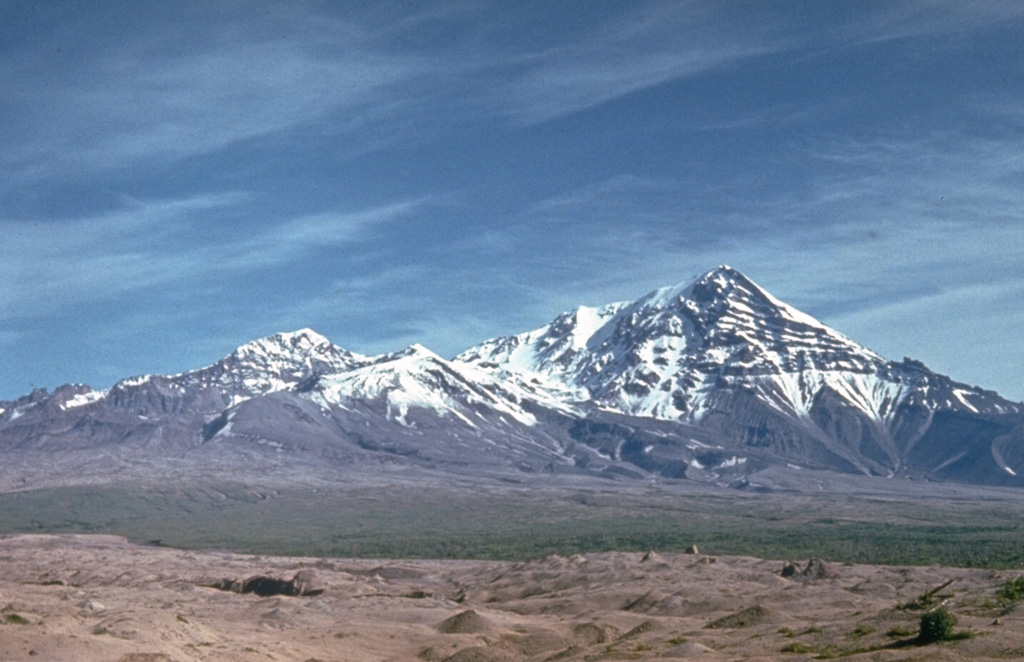
Krasheninnikov (Russia) | 13 August-19 August 2025 | New Activity / Unrest
Cite this Report
|
 Krasheninnikov Krasheninnikov
Eastern Kamchatka Volcanic Arc
|
The Kamchatkan Volcanic Eruption Response Team (KVERT) and reported that the eruption at Krasheninnikov continued during 12-19 August. A large bright thermal anomaly over the volcano was identified in satellite images on most days; weather clouds obscured views on 17 August. Ash plumes from explosions at the northern cone drifted as far as 170 km E and SE on 13 August. Explosions on 14 August generated ash plumes that reached 2-3 km a.s.l. and drifted 170 km SE based on satellite data. Branching lava flows on the NW flank were active at least through 15 August. The Aviation Color Code remained at Orange (the second highest level on a four-color scale). Dates and times are provided in Coordinated Universal Time (UTC); specific events are indicated in local time where specified.
Source: Kamchatkan Volcanic Eruption Response Team (KVERT)
|
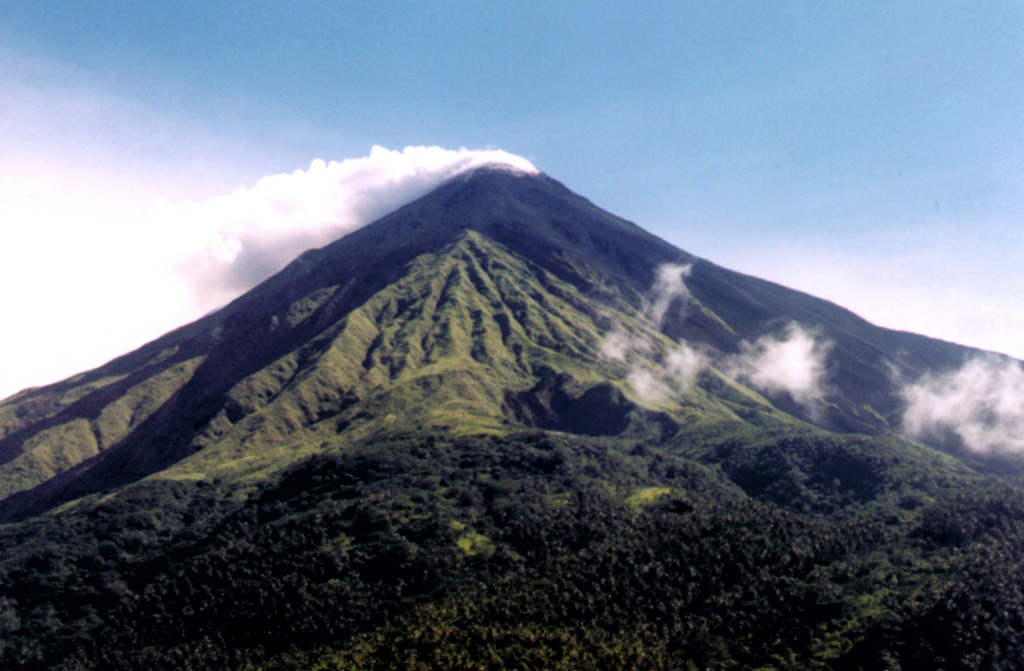
Lewotobi (Indonesia) | 13 August-19 August 2025 | New Activity / Unrest
Cite this Report
|
 Lewotobi Lewotobi
Sunda Volcanic Arc
|
On 16 August the Pusat Vulkanologi dan Mitigasi Bencana Geologi (PVMBG) reported increased activity at Lewotobi Laki-laki after the 9 August eruption. At 1405 and 1747 on 13 August a white, gray, and brown ash plume and a gray-to-brown ash plume, respectively, rose around 200 m above the summit and drifted W and SW. Seismic data during 10-16 August, specifically an increase in non-harmonic tremor signals, indicated increased activity at shallow depths. In addition, deformation data indicated inflation. At 0800 on 16 August the Alert Level was raised to 4 (on a scale of 1-4) and increased the exclusion zone to a radius of 6 km from the center of Laki-laki and 7 km in a semicircle clockwise from the SW to the NE. At 1830 on 17 August a dense gray ash plume rose 1 km above the summit and drifted SW.
Activity escalated on 18 August with multiple ash plumes observed through the day. During 0038-0221 dense gray ash plumes rose at least 8 km above the summit and drifted W and NW. Webcam images from 0040 and 0222 showed incandescent material on the upper flanks and ash plumes rising from the summit and from areas along the down-flank margins of the ejected material. Ash plumes continued to be produced for almost another hour, though at 0723 the ash plumes were lower, rising 3.5 km above the summit and drifting W and NW. Dense gray ash plumes recorded at 0834, 0857, and 0911 rose 3.5-4 km above the summit and drifted W and NW. Dense gray ash plumes in the afternoon, at 1622 and 1651, rose 800 m above the summit and drifted S and SW. At 1721 a dense gray ash plume rose at least 6 km above the summit and drifted W and NW. A white-and-gray ash plume at 2008 rose 500 m above the summit and drifted N and NE; a webcam image a minute later showed minor crater incandescence. According to a news report a half a dozen flights in and out of Maumere (61 km W), Ende (125 km WSW), and Bajawa (200 km W) were canceled due to ash in the air.
Sources: Pusat Vulkanologi dan Mitigasi Bencana Geologi (PVMBG, also known as CVGHM), Antara News
|
Telica (Nicaragua) | 13 August-19 August 2025 | New Activity / Unrest
Cite this Report
|
 Telica Telica
Central America Volcanic Arc
|
The Washington Volcanic Ash Advisory Center (VAAC) reported that on 18 August a diffuse ash plume at Telica was visible in webcam images rising to 1.5 km (5,000 ft) a.s.l. and drifting SW. Weather clouds obscured satellite views.
Source: Washington Volcanic Ash Advisory Center (VAAC)
|
Aira (Japan) | 13 August-19 August 2025 | Continuing ActivityCite this Report |
 Aira Aira
Ryukyu Volcanic Arc
|
The Japan Meteorological Agency (JMA) reported ongoing eruptive activity at Minamidake Crater (Aira Caldera’s Sakurajima volcano) during 11-18 August. Nightly crater incandescence visible in webcam images and very small eruptive events occasionally occurred. The Alert Level remained at 3 (on a 5-level scale), and the public was warned to be cautious within 2 km of both the Minimadake and Showa craters.
Source: Japan Meteorological Agency (JMA)
|
Dukono (Indonesia) | 13 August-19 August 2025 | Continuing ActivityCite this Report |
 Dukono Dukono
Halmahera Volcanic Arc
|
The Pusat Vulkanologi dan Mitigasi Bencana Geologi (PVMBG) reported that eruptive activity at Dukono continued during 13-19 August. Daily white-and-gray gas-and-ash plumes rose as high as 700 m above the summit and drifted W, NW, E, and NE. The Alert Level remained at Level 2 (on a scale of 1-4) and the public was warned to stay 4 km away from the Malupang Warirang Crater.
Source: Pusat Vulkanologi dan Mitigasi Bencana Geologi (PVMBG, also known as CVGHM)
|
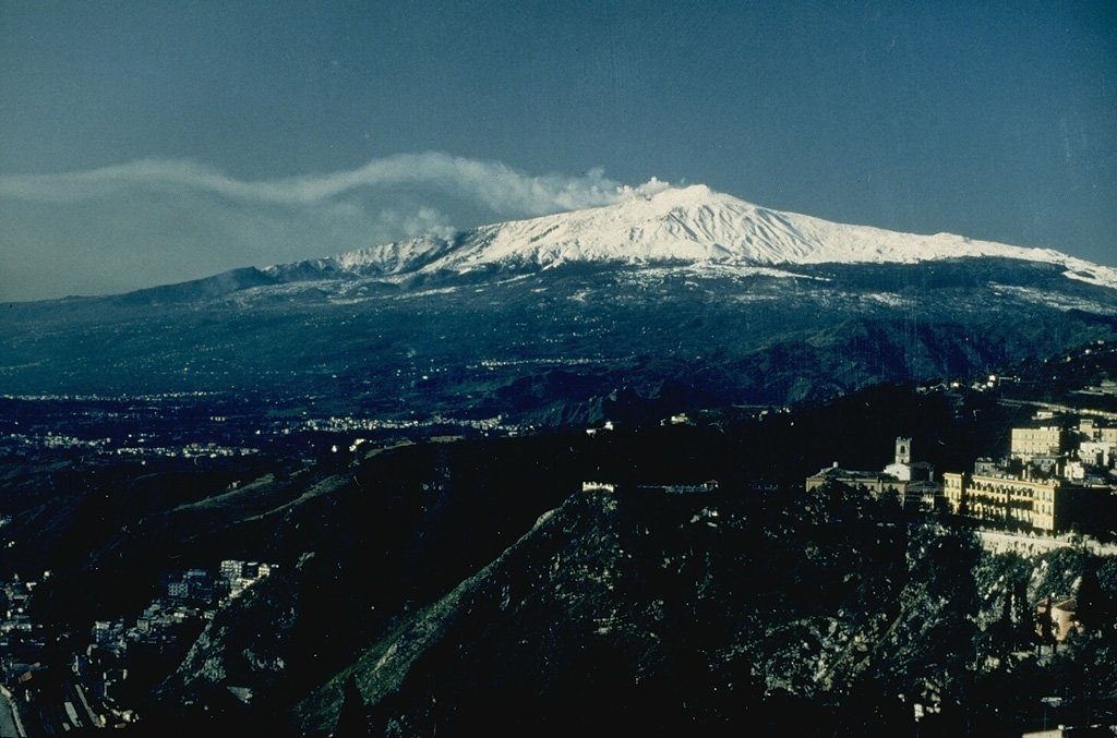
Etna (Italy) | 13 August-19 August 2025 | Continuing ActivityCite this Report |
 Etna Etna
Sicily Volcanic Province
|
The Sezione di Catania - Osservatorio Etneo (INGV) reported that eruptive activity at Etna’s summit craters during 11-17 August was characterized by lava effusion and periodic reddish ash emissions at Bocca Nuova Crater, Strombolian activity at SE Crater, and gas emissions at both NE Crater and Voragine. Lava effusion restarted at 1245 on 14 August along the N-S-trending fissure located between Bocca Nuova and SE Crater at a vent around 2,980 m elevation. Observatory staff on site noted that the fissure had propagated SW and that a new NE-SW-trending fracture field had developed in the area. The initial lava flow was 2-3 m wide and was followed by a more dominant flow that advanced SW. By 1000 on 15 August the lava flow was about 500 m long. During field inspections on 17 and 19 August staff observed ongoing effusion and that a tube had formed over the proximal part of the flow. They also observed several ephemeral vents. Satellite images and field surveys revealed that the distal part of the main flow branched and traveled SW. The most advanced end of the flow reached 2,270 m elevation.
Source: Sezione di Catania - Osservatorio Etneo (INGV)
|
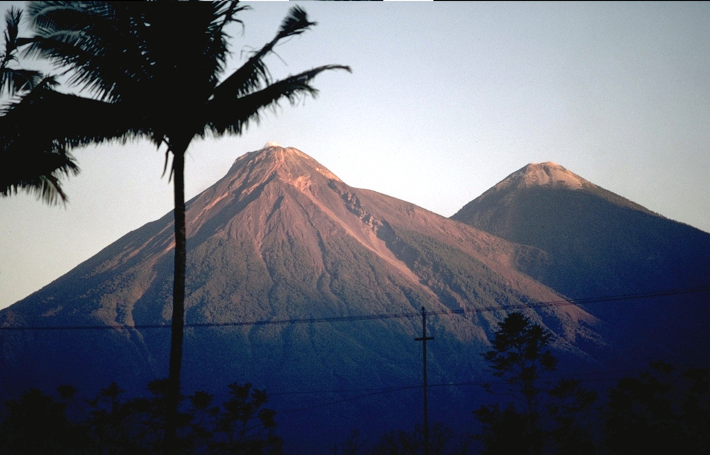
Fuego (Guatemala) | 13 August-19 August 2025 | Continuing ActivityCite this Report |
 Fuego Fuego
Central America Volcanic Arc
|
The Instituto Nacional de Sismología, Vulcanologia, Meteorologia e Hidrología (INSIVUMEH) reported that eruptive activity at Fuego continued during 12-19 August. Daily Strombolian explosions were recorded by the seismic network at rates of 2-9 per hour when reported. The explosions generated daily gas-and-ash plumes that rose as high as 1.1 km above the summit and drifted 10-30 km NW, W, and SW. Rumbling sounds, shock waves, and sound associated with gas emissions were occasionally reported. Incandescence at the summit was visible during dark hours from 13 August to 16 August. Ashfall was reported on most days in areas downwind including Panimache I and II (8 km SW), Morelia (10 km SW), Santa Sofia (12 km SW), and El Porvenir (11 km SW). During the early afternoon on 12 August and around noon on 16 August lahars descended the Ceniza, Zarco, Mazate, El Jute, and Las Lajas drainages, carrying tree branches, trunks, volcanic material, and blocks as large as 3 m in diameter.
Source: Instituto Nacional de Sismologia, Vulcanologia, Meteorologia, e Hidrologia (INSIVUMEH)
|
Great Sitkin (United States) | 13 August-19 August 2025 | Continuing ActivityCite this Report |
 Great Sitkin Great Sitkin
Aleutian Ridge Volcanic Arc
|
The Alaska Volcano Observatory (AVO) reported that slow lava effusion continued to feed a thick flow in Great Sitkin’s summit crater during 12-19 August. Satellite data indicated that the flow was advancing S, with some rockfalls occurring along the S and E margins. Small daily earthquakes were detected by the seismic network, including signals probably caused by the small rockfalls. Weather clouds mostly obscured satellite and webcam views; clear conditions during 13-14 August showed elected surface temperatures in satellite data and during 14-15 August a steam plume was visible in webcam images. The Volcano Alert Level remained at Watch (the third level on a four-level scale) and the Aviation Color Code remained at Orange (the third color on a four-color scale).
Source: US Geological Survey Alaska Volcano Observatory (AVO)
|
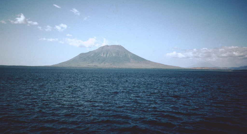
Home Reef (Tonga) | 13 August-19 August 2025 | Continuing ActivityCite this Report |
 Home Reef Home Reef
Tofua Volcanic Arc
|
The Tonga Geological Services reported no indications of activity at Home Reef during 2-16 August. A comparison of satellite images from 15 July and 11 August showed new deposits of eroded material at the NW coastline and sharp edges along the SE coastline from wind and wave action. Yellow sulfur deposits in and around the main crater were more prominent in the 11 August image, suggesting that emissions of steam and sulfur dioxide gas were continuing; a diffuse plume was visible in both images. Discolored water around the island was visible in both images. The Aviation Color Code remained at Yellow (the second lowest level on a four-level scale, the Maritime Alert Level remained at Orange (the third level on a four-level scale) with advice to stay at least 2 nautical miles (3.7 km) from the island, and the Alert Level for residents of Vava’u and Ha’apai remained at Green (the first level on a four-level scale).
Source: Tonga Geological Services, Government of Tonga
|
Ibu (Indonesia) | 13 August-19 August 2025 | Continuing ActivityCite this Report |
 Ibu Ibu
Halmahera Volcanic Arc
|
The Pusat Vulkanologi dan Mitigasi Bencana Geologi (PVMBG) reported that the eruption at Ibu continued during 13-19 August. Daily dense gray ash plumes rose 400-700 m above the summit and drifted in multiple directions. The Alert Level remained at 2 (the second lowest level on a four-level scale) and the public was advised to stay 2 km away from the active crater and 3.5 km away from the N crater wall opening.
Source: Pusat Vulkanologi dan Mitigasi Bencana Geologi (PVMBG, also known as CVGHM)
|
Karangetang (Indonesia) | 13 August-19 August 2025 | Continuing ActivityCite this Report |
 Karangetang Karangetang
Sangihe Volcanic Arc
|
In a special statement the Pusat Vulkanologi dan Mitigasi Bencana Geologi (PVMBG) reported increased seismic activity at Karangetang. An increase in earthquake signals indicating gas emissions was recorded on 5 August with 40 events. Seismicity again increased; on 17 August the seismic network recorded 96 events indicating gas emissions along with 13 episodes of harmonic tremor. The Alert Level remained at 2 (on a scale of 1-4) and the public was advised to stay 1.5 km away from both the Kawah Dua (North Crater) and the Main Crater (South Crater) and 2.5 km away from the SW and S flanks of Main Crater.
Source: Pusat Vulkanologi dan Mitigasi Bencana Geologi (PVMBG, also known as CVGHM)
|
Kilauea (United States) | 13 August-19 August 2025 | Continuing ActivityCite this Report |
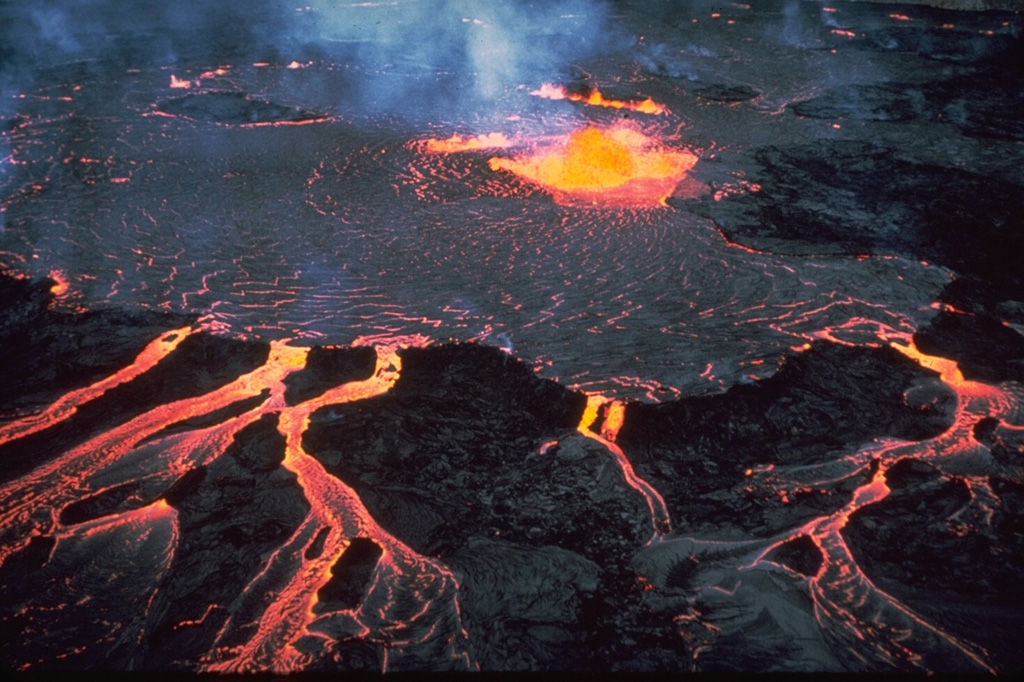 Kilauea Kilauea
Hawaiian-Emperor Hotspot Volcano Group
|
The Hawaiian Volcano Observatory (HVO) reported that the eruption within Kilauea’s Kaluapele summit caldera, characterized by episodic fountaining, incandescence, and intermittent spatter at vents along the SW margin of Halema’uma’u Crater, continued at variable levels during 12-19 August. Low-frequency tremor bursts characteristic of gas pistoning persisted during most of the week. Incandescence at the S vent was visible during the first half of the week and then diminished. Incandescence that had reappeared at the N vent and cracks above it intensified overnight during 15-16 August. Strong incandescence and spattering at the N vent were visible during 17-18 August, along with overnight incandescence at the cracks above the N vent. Gas pistoning stopped around 0000 on 19 August at the same time that tremor became more continuous and was punctuated by bursts. Incandescence at the N vent decreased. The Volcano Alert Level remained at Watch (the third level on a four-level scale) and the Aviation Color Code remained at Orange (the third color on a four-color scale).
Source: US Geological Survey Hawaiian Volcano Observatory (HVO)
|
Lewotolok (Indonesia) | 13 August-19 August 2025 | Continuing ActivityCite this Report |
 Lewotolok Lewotolok
Sunda Volcanic Arc
|
The Pusat Vulkanologi dan Mitigasi Bencana Geologi (PVMBG) reported that an eruption at Lewotolok was ongoing during 13-19 August. Daily white-to-gray, gray, or gray-to-black ash plumes rose 300-800 m above the summit of the cone and drifted in multiple directions. The Alert Level remained at 3 (on a scale of 1-4) and the public was warned to stay 3 km away from the summit.
Source: Pusat Vulkanologi dan Mitigasi Bencana Geologi (PVMBG, also known as CVGHM)
|
Marapi (Indonesia) | 13 August-19 August 2025 | Continuing ActivityCite this Report |
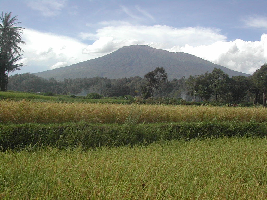 Marapi Marapi
Sunda Volcanic Arc
|
The Pusat Vulkanologi dan Mitigasi Bencana Geologi (PVMBG) reported that eruptive activity at Marapi (on Sumatra) continued during 13-19 August. At 1202 on 13 August an eruptive event generated a white-and-gray ash plume that rose 500 m above the summit and drifted NE. An eruptive event was recorded at 0119 on 16 August but not visually observed. The Alert Level remained at 2 (on a scale of 1-4) and the public was warned to stay 3 km away from the active crater.
Source: Pusat Vulkanologi dan Mitigasi Bencana Geologi (PVMBG, also known as CVGHM)
|
Merapi (Indonesia) | 13 August-19 August 2025 | Continuing ActivityCite this Report |
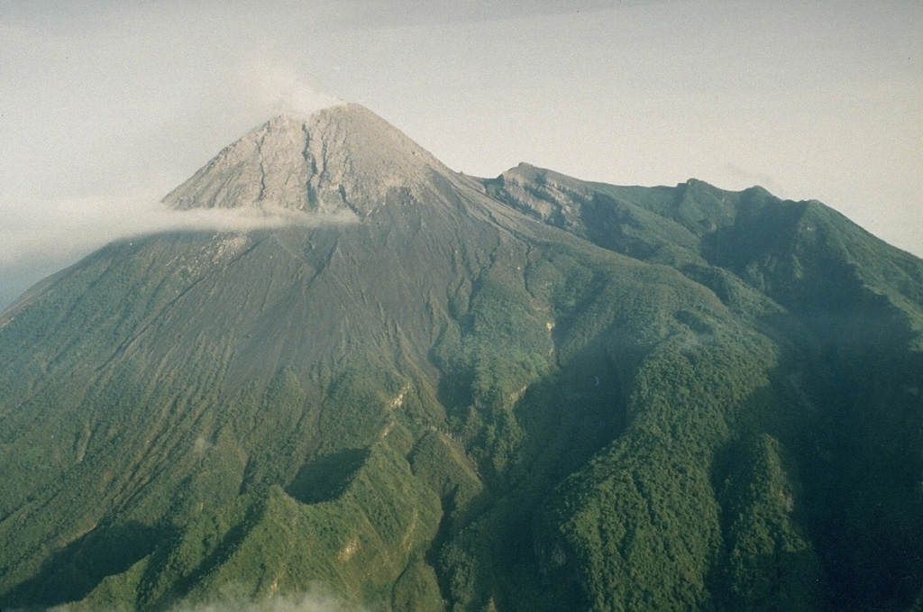 Merapi Merapi
Sunda Volcanic Arc
|
The Balai Penyelidikan dan Pengembangan Teknologi Kebencanaan Geologi (BPPTKG) reported that the eruption at Merapi (on Java) continued during 8-14 August. Earthquakes were about the same intensity compared to the previous week. The SW lava dome produced 15 lava avalanches that traveled as far as 2 km SW down the Bebeng drainage, 13 that traveled as far as 2 km SW down the Krasak drainage, and 58 that traveled as far as 2 km W down the Sat/Putih drainage. Small morphological changes to the SW lava dome resulted from lava effusion and minor collapses. The Alert Level remained at 3 (on a scale of 1-4), and the public was warned to stay 3-7 km away from the summit, based on location.
Source: Balai Penyelidikan dan Pengembangan Teknologi Kebencanaan Geologi (BPPTKG)
|
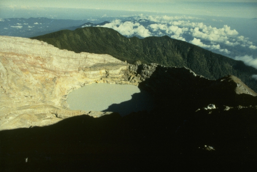
Poas (Costa Rica) | 13 August-19 August 2025 | Continuing ActivityCite this Report |
 Poas Poas
Central America Volcanic Arc
|
The Observatorio Vulcanológico y Sismológico de Costa Rica-Universidad Nacional (OVSICORI-UNA) reported continuing gas-and-steam emissions with occasional minor amounts of ash at Poás during 12-19 August. Variable incandescence at Boca A vent continued to be visible at night. An ash emission lasting about 12 minutes began at 1710 on 15 August, rose 200 m above the crater rim, and drifted W. The volcanic Alert Level remained at 2 (the second lowest level on a four-level scale) and the Aviation Color Code remained at Yellow (the second lowest color on a four-color scale).
Source: Observatorio Vulcanologico y Sismologico de Costa Rica-Universidad Nacional (OVSICORI-UNA)
|
Popocatepetl (Mexico) | 13 August-19 August 2025 | Continuing ActivityCite this Report |
 Popocatepetl Popocatepetl
Trans-Mexican Volcanic Arc
|
The Centro Nacional de Prevención de Desastres (CENAPRED) reported that eruptive activity continued at Popocatépetl during 12-19 August. The seismic network recorded 22-60 long-period events per day, accompanied by steam-and-gas emissions with occasional ash content. In addition, the seismic network recorded daily periods of low-amplitude tremor, sometimes characterized by harmonic and high-frequency signals, lasting from three hours and 44 minutes to just over 14 hours. According to the Washington VAAC ash plumes visible in webcam and/or satellite images during 12, 14, and 16-19 August rose 5.8-6.7 km (19,000-22,000 ft) a.s.l., or as high as 1.3 km above the summit, and drifted NW, W, and SW. The Alert Level remained at Yellow, Phase Two (the middle level on a three-color scale) and the public was warned to stay 12 km away from the crater.
Sources: Centro Nacional de Prevencion de Desastres (CENAPRED), Washington Volcanic Ash Advisory Center (VAAC)
|
Santa Maria (Guatemala) | 13 August-19 August 2025 | Continuing ActivityCite this Report |
 Santa Maria Santa Maria
Central America Volcanic Arc
|
The Instituto Nacional de Sismología, Vulcanología, Meteorología e Hidrología (INSIVUMEH) reported high levels of ongoing eruptive activity at Santa Maria’s Santiaguito dome complex during 12-19 August, with continuing lava extrusion at Caliente dome. Daily explosions, 1-2 per hour when reported, generated gas-and-ash plumes that rose 800-900 m above the dome and drifted W and SW. Effusion of blocky lava and collapses of previous deposits produced block avalanches that descended mainly the W and SW flanks; the collapsed material produced short pyroclastic flows that descended the SW and S flanks during 12-13 August. Incandescence during dark hours was visible from Caliente dome and block avalanches. During the early afternoon of 12 August heavy rainfall generated lahars in the Tambor drainage (SSW) that carried blocks up to 1 m in diameter mixed with fine sediment, tree trunks, and branches. The lahars were hot and had a sulfur odor. Material accumulated at the W crater rim began collapsing at 1630 on 16 August, generating pyroclastic flows that descended the San Isidro drainage as far as 4 km. Associated gas-and-ash plumes rose 1 km and drifted 30-60 km W and SW, causing abundant ashfall in San Marcos Palajunoj (8 km SW), Loma Linda (7 km W), San Martín Sacatepéquez (11 km NW), and Colomba (18 km WSW) and minor ashfall in more distance areas including La Reforma (28 km WNW), El Quetzal (26 km WNW), Coatepeque (31 km W), and Pajapita (50 km W). In the early evening of 16 August minor lahars descended the Zanjón Seco (SW) and Tambor River channels.
Source: Instituto Nacional de Sismologia, Vulcanologia, Meteorologia, e Hidrologia (INSIVUMEH)
|
Semeru (Indonesia) | 13 August-19 August 2025 | Continuing ActivityCite this Report |
 Semeru Semeru
Sunda Volcanic Arc
|
The Pusat Vulkanologi dan Mitigasi Bencana Geologi (PVMBG) reported that activity continued at Semeru during 6-12 August, often with multiple daily eruptive events recorded by the seismic network. Daily white-and-gray ash plumes rose 500-1,000 m above the summit and drifted in multiple directions. Minor incandescence at the summit was visible in a webcam image at 2229 on 17 August. The Alert Level remained at 2 (the second lowest level on a scale of 1-4). The public was warned to stay at least 3 km away from the summit in all directions, 8 km from the summit to the SE, 500 m from the banks of the Kobokan drainage as far as 13 km from the summit, and to avoid other drainages including the Bang, Kembar, and Sat, due to lahar, avalanche, and pyroclastic flow hazards.
Source: Pusat Vulkanologi dan Mitigasi Bencana Geologi (PVMBG, also known as CVGHM)
|
Sheveluch (Russia) | 13 August-19 August 2025 | Continuing ActivityCite this Report |
 Sheveluch Sheveluch
Eastern Kamchatka Volcanic Arc
|
The Kamchatkan Volcanic Eruption Response Team (KVERT) reported continuing eruptive activity at Sheveluch’s “300 years of RAS” dome on the SW flank of Old Sheveluch and at the Young Sheveluch dome during 8-14 August. Thermal anomalies over the domes were identified in satellite images during 13-14 August; weather clouds obscured views on the other days. The Aviation Color Code remained at Orange (the second highest level on a four-color scale). Dates are based on UTC; specific events are in local time where noted.
Source: Kamchatkan Volcanic Eruption Response Team (KVERT)
|
Spurr (United States) | 13 August-19 August 2025 | Continuing ActivityCite this Report |
 Spurr Spurr
Alaska Peninsula Volcanic Arc
|
The Alaska Volcano Observatory (AVO) reported that over the past several months Spurr had exhibited decreasing signs of volcanic unrest, including small earthquakes, gas emissions, melting ice, and surface changes. Ground deformation had not been detected since March 2025. The data suggested that movement of magma toward the surface, which began in early 2024, had stopped. At 1007 on 20 August the Volcano Alert Level was lowered to Normal (the lowest level on a four-level scale) and the Aviation Color Code was lowered to Green (the lowest level on a four-color scale).
Source: US Geological Survey Alaska Volcano Observatory (AVO)
|
Stromboli (Italy) | 13 August-19 August 2025 | Continuing ActivityCite this Report |
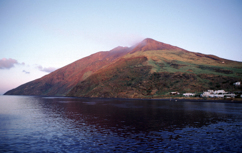 Stromboli Stromboli
Aeolian Volcanic Arc
|
The Sezione di Catania - Osservatorio Etneo (INGV) reported that eruptive activity continued at Stromboli during 11-17 August. Webcam images showed Strombolian activity at four vents in Area N within the upper part of the Sciara del Fuoco, and from at least two vents in Area C-S (South-Central Crater) on the crater terrace. The vents in Area N continued to produce low- to medium-intensity explosions at a rate of 10-14 events per hour, ejecting lapilli and bombs less than 150 m above the vents. Weak spattering at N2 was visible on 17 August. Low- to medium-intensity explosions ejected ash from the vents in Area C-S at a rate of 1-4 times per hour. The Alert Level remained at Yellow (the second lowest level on a four-level scale) according to the Dipartimento della Protezione Civile.
Sources: Sezione di Catania - Osservatorio Etneo (INGV), Dipartimento della Protezione Civile
|
Suwanosejima (Japan) | 13 August-19 August 2025 | Continuing ActivityCite this Report |
 Suwanosejima Suwanosejima
Ryukyu Volcanic Arc
|
The Japan Meteorological Agency (JMA) reported that eruptive activity at Suwanosejima's Ontake Crater continued during 11-18 August. Incandescence was observed nightly in webcam images. Volcanic earthquakes below the W flank had been at low levels but became more frequent on 14 August. Explosions at 2130 on 13 August, at 2046 on 14 August, at 0023 and 0049 on 15 August, at 2102 on 15 August, and at 0237 on 16 August produced ash plumes that rose as high as 1.4 km above the crater rim and drifted SW and W; plumes from the first and last explosions were not characterized. Large blocks were ejected 700 m above the crater rim. Eruptive events during 14-16 and 18 August produced ash plumes that rose as high as 1.4 km above the crater rim and drifted SW, W, and NW. The Alert Level remained at 2 (the second level on a five-level scale) and the public was warned to be cautious within 1.5 km of the crater.
Source: Japan Meteorological Agency (JMA)
|